Property Record
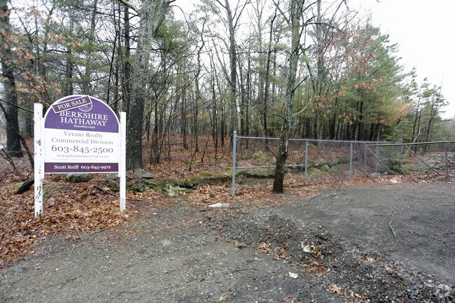
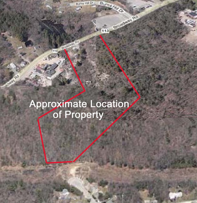
525 Broadway Rd, Dracut, MA 01826


Property Detail
525 Broadway Rd
DRAC-000037-000000-000072
MIDDLESEX
Commercialnec
Massachusetts
I
72
B and X Area of moderate flood hazard, usually the area between the limits of the 100-year and 500-year floods.
26.60 AC
2025
Groton/Townsend
2025
Boston
314301
Boston-Cambridge-Newton, MA-NH
10,014 SF
NEARBY LISTINGS FOR SALE OR LEASE
DEMOGRAPHICS near 525 Broadway Rd
1 mile
3 mile
5 mile
2025 Total Population
2,429
58,278
185,536
2030 Population
2,539
60,216
191,085
Pop Growth 2025-2030
+ 4.53%
+ 3.33%
+ 2.99%
Average Age
43
40
39
2025 Total Households
831
21,198
66,399
HH Growth 2025-2030
+ 4.57%
+ 3.46%
+ 3.14%
Median Household Inc
$128,555
$91,259
$94,547
Avg Household Size
2.80
2.60
2.60
2025 Avg HH Vehicles
2.00
2.00
2.00
Median Home Value
$636,318
$510,512
$489,769
Median Year Built
1980
1963
1964
Nearby Places
Map Layers
Map Styles
 Street
 Aerial
Layers
 Traffic
 Biking
Places
Listings with unknown addresses are not visible on the map
- Restaurants
- Banks
- Shops
- Fitness
- Groceries
PUBLIC TRANSPORTATION
COMMUTER RAIL
Lowell (Lowell Line - Massachusetts Bay Transportation Authority Commuter Rail (Purple Line))
Drive
Walk
Distance
Lowell (Lowell Line - Massachusetts Bay Transportation Authority Commuter Rail (Purple Line))
9 min
4.3 mi
North Billerica (Lowell Line - Massachusetts Bay Transportation Authority Commuter Rail (Purple Line))
Drive
Walk
Distance
North Billerica (Lowell Line - Massachusetts Bay Transportation Authority Commuter Rail (Purple Line))
17 min
7.8 mi
AIRPORT
Manchester Boston Regional
Drive
Walk
Distance
Manchester Boston Regional
45 min
29.1 mi
General Edward Lawrence Logan International
Drive
Walk
Distance
General Edward Lawrence Logan International
46 min
32.9 mi
Portsmouth International at Pease
Drive
Walk
Distance
Portsmouth International at Pease
61 min
45.4 mi
Freight Ports
Port of Boston
Drive
Walk
Distance
Port of Boston
46 min
32.7 mi
SALE & LEASE HISTORY
LISTING DATE
SALE/LEASE

Sep 25, 2016
For Lease
Sep 24, 2016
For Sale
Nearby Properties
Address
Land Use
TOTAL SIZE
Lot Size
Zoning
Address
Land Use
TOTAL SIZE
Lot Size
Zoning
70.20 AC
R3
Address
Land Use
TOTAL SIZE
Lot Size
Zoning
30,744 SF
31.28 AC
INST
Address
Land Use
TOTAL SIZE
Lot Size
Zoning
803 SF
3.29 AC
R1
Address
Land Use
TOTAL SIZE
Lot Size
Zoning
215,884 SF
1.55 AC
DMU
Address
Land Use
TOTAL SIZE
Lot Size
Zoning
134,439 SF
3.29 AC
DMU
Address
Land Use
TOTAL SIZE
Lot Size
Zoning
152,040 SF
9.10 AC
SRC
Address
Land Use
TOTAL SIZE
Lot Size
Zoning
6.27 AC
DMU
Address
Land Use
TOTAL SIZE
Lot Size
Zoning
225,252 SF
2.31 AC
DMU
Address
Land Use
TOTAL SIZE
Lot Size
Zoning
10.48 AC
INST
Address
Land Use
TOTAL SIZE
Lot Size
Zoning
7.25 AC
INST
Address
Land Use
TOTAL SIZE
Lot Size
Zoning
167,201 SF
6.31 AC
DMU
Address
Land Use
TOTAL SIZE
Lot Size
Zoning
20.88 AC
TSF
Address
Land Use
TOTAL SIZE
Lot Size
Zoning
185,172 SF
2.93 AC
DMU
Address
Land Use
TOTAL SIZE
Lot Size
Zoning
245,562 SF
1.44 AC
DMU
Address
Land Use
TOTAL SIZE
Lot Size
Zoning
13.74 AC
SSF
Address
Land Use
TOTAL SIZE
Lot Size
Zoning
2.35 AC
DMU
Address
Land Use
TOTAL SIZE
Lot Size
Zoning
122,533 SF
2.37 AC
DMU
Address
Land Use
TOTAL SIZE
Lot Size
Zoning
105,826 SF
2.27 AC
DMU
Address
Land Use
TOTAL SIZE
Lot Size
Zoning
119,372 SF
1.74 AC
INST
Address
Land Use
TOTAL SIZE
Lot Size
Zoning
3,822 SF
1.88 AC
INST
Address
Land Use
TOTAL SIZE
Lot Size
Zoning
142,490 SF
0.80 AC
INST
Address
Land Use
TOTAL SIZE
Lot Size
Zoning
110,384 SF
0.96 AC
UMU
Address
Land Use
TOTAL SIZE
Lot Size
Zoning
73,034 SF
2.30 AC
TMF
Address
Land Use
TOTAL SIZE
Lot Size
Zoning
72,930 SF
1.43 AC
DMU
Address
Land Use
TOTAL SIZE
Lot Size
Zoning
78,800 SF
2.70 AC
UMU
Address
Land Use
TOTAL SIZE
Lot Size
Zoning
134,300 SF
5.58 AC
INST
Address
Land Use
TOTAL SIZE
Lot Size
Zoning
10,512 SF
4.83 AC
UMU
Address
Land Use
TOTAL SIZE
Lot Size
Zoning
120,807 SF
11 AC
R1
Address
Land Use
TOTAL SIZE
Lot Size
Zoning
8 AC
R3
Address
Land Use
TOTAL SIZE
Lot Size
Zoning
8.45 AC
RR
The World's #1 Commercial Real Estate Marketplace
Connect with us
© 2026 CoStar Group
The information above has been obtained from sources believed reliable. While we do not doubt its accuracy we have not verified it and make no guarantee, warranty or representation about it. It is your responsibility to independently confirm its accuracy and completeness. Any projections, opinions, assumptions, or estimates used are for example only and do not represent the current or future performance of the property. The value of this transaction to you depends on tax and other factors which should be evaluated by your tax, financial, and legal advisors. You and your advisors should conduct a careful, independent investigation of the property to determine to your satisfaction the suitability of the property for your needs.