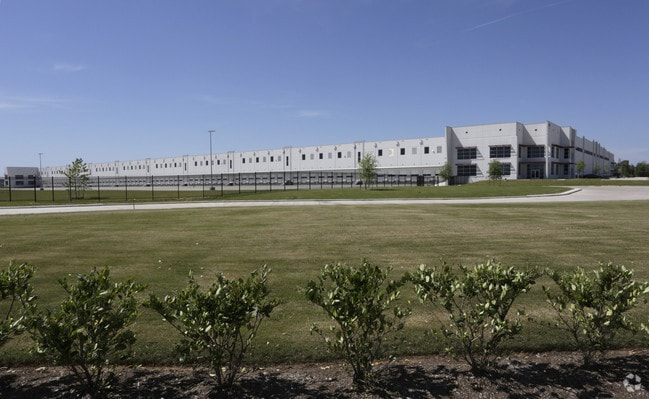
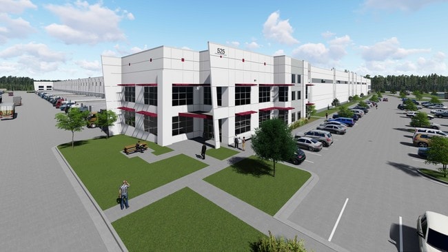
Property Record
525 Cane Island Pkwy, Katy, TX 77494

NEARBY LISTINGS FOR SALE OR LEASE
Property Detail
525 Cane Island Pkwy
Houston-The Woodlands-Sugar Land, TX
West Ten Bus Park Comm Res E R/P No 1
253215
S889605 WEST TEN BUS PARK COMM RES E R/P NO 1 ACRES 42.6314 REST RES E-1 COMMERCIAL ONLY
Commercialnec
Waller
AE
Texas
48157C0040L
res e
2024
42.63 AC
2025
Northwest Outliers
680100
Houston
678,028 SF
DEMOGRAPHICS near 525 Cane Island Pkwy
1 Mile
3 Mile
5 Mile
2024 Total Population
1,196
54,757
173,821
2029 Population
1,534
65,872
202,692
Pop Growth 2024-2029
+ 28.26%
+ 20.30%
+ 16.61%
Average Age
35
36
35
2024 Total Households
363
17,032
54,430
HH Growth 2024-2029
+ 29.48%
+ 20.64%
+ 16.51%
Median Household Inc
$136,491
$135,486
$118,541
Avg Household Size
3.30
3.20
3.20
2024 Avg HH Vehicles
2.00
2.00
2.00
Median Home Value
$348,598
$381,816
$358,926
Median Year Built
2011
2010
2010
Nearby Places
Map Layers
Map Styles
 Street
 Aerial
- Restaurants
- Banks
- Shops
- Fitness
- Groceries
SALE & LEASE HISTORY
LISTING DATE
SALE/LEASE

Oct 05, 2017
For Lease
Nearby Properties
Address
Land Use
TOTAL SIZE
Lot Size
Zoning
Address
Land Use
TOTAL SIZE
Lot Size
Zoning
1,655,920 SF
121.35 AC
Address
Land Use
TOTAL SIZE
Lot Size
Zoning
720,217 SF
65.17 AC
Address
Land Use
TOTAL SIZE
Lot Size
Zoning
1,300,000 SF
60.33 AC
Address
Land Use
TOTAL SIZE
Lot Size
Zoning
185,815 SF
30.28 AC
Address
Land Use
TOTAL SIZE
Lot Size
Zoning
Address
Land Use
TOTAL SIZE
Lot Size
Zoning
6.13 AC
Address
Land Use
TOTAL SIZE
Lot Size
Zoning
16.46 AC
Address
Land Use
TOTAL SIZE
Lot Size
Zoning
Address
Land Use
TOTAL SIZE
Lot Size
Zoning
Address
Land Use
TOTAL SIZE
Lot Size
Zoning
148,600 SF
14.61 AC
Address
Land Use
TOTAL SIZE
Lot Size
Zoning
29.37 AC
Address
Land Use
TOTAL SIZE
Lot Size
Zoning
20.05 AC
SYQ
Address
Land Use
TOTAL SIZE
Lot Size
Zoning
51,600 SF
19.66 AC
Address
Land Use
TOTAL SIZE
Lot Size
Zoning
108,600 SF
9.08 AC
Address
Land Use
TOTAL SIZE
Lot Size
Zoning
510,614 SF
56.19 AC
Address
Land Use
TOTAL SIZE
Lot Size
Zoning
12.71 AC
Address
Land Use
TOTAL SIZE
Lot Size
Zoning
13.39 AC
Address
Land Use
TOTAL SIZE
Lot Size
Zoning
168,025 SF
13.55 AC
Address
Land Use
TOTAL SIZE
Lot Size
Zoning
510,020 SF
7.29 AC
Address
Land Use
TOTAL SIZE
Lot Size
Zoning
419,840 SF
31.94 AC
Address
Land Use
TOTAL SIZE
Lot Size
Zoning
15.54 AC
Address
Land Use
TOTAL SIZE
Lot Size
Zoning
72,499 SF
11.18 AC
XQ
Address
Land Use
TOTAL SIZE
Lot Size
Zoning
58,275 SF
8.15 AC
QSY
Address
Land Use
TOTAL SIZE
Lot Size
Zoning
209,134 SF
21.75 AC
Address
Land Use
TOTAL SIZE
Lot Size
Zoning
123,086 SF
13.49 AC
Address
Land Use
TOTAL SIZE
Lot Size
Zoning
342,360 SF
22.75 AC
Address
Land Use
TOTAL SIZE
Lot Size
Zoning
326,364 SF
17.39 AC
Address
Land Use
TOTAL SIZE
Lot Size
Zoning
237,584 SF
27.48 AC
Address
Land Use
TOTAL SIZE
Lot Size
Zoning
150,548 SF
12.71 AC
The World's #1 Commercial Real Estate Marketplace
Connect with us
© 2025 CoStar Group
The information above has been obtained from sources believed reliable. While we do not doubt its accuracy we have not verified it and make no guarantee, warranty or representation about it. It is your responsibility to independently confirm its accuracy and completeness. Any projections, opinions, assumptions, or estimates used are for example only and do not represent the current or future performance of the property. The value of this transaction to you depends on tax and other factors which should be evaluated by your tax, financial, and legal advisors. You and your advisors should conduct a careful, independent investigation of the property to determine to your satisfaction the suitability of the property for your needs.