Property Record
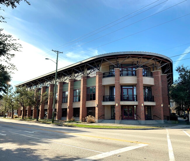
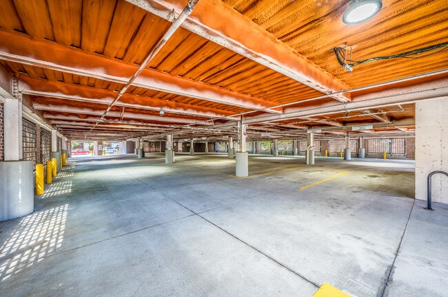
525 E Bay St, Charleston, SC 29403

Current Lease Availabilities
Property Detail
525 E Bay St
459-13-02-015
DESCRIPTION -PARCEL A CHAPEL AND EAST BAY STREETS SITE NAME -PAPA JOHNS REST & CHAS DRYCLEANERS
Officebuilding
Charleston
AE The base floodplain where base flood elevations are provided. AE Zones are now used on new format FIRMs instead of A1-A30 Zones.
South Carolina
2025
0.74 AC
2024
Downtown Charleston
005100
Charleston/N Charleston
24,492 SF
Charleston-North Charleston, SC
NEARBY LISTINGS FOR SALE OR LEASE
DEMOGRAPHICS near 525 E Bay St
1 mile
3 mile
5 mile
2024 Total Population
17,761
49,310
135,586
2029 Population
19,050
52,364
142,528
Pop Growth 2024-2029
+ 7.26%
+ 6.19%
+ 5.12%
Average Age
34
37
40
2024 Total Households
8,227
22,447
60,298
HH Growth 2024-2029
+ 7.74%
+ 6.59%
+ 5.35%
Median Household Inc
$65,616
$85,670
$95,539
Avg Household Size
1.90
2.00
2.10
2024 Avg HH Vehicles
1.00
1.00
2.00
Median Home Value
$903,498
$857,728
$684,805
Median Year Built
1967
1965
1978
Nearby Places
Map Layers
Map Styles
 Street
 Aerial
Transit
 Traffic
 Biking
Places
Listings with unknown addresses are not visible on the map
- Restaurants
- Banks
- Shops
- Fitness
- Groceries
PUBLIC TRANSPORTATION
COMMUTER RAIL
Charleston Amtrak Station (Palmetto - Amtrak, Silver Meteor - Amtrak)
Drive
Walk
Distance
Charleston Amtrak Station (Palmetto - Amtrak, Silver Meteor - Amtrak)
10 min
7.4 mi
AIRPORT
Charleston AFB/International
Drive
Walk
Distance
Charleston AFB/International
20 min
13.9 mi
Freight Ports
Columbus Street Terminal
Drive
Walk
Distance
Columbus Street Terminal
0 min
0.4 mi
Nearby Properties
Address
Land Use
TOTAL SIZE
Lot Size
Zoning
Address
Land Use
TOTAL SIZE
Lot Size
Zoning
79,990 SF
9.22 AC
Address
Land Use
TOTAL SIZE
Lot Size
Zoning
2,592 SF
13.64 AC
Address
Land Use
TOTAL SIZE
Lot Size
Zoning
Address
Land Use
TOTAL SIZE
Lot Size
Zoning
0.62 AC
Address
Land Use
TOTAL SIZE
Lot Size
Zoning
39,150 SF
7.76 AC
Address
Land Use
TOTAL SIZE
Lot Size
Zoning
80,044 SF
2.48 AC
Address
Land Use
TOTAL SIZE
Lot Size
Zoning
85,408 SF
9.39 AC
Address
Land Use
TOTAL SIZE
Lot Size
Zoning
22,620 SF
12.23 AC
Address
Land Use
TOTAL SIZE
Lot Size
Zoning
66,136 SF
1.88 AC
Address
Land Use
TOTAL SIZE
Lot Size
Zoning
8,472 SF
9.83 AC
Address
Land Use
TOTAL SIZE
Lot Size
Zoning
8,472 SF
9.84 AC
Address
Land Use
TOTAL SIZE
Lot Size
Zoning
Address
Land Use
TOTAL SIZE
Lot Size
Zoning
1,435 SF
1.98 AC
Address
Land Use
TOTAL SIZE
Lot Size
Zoning
6.11 AC
Address
Land Use
TOTAL SIZE
Lot Size
Zoning
17,459 SF
4.16 AC
Address
Land Use
TOTAL SIZE
Lot Size
Zoning
8,714 SF
1.60 AC
Address
Land Use
TOTAL SIZE
Lot Size
Zoning
Address
Land Use
TOTAL SIZE
Lot Size
Zoning
1,282 SF
8.42 AC
Address
Land Use
TOTAL SIZE
Lot Size
Zoning
Address
Land Use
TOTAL SIZE
Lot Size
Zoning
Address
Land Use
TOTAL SIZE
Lot Size
Zoning
5,733 SF
0.10 AC
Address
Land Use
TOTAL SIZE
Lot Size
Zoning
43,934 SF
1.50 AC
Address
Land Use
TOTAL SIZE
Lot Size
Zoning
14,240 SF
3.50 AC
Address
Land Use
TOTAL SIZE
Lot Size
Zoning
8,740 SF
0.58 AC
Address
Land Use
TOTAL SIZE
Lot Size
Zoning
1,150 SF
Address
Land Use
TOTAL SIZE
Lot Size
Zoning
24,320 SF
1.31 AC
Address
Land Use
TOTAL SIZE
Lot Size
Zoning
29,910 SF
2.82 AC
Address
Land Use
TOTAL SIZE
Lot Size
Zoning
41,070 SF
0.61 AC
Address
Land Use
TOTAL SIZE
Lot Size
Zoning
Address
Land Use
TOTAL SIZE
Lot Size
Zoning
22,825 SF
4.36 AC
The World's #1 Commercial Real Estate Marketplace
Connect with us
© 2026 CoStar Group
The information above has been obtained from sources believed reliable. While we do not doubt its accuracy we have not verified it and make no guarantee, warranty or representation about it. It is your responsibility to independently confirm its accuracy and completeness. Any projections, opinions, assumptions, or estimates used are for example only and do not represent the current or future performance of the property. The value of this transaction to you depends on tax and other factors which should be evaluated by your tax, financial, and legal advisors. You and your advisors should conduct a careful, independent investigation of the property to determine to your satisfaction the suitability of the property for your needs.