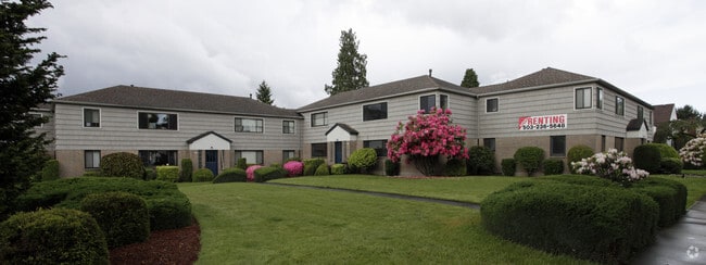
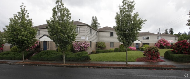
Property Record
525 Se 41St Ave, Portland, OR 97214

Property Detail
525 Se 41St Ave
R233547
PARADISE SPR FARM, LOT 3 TL 100
Multifamilydwelling
Multnomah
RM1
Oregon
B and X Area of moderate flood hazard, usually the area between the limits of the 100-year and 500-year floods.
3
2025
3.56 AC
2025
Sunnyside
001400
Portland
75,584 SF
Portland-Vancouver-Hillsboro, OR-WA
NEARBY LISTINGS FOR SALE OR LEASE
DEMOGRAPHICS near 525 Se 41St Ave
1 mile
3 mile
5 mile
2025 Total Population
30,538
219,810
489,180
2030 Population
30,033
217,131
484,806
Pop Growth 2025-2030
(1.65%)
(1.22%)
(0.89%)
Average Age
41
41
41
2025 Total Households
14,123
101,293
218,907
HH Growth 2025-2030
(1.86%)
(1.28%)
(0.97%)
Median Household Inc
$104,611
$92,326
$88,353
Avg Household Size
2.10
2.10
2.10
2025 Avg HH Vehicles
1.00
1.00
1.00
Median Home Value
$731,469
$679,216
$627,936
Median Year Built
1948
1953
1961
Nearby Places
Map Layers
Map Styles
 Street
 Aerial
Transit
 Traffic
 Biking
Places
Listings with unknown addresses are not visible on the map
- Restaurants
- Banks
- Shops
- Fitness
- Groceries
PUBLIC TRANSPORTATION
COMMUTER RAIL
Portland (Amtrak Cascades - Amtrak, Coast Starlight - Amtrak, Empire Builder - Amtrak)
Drive
Walk
Distance
Portland (Amtrak Cascades - Amtrak, Coast Starlight - Amtrak, Empire Builder - Amtrak)
11 min
3.5 mi
AIRPORT
Portland International
Drive
Walk
Distance
Portland International
18 min
7.1 mi
Freight Ports
Port of Portland
Drive
Walk
Distance
Port of Portland
14 min
7.2 mi
Nearby Properties
Address
Land Use
TOTAL SIZE
Lot Size
Zoning
Address
Land Use
TOTAL SIZE
Lot Size
Zoning
395,815 SF
2.66 AC
IRD
Address
Land Use
TOTAL SIZE
Lot Size
Zoning
627,500 SF
16.60 AC
CX
Address
Land Use
TOTAL SIZE
Lot Size
Zoning
822,867 SF
103.39 AC
CI1
Address
Land Use
TOTAL SIZE
Lot Size
Zoning
560,000 SF
0.15 AC
CX
Address
Land Use
TOTAL SIZE
Lot Size
Zoning
1.09 AC
EX
Address
Land Use
TOTAL SIZE
Lot Size
Zoning
2.24 AC
CX
Address
Land Use
TOTAL SIZE
Lot Size
Zoning
417,324 SF
0.68 AC
CX
Address
Land Use
TOTAL SIZE
Lot Size
Zoning
257,700 SF
2.89 AC
EX
Address
Land Use
TOTAL SIZE
Lot Size
Zoning
178,785 SF
10.20 AC
R5
Address
Land Use
TOTAL SIZE
Lot Size
Zoning
460,000 SF
0.92 AC
CX
Address
Land Use
TOTAL SIZE
Lot Size
Zoning
689,840 SF
0.92 AC
CX
Address
Land Use
TOTAL SIZE
Lot Size
Zoning
125,217 SF
0.23 AC
CX
Address
Land Use
TOTAL SIZE
Lot Size
Zoning
296,039 SF
11.70 AC
R5
Address
Land Use
TOTAL SIZE
Lot Size
Zoning
7.78 AC
EX
Address
Land Use
TOTAL SIZE
Lot Size
Zoning
183,664 SF
8.96 AC
R5
Address
Land Use
TOTAL SIZE
Lot Size
Zoning
584,483 SF
0.90 AC
CX
Address
Land Use
TOTAL SIZE
Lot Size
Zoning
280,069 SF
18.31 AC
IR
Address
Land Use
TOTAL SIZE
Lot Size
Zoning
247,520 SF
7.74 AC
CX
Address
Land Use
TOTAL SIZE
Lot Size
Zoning
306,000 SF
1.21 AC
NULL
Address
Land Use
TOTAL SIZE
Lot Size
Zoning
596,161 SF
0.92 AC
CX
Address
Land Use
TOTAL SIZE
Lot Size
Zoning
193,898 SF
2.50 AC
IRD
Address
Land Use
TOTAL SIZE
Lot Size
Zoning
387,000 SF
0.88 AC
CXD
Address
Land Use
TOTAL SIZE
Lot Size
Zoning
473,746 SF
1.68 AC
Address
Land Use
TOTAL SIZE
Lot Size
Zoning
262,645 SF
1 AC
CX
Address
Land Use
TOTAL SIZE
Lot Size
Zoning
354,677 SF
0.79 AC
CX
Address
Land Use
TOTAL SIZE
Lot Size
Zoning
2,218,439 SF
21.88 AC
CX
Address
Land Use
TOTAL SIZE
Lot Size
Zoning
477,636 SF
0.90 AC
CXD
Address
Land Use
TOTAL SIZE
Lot Size
Zoning
191,724 SF
0.45 AC
CXD
Address
Land Use
TOTAL SIZE
Lot Size
Zoning
388,191 SF
1.86 AC
CX
Address
Land Use
TOTAL SIZE
Lot Size
Zoning
42,920 SF
1.16 AC
CX
The World's #1 Commercial Real Estate Marketplace
Connect with us
© 2026 CoStar Group
The information above has been obtained from sources believed reliable. While we do not doubt its accuracy we have not verified it and make no guarantee, warranty or representation about it. It is your responsibility to independently confirm its accuracy and completeness. Any projections, opinions, assumptions, or estimates used are for example only and do not represent the current or future performance of the property. The value of this transaction to you depends on tax and other factors which should be evaluated by your tax, financial, and legal advisors. You and your advisors should conduct a careful, independent investigation of the property to determine to your satisfaction the suitability of the property for your needs.