Property Record
5250 Millersport Hwy, East Amherst, NY 14051
NEARBY LISTINGS FOR SALE OR LEASE
Property Detail
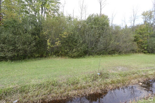
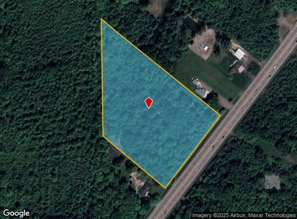
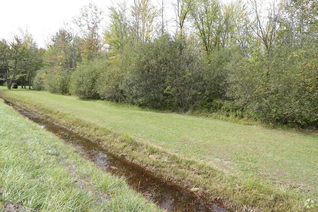
5250 Millersport Hwy
Buffalo-Cheektowaga-Niagara Falls, NY
Holland Land Companys Survey
142289-004-000-0002-037-100
3 13 7
Residentialacreage
Erie
X
New York
36029C0079H
37.100
2025
8.41 AC
2024
North
009009
Buffalo/Niagara Falls
DEMOGRAPHICS near 5250 Millersport Hwy
1 Mile
3 Mile
5 Mile
2024 Total Population
1,567
13,529
54,484
2029 Population
1,557
13,431
54,260
Pop Growth 2024-2029
(0.64%)
(0.72%)
(0.41%)
Average Age
43
43
42
2024 Total Households
678
5,548
21,351
HH Growth 2024-2029
(0.74%)
(0.87%)
(0.51%)
Median Household Inc
$93,395
$92,114
$102,301
Avg Household Size
2.30
2.40
2.50
2024 Avg HH Vehicles
2.00
2.00
2.00
Median Home Value
$280,487
$263,501
$310,617
Median Year Built
1991
1987
1987
Nearby Places
- Restaurants
- Banks
- Shops
- Fitness
- Groceries
PUBLIC TRANSPORTATION
AIRPORT
Buffalo Niagara International
DRIVE
WALK
Distance
Buffalo Niagara International
18 min
11.8 mi
Niagara Falls International
DRIVE
WALK
Distance
Niagara Falls International
26 min
15.7 mi
Freight Ports
Albany, NY Port
DRIVE
WALK
Distance
Albany, NY Port
337 min
288.0 mi
SALE & LEASE HISTORY
LISTING DATE
SALE/LEASE

Oct 16, 2017
For Sale
Nearby Properties
Address
Land Use
TOTAL SIZE
Lot Size
Zoning
Address
Land Use
TOTAL SIZE
Lot Size
Zoning
5,364 SF
56.45 AC
Address
Land Use
TOTAL SIZE
Lot Size
Zoning
7,080 SF
21.40 AC
MFR-5
Address
Land Use
TOTAL SIZE
Lot Size
Zoning
4,436 SF
18.51 AC
Address
Land Use
TOTAL SIZE
Lot Size
Zoning
154,296 SF
7.90 AC
RD
Address
Land Use
TOTAL SIZE
Lot Size
Zoning
87,718 SF
1.26 AC
RD
Address
Land Use
TOTAL SIZE
Lot Size
Zoning
9,338 SF
6.20 AC
Address
Land Use
TOTAL SIZE
Lot Size
Zoning
106,676 SF
8.90 AC
RD
Address
Land Use
TOTAL SIZE
Lot Size
Zoning
131,128 SF
15.48 AC
RD
Address
Land Use
TOTAL SIZE
Lot Size
Zoning
92,368 SF
0.75 AC
RD
Address
Land Use
TOTAL SIZE
Lot Size
Zoning
280 SF
31 AC
Address
Land Use
TOTAL SIZE
Lot Size
Zoning
37,183 SF
62.32 AC
RC
Address
Land Use
TOTAL SIZE
Lot Size
Zoning
51,125 SF
12.20 AC
Address
Land Use
TOTAL SIZE
Lot Size
Zoning
11,858 SF
5.30 AC
Address
Land Use
TOTAL SIZE
Lot Size
Zoning
15,969 SF
2.86 AC
Address
Land Use
TOTAL SIZE
Lot Size
Zoning
6,072 SF
6.46 AC
TND
Address
Land Use
TOTAL SIZE
Lot Size
Zoning
16.08 AC
RD
Address
Land Use
TOTAL SIZE
Lot Size
Zoning
26,080 SF
16.71 AC
RD
Address
Land Use
TOTAL SIZE
Lot Size
Zoning
21,216 SF
3.90 AC
Address
Land Use
TOTAL SIZE
Lot Size
Zoning
14,736 SF
3.13 AC
Address
Land Use
TOTAL SIZE
Lot Size
Zoning
36,725 SF
7 AC
B-2
Address
Land Use
TOTAL SIZE
Lot Size
Zoning
5,000 SF
2.60 AC
Address
Land Use
TOTAL SIZE
Lot Size
Zoning
884 SF
35 AC
Address
Land Use
TOTAL SIZE
Lot Size
Zoning
78,640 SF
15.60 AC
R-2 RESI
Address
Land Use
TOTAL SIZE
Lot Size
Zoning
4.23 AC
Address
Land Use
TOTAL SIZE
Lot Size
Zoning
29.10 AC
Address
Land Use
TOTAL SIZE
Lot Size
Zoning
40,599 SF
5.90 AC
R-2
Address
Land Use
TOTAL SIZE
Lot Size
Zoning
7,553 SF
175.27 AC
CF
Address
Land Use
TOTAL SIZE
Lot Size
Zoning
6,108 SF
1.50 AC
Address
Land Use
TOTAL SIZE
Lot Size
Zoning
Address
Land Use
TOTAL SIZE
Lot Size
Zoning
20,147 SF
3.99 AC
B-1
The World's #1 Commercial Real Estate Marketplace
Connect with us
© 2025 CoStar Group
The information above has been obtained from sources believed reliable. While we do not doubt its accuracy we have not verified it and make no guarantee, warranty or representation about it. It is your responsibility to independently confirm its accuracy and completeness. Any projections, opinions, assumptions, or estimates used are for example only and do not represent the current or future performance of the property. The value of this transaction to you depends on tax and other factors which should be evaluated by your tax, financial, and legal advisors. You and your advisors should conduct a careful, independent investigation of the property to determine to your satisfaction the suitability of the property for your needs.