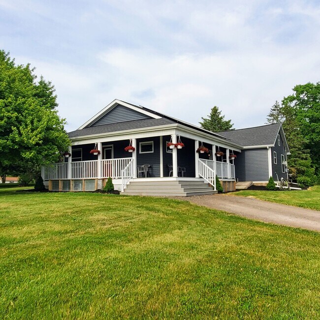
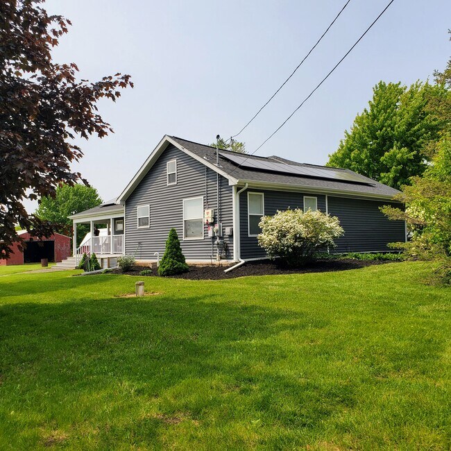
Property Record
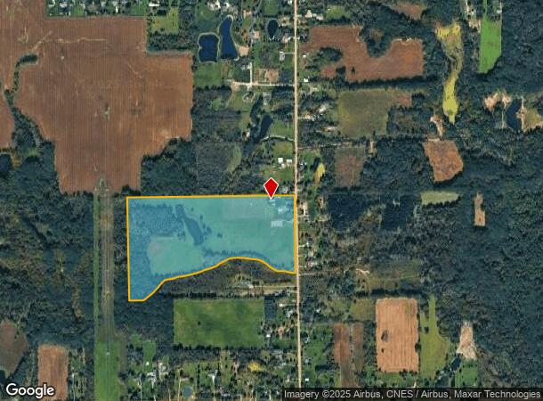
5253 N Henderson Rd, Davison, MI 48423
NEARBY LISTINGS FOR SALE OR LEASE
-
-
View all Davison listings for sale on LoopNet.com
Property Detail
5253 N Henderson Rd
16-23-400-001
N 1/2 OF SE 1/4 EXCEPT A PARCEL OF LAND BEG AT SE COR OF N 1/2 OF SE 1/4 TH W 2005 FT TO C L OF CREEK TH NELY ALONG C L OF
Agriculturalland
Genesee
X
Michigan
26049C0250D
48 AC
2024
Flint
2025
Detroit
011902
Flint, MI
1,615 SF
DEMOGRAPHICS near 5253 N Henderson Rd
1 Mile
3 Mile
5 Mile
2024 Total Population
447
6,998
23,495
2029 Population
432
6,891
23,094
Pop Growth 2024-2029
(3.36%)
(1.53%)
(1.71%)
Average Age
41
41
43
2024 Total Households
163
2,636
9,614
HH Growth 2024-2029
(3.68%)
(1.59%)
(1.76%)
Median Household Inc
$73,604
$71,067
$64,398
Avg Household Size
2.60
2.60
2.40
2024 Avg HH Vehicles
2.00
2.00
2.00
Median Home Value
$254,411
$199,347
$180,904
Median Year Built
1976
1981
1976
Nearby Places
Map Layers
Map Styles
 Street
 Aerial
- Restaurants
- Banks
- Shops
- Fitness
- Groceries
PUBLIC TRANSPORTATION
AIRPORT
Bishop International
DRIVE
WALK
Distance
Bishop International
43 min
24.9 mi
Freight Ports
Port of Toledo
DRIVE
WALK
Distance
Port of Toledo
158 min
114.7 mi
SALE & LEASE HISTORY
LISTING DATE
SALE/LEASE

Jun 29, 2023
For Sale
Nearby Properties
Address
Land Use
TOTAL SIZE
Lot Size
Zoning
Address
Land Use
TOTAL SIZE
Lot Size
Zoning
6,449 SF
90.81 AC
MH
Address
Land Use
TOTAL SIZE
Lot Size
Zoning
101,648 SF
18.65 AC
I
Address
Land Use
TOTAL SIZE
Lot Size
Zoning
2,328 SF
79 AC
RRA
Address
Land Use
TOTAL SIZE
Lot Size
Zoning
36,620 SF
47.81 AC
CB
Address
Land Use
TOTAL SIZE
Lot Size
Zoning
8.37 AC
CB
Address
Land Use
TOTAL SIZE
Lot Size
Zoning
40,393 SF
10.05 AC
I
Address
Land Use
TOTAL SIZE
Lot Size
Zoning
10,472 SF
12.89 AC
CB
Address
Land Use
TOTAL SIZE
Lot Size
Zoning
312.60 AC
SRM
Address
Land Use
TOTAL SIZE
Lot Size
Zoning
10,200 SF
2.72 AC
CB
Address
Land Use
TOTAL SIZE
Lot Size
Zoning
1,452 SF
5.01 AC
CB
Address
Land Use
TOTAL SIZE
Lot Size
Zoning
8,612 SF
10.34 AC
CB
Address
Land Use
TOTAL SIZE
Lot Size
Zoning
7,434 SF
22 AC
CB
Address
Land Use
TOTAL SIZE
Lot Size
Zoning
1,514 SF
8.43 AC
CB
Address
Land Use
TOTAL SIZE
Lot Size
Zoning
2,926 SF
146.83 AC
RRA
Address
Land Use
TOTAL SIZE
Lot Size
Zoning
12,026 SF
28.60 AC
I
Address
Land Use
TOTAL SIZE
Lot Size
Zoning
3,251 SF
1.79 AC
CB
Address
Land Use
TOTAL SIZE
Lot Size
Zoning
1,608 SF
111.51 AC
RRA
Address
Land Use
TOTAL SIZE
Lot Size
Zoning
Address
Land Use
TOTAL SIZE
Lot Size
Zoning
12,000 SF
10.11 AC
CB
Address
Land Use
TOTAL SIZE
Lot Size
Zoning
Address
Land Use
TOTAL SIZE
Lot Size
Zoning
2,088 SF
29.04 AC
RRA
Address
Land Use
TOTAL SIZE
Lot Size
Zoning
1,232 SF
39.50 AC
RRA
Address
Land Use
TOTAL SIZE
Lot Size
Zoning
14,460 SF
1.67 AC
CB
Address
Land Use
TOTAL SIZE
Lot Size
Zoning
3,456 SF
3.09 AC
CB
Address
Land Use
TOTAL SIZE
Lot Size
Zoning
2,056 SF
36.20 AC
RRA
Address
Land Use
TOTAL SIZE
Lot Size
Zoning
158 AC
SRA
Address
Land Use
TOTAL SIZE
Lot Size
Zoning
155.03 AC
RRA
Address
Land Use
TOTAL SIZE
Lot Size
Zoning
16,800 SF
5.33 AC
CB
Address
Land Use
TOTAL SIZE
Lot Size
Zoning
1,528 SF
59.48 AC
RRA
Address
Land Use
TOTAL SIZE
Lot Size
Zoning
11,764 SF
4.20 AC
I
The World's #1 Commercial Real Estate Marketplace
Connect with us
© 2026 CoStar Group
The information above has been obtained from sources believed reliable. While we do not doubt its accuracy we have not verified it and make no guarantee, warranty or representation about it. It is your responsibility to independently confirm its accuracy and completeness. Any projections, opinions, assumptions, or estimates used are for example only and do not represent the current or future performance of the property. The value of this transaction to you depends on tax and other factors which should be evaluated by your tax, financial, and legal advisors. You and your advisors should conduct a careful, independent investigation of the property to determine to your satisfaction the suitability of the property for your needs.