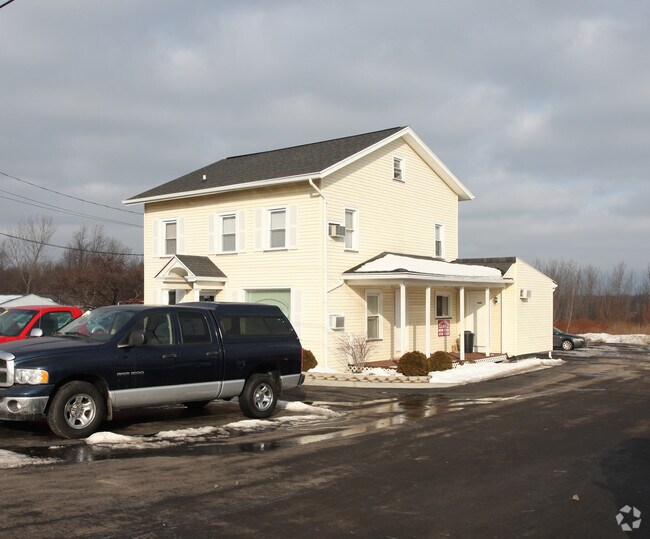
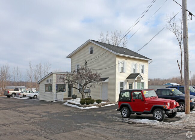
Property Record
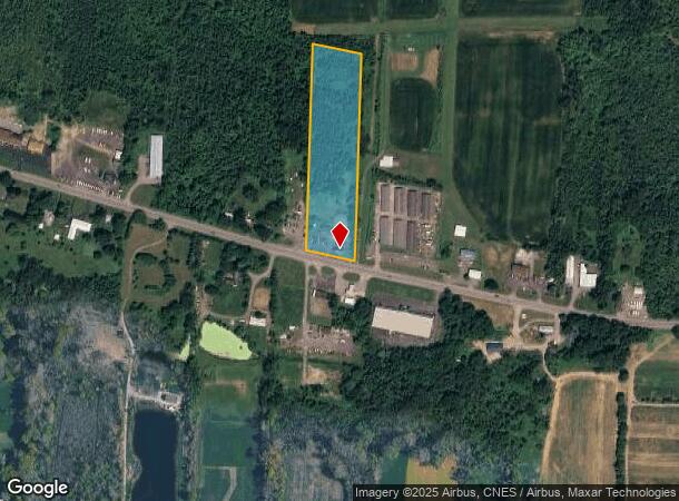
5256 W Ridge Rd, Spencerport, NY 14559
NEARBY LISTINGS FOR SALE OR LEASE
-
-
View all Spencerport listings for sale on LoopNet.com
Property Detail
5256 W Ridge Rd
264089-071-020-0001-009-000
GORE TR L9 TWP4 R1 PLUS DEED 8023 513
Commercialofficeresidentialmixeduse
Monroe
X
New York
36055C0155G
9.000
2025
6.10 AC
2024
Northwest
014802
Rochester
1,970 SF
Rochester, NY
DEMOGRAPHICS near 5256 W Ridge Rd
1 Mile
3 Mile
5 Mile
2024 Total Population
388
11,920
35,697
2029 Population
380
11,704
35,031
Pop Growth 2024-2029
(2.06%)
(1.81%)
(1.87%)
Average Age
45
43
43
2024 Total Households
160
4,835
14,247
HH Growth 2024-2029
(1.88%)
(1.92%)
(1.99%)
Median Household Inc
$105,814
$85,276
$79,136
Avg Household Size
2.40
2.40
2.50
2024 Avg HH Vehicles
2.00
2.00
2.00
Median Home Value
$213,333
$196,560
$190,982
Median Year Built
1960
1973
1980
Nearby Places
- Restaurants
- Banks
- Shops
- Fitness
- Groceries
PUBLIC TRANSPORTATION
AIRPORT
Frederick Douglass/Greater Rochester International
DRIVE
WALK
Distance
Frederick Douglass/Greater Rochester International
22 min
14.7 mi
Freight Ports
Albany, NY Port
DRIVE
WALK
Distance
Albany, NY Port
285 min
240.5 mi
Nearby Properties
Address
Land Use
TOTAL SIZE
Lot Size
Zoning
Address
Land Use
TOTAL SIZE
Lot Size
Zoning
279,852 SF
78.40 AC
R-1
Address
Land Use
TOTAL SIZE
Lot Size
Zoning
149,427 SF
10.90 AC
R-1
Address
Land Use
TOTAL SIZE
Lot Size
Zoning
180,566 SF
13.30 AC
R-1
Address
Land Use
TOTAL SIZE
Lot Size
Zoning
60,509 SF
29.40 AC
R-1
Address
Land Use
TOTAL SIZE
Lot Size
Zoning
8,386 SF
15.50 AC
MFR
Address
Land Use
TOTAL SIZE
Lot Size
Zoning
86,432 SF
34.86 AC
R-1
Address
Land Use
TOTAL SIZE
Lot Size
Zoning
42,944 SF
8.04 AC
05 - COMME
Address
Land Use
TOTAL SIZE
Lot Size
Zoning
13,764 SF
10.90 AC
MFR
Address
Land Use
TOTAL SIZE
Lot Size
Zoning
71,344 SF
29.90 AC
R-1
Address
Land Use
TOTAL SIZE
Lot Size
Zoning
19,280 SF
1.15 AC
B2
Address
Land Use
TOTAL SIZE
Lot Size
Zoning
14,671 SF
33.82 AC
GC
Address
Land Use
TOTAL SIZE
Lot Size
Zoning
5,260 SF
5.63 AC
SC
Address
Land Use
TOTAL SIZE
Lot Size
Zoning
20,845 SF
2.87 AC
RB
Address
Land Use
TOTAL SIZE
Lot Size
Zoning
13,718 SF
4.85 AC
MFR
Address
Land Use
TOTAL SIZE
Lot Size
Zoning
2,234 SF
4.52 AC
05 - COMME
Address
Land Use
TOTAL SIZE
Lot Size
Zoning
3,904 SF
5.19 AC
R3
Address
Land Use
TOTAL SIZE
Lot Size
Zoning
35,044 SF
10.90 AC
R-1
Address
Land Use
TOTAL SIZE
Lot Size
Zoning
37,000 SF
15.80 AC
R2
Address
Land Use
TOTAL SIZE
Lot Size
Zoning
2,226 SF
5.61 AC
SC
Address
Land Use
TOTAL SIZE
Lot Size
Zoning
24,482 SF
97.01 AC
Address
Land Use
TOTAL SIZE
Lot Size
Zoning
14,834 SF
6.23 AC
02 - SINGL
Address
Land Use
TOTAL SIZE
Lot Size
Zoning
61,065 SF
9.42 AC
C
Address
Land Use
TOTAL SIZE
Lot Size
Zoning
10,000 SF
9.98 AC
Address
Land Use
TOTAL SIZE
Lot Size
Zoning
5,600 SF
3.93 AC
05 - COMME
Address
Land Use
TOTAL SIZE
Lot Size
Zoning
69,166 SF
3.76 AC
R2
Address
Land Use
TOTAL SIZE
Lot Size
Zoning
3,600 SF
3.65 AC
05 - COMME
Address
Land Use
TOTAL SIZE
Lot Size
Zoning
18,264 SF
5 AC
05 - COMME
Address
Land Use
TOTAL SIZE
Lot Size
Zoning
7,756 SF
10.11 AC
R-1
Address
Land Use
TOTAL SIZE
Lot Size
Zoning
Address
Land Use
TOTAL SIZE
Lot Size
Zoning
20,610 SF
3.07 AC
B3
The World's #1 Commercial Real Estate Marketplace
Connect with us
© 2025 CoStar Group
The information above has been obtained from sources believed reliable. While we do not doubt its accuracy we have not verified it and make no guarantee, warranty or representation about it. It is your responsibility to independently confirm its accuracy and completeness. Any projections, opinions, assumptions, or estimates used are for example only and do not represent the current or future performance of the property. The value of this transaction to you depends on tax and other factors which should be evaluated by your tax, financial, and legal advisors. You and your advisors should conduct a careful, independent investigation of the property to determine to your satisfaction the suitability of the property for your needs.