Property Record
52585 Dequindre Rd, Rochester Hills, MI 48307


NEARBY LISTINGS FOR SALE OR LEASE
Property Detail
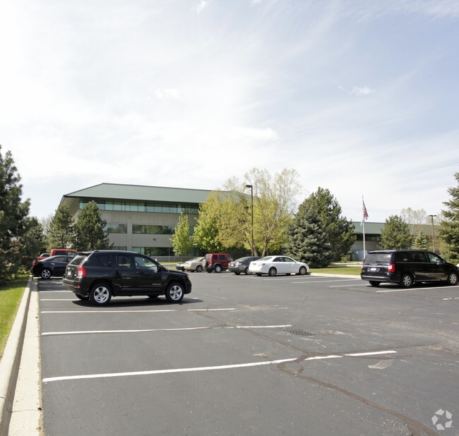
52585 Dequindre Rd
15-13-276-007
T3N, R11E, SEC 13 PART OF NE 1/4 BEG AT PT DIST N 01-57-15 W 885.71 FT FROM E 1/4 COR, TH S 88-02-45 W 746.34 FT, TH N
Officebuilding
Oakland
AE
Michigan
26099C0211G
17.50 AC
0
Rochester
2025
Detroit
191300
Detroit-Warren-Dearborn, MI
96,460 SF
DEMOGRAPHICS near 52585 Dequindre Rd
1 Mile
3 Mile
5 Mile
2024 Total Population
8,422
67,692
163,222
2029 Population
8,322
67,232
161,674
Pop Growth 2024-2029
(1.19%)
(0.68%)
(0.95%)
Average Age
40
42
42
2024 Total Households
3,251
27,929
65,195
HH Growth 2024-2029
(1.23%)
(0.61%)
(0.93%)
Median Household Inc
$91,629
$92,713
$95,575
Avg Household Size
2.50
2.40
2.40
2024 Avg HH Vehicles
2.00
2.00
2.00
Median Home Value
$341,259
$332,881
$336,913
Median Year Built
1992
1984
1984
Nearby Places
Map Layers
Map Styles
 Street
 Aerial
- Restaurants
- Banks
- Shops
- Fitness
- Groceries
PUBLIC TRANSPORTATION
AIRPORT
Windsor International
DRIVE
WALK
Distance
Windsor International
62 min
37.2 mi
Detroit Metro Wayne County
DRIVE
WALK
Distance
Detroit Metro Wayne County
66 min
46.8 mi
Bishop International
DRIVE
WALK
Distance
Bishop International
70 min
49.7 mi
SALE & LEASE HISTORY
LISTING DATE
SALE/LEASE

May 05, 2020
For Lease
May 05, 2020
For Sale
Nearby Properties
Address
Land Use
TOTAL SIZE
Lot Size
Zoning
Address
Land Use
TOTAL SIZE
Lot Size
Zoning
998,316 SF
85.99 AC
CK MAP
Address
Land Use
TOTAL SIZE
Lot Size
Zoning
444,087 SF
83.19 AC
II
Address
Land Use
TOTAL SIZE
Lot Size
Zoning
3,529 SF
29.19 AC
BI
Address
Land Use
TOTAL SIZE
Lot Size
Zoning
57.84 AC
AV
Address
Land Use
TOTAL SIZE
Lot Size
Zoning
389,465 SF
30.24 AC
II
Address
Land Use
TOTAL SIZE
Lot Size
Zoning
Address
Land Use
TOTAL SIZE
Lot Size
Zoning
12.38 AC
R-10
Address
Land Use
TOTAL SIZE
Lot Size
Zoning
332,286 SF
CK MAP
Address
Land Use
TOTAL SIZE
Lot Size
Zoning
195,413 SF
4.43 AC
Address
Land Use
TOTAL SIZE
Lot Size
Zoning
35.60 AC
R-12
Address
Land Use
TOTAL SIZE
Lot Size
Zoning
257,878 SF
30 AC
Address
Land Use
TOTAL SIZE
Lot Size
Zoning
190,996 SF
33.80 AC
LM
Address
Land Use
TOTAL SIZE
Lot Size
Zoning
22.09 AC
AI
Address
Land Use
TOTAL SIZE
Lot Size
Zoning
134,904 SF
5 AC
Address
Land Use
TOTAL SIZE
Lot Size
Zoning
29,394 SF
33.83 AC
CK MAP
Address
Land Use
TOTAL SIZE
Lot Size
Zoning
19.47 AC
R-8
Address
Land Use
TOTAL SIZE
Lot Size
Zoning
119.30 AC
Address
Land Use
TOTAL SIZE
Lot Size
Zoning
181,725 SF
CK MAP
Address
Land Use
TOTAL SIZE
Lot Size
Zoning
43.80 AC
Address
Land Use
TOTAL SIZE
Lot Size
Zoning
167,747 SF
CK MAP
Address
Land Use
TOTAL SIZE
Lot Size
Zoning
21.52 AC
AI
Address
Land Use
TOTAL SIZE
Lot Size
Zoning
Address
Land Use
TOTAL SIZE
Lot Size
Zoning
10.28 AC
CK MAP
Address
Land Use
TOTAL SIZE
Lot Size
Zoning
9.47 AC
R-9
Address
Land Use
TOTAL SIZE
Lot Size
Zoning
51.98 AC
MHP
Address
Land Use
TOTAL SIZE
Lot Size
Zoning
62,495 SF
2.49 AC
MM
The World's #1 Commercial Real Estate Marketplace
Connect with us
© 2026 CoStar Group
The information above has been obtained from sources believed reliable. While we do not doubt its accuracy we have not verified it and make no guarantee, warranty or representation about it. It is your responsibility to independently confirm its accuracy and completeness. Any projections, opinions, assumptions, or estimates used are for example only and do not represent the current or future performance of the property. The value of this transaction to you depends on tax and other factors which should be evaluated by your tax, financial, and legal advisors. You and your advisors should conduct a careful, independent investigation of the property to determine to your satisfaction the suitability of the property for your needs.