Property Record
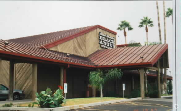
5259 W Indian School Rd, Phoenix, AZ 85031


NEARBY LISTINGS FOR SALE OR LEASE
Property Detail
5259 W Indian School Rd
103-08-006N
PT NE4 DAF BEG NE COR SD NE4 SEC TH W 1080.30F TH S 40F TO POB TH CONT S 333F W 225F N 318F TH N 4 5D 00M E 21.21F TH E 210F TO POB
Storebuilding
Maricopa
X
Arizona
04013C2185L
1.72 AC
2025
West Phoenix/Maryvale
2025
Phoenix
109900
Phoenix-Mesa-Chandler, AZ
13,367 SF
DEMOGRAPHICS near 5259 W Indian School Rd
1 Mile
3 Mile
5 Mile
2024 Total Population
23,839
211,546
480,793
2029 Population
25,576
227,193
516,868
Pop Growth 2024-2029
+ 7.29%
+ 7.40%
+ 7.50%
Average Age
32
32
33
2024 Total Households
5,852
60,141
143,666
HH Growth 2024-2029
+ 7.45%
+ 7.57%
+ 7.72%
Median Household Inc
$62,759
$48,515
$49,974
Avg Household Size
3.70
3.30
3.10
2024 Avg HH Vehicles
2.00
2.00
2.00
Median Home Value
$214,155
$207,915
$239,426
Median Year Built
1959
1973
1975
Nearby Places
Map Layers
Map Styles
 Street
 Aerial
- Restaurants
- Banks
- Shops
- Fitness
- Groceries
PUBLIC TRANSPORTATION
AIRPORT
Phoenix Sky Harbor International
DRIVE
WALK
Distance
Phoenix Sky Harbor International
22 min
14.2 mi
Phoenix-Mesa Gateway
DRIVE
WALK
Distance
Phoenix-Mesa Gateway
56 min
41.3 mi
Nearby Properties
Address
Land Use
TOTAL SIZE
Lot Size
Zoning
Address
Land Use
TOTAL SIZE
Lot Size
Zoning
569,517 SF
33.38 AC
PUD
Address
Land Use
TOTAL SIZE
Lot Size
Zoning
69,542 SF
4.92 AC
I-P
Address
Land Use
TOTAL SIZE
Lot Size
Zoning
1,063,188 SF
59.94 AC
Address
Land Use
TOTAL SIZE
Lot Size
Zoning
42,631 SF
2.90 AC
A-2
Address
Land Use
TOTAL SIZE
Lot Size
Zoning
281,038 SF
7.71 AC
Address
Land Use
TOTAL SIZE
Lot Size
Zoning
337,487 SF
39 AC
R-6
Address
Land Use
TOTAL SIZE
Lot Size
Zoning
348,753 SF
19.36 AC
R-6
Address
Land Use
TOTAL SIZE
Lot Size
Zoning
629,928 SF
41.37 AC
Address
Land Use
TOTAL SIZE
Lot Size
Zoning
436,817 SF
23.21 AC
I-P
Address
Land Use
TOTAL SIZE
Lot Size
Zoning
316,386 SF
45.04 AC
R16
Address
Land Use
TOTAL SIZE
Lot Size
Zoning
25.91 AC
A1
Address
Land Use
TOTAL SIZE
Lot Size
Zoning
350,874 SF
28.66 AC
C-C
Address
Land Use
TOTAL SIZE
Lot Size
Zoning
554,011 SF
26.10 AC
I-P
Address
Land Use
TOTAL SIZE
Lot Size
Zoning
211,015 SF
9.59 AC
R-6
Address
Land Use
TOTAL SIZE
Lot Size
Zoning
532,713 SF
27.31 AC
Address
Land Use
TOTAL SIZE
Lot Size
Zoning
874,407 SF
38.57 AC
I-P
Address
Land Use
TOTAL SIZE
Lot Size
Zoning
18,522 SF
1.69 AC
R-6
Address
Land Use
TOTAL SIZE
Lot Size
Zoning
208,563 SF
9.78 AC
R-6
Address
Land Use
TOTAL SIZE
Lot Size
Zoning
454,368 SF
23.36 AC
I-1
Address
Land Use
TOTAL SIZE
Lot Size
Zoning
74,208 SF
7.25 AC
I-P
Address
Land Use
TOTAL SIZE
Lot Size
Zoning
132,597 SF
59.45 AC
C-2
Address
Land Use
TOTAL SIZE
Lot Size
Zoning
18,296 SF
0.93 AC
I-P
Address
Land Use
TOTAL SIZE
Lot Size
Zoning
367,133 SF
17.88 AC
IND.PK.
Address
Land Use
TOTAL SIZE
Lot Size
Zoning
241,557 SF
20.02 AC
CPGCP
Address
Land Use
TOTAL SIZE
Lot Size
Zoning
176,657 SF
12.28 AC
I-1
Address
Land Use
TOTAL SIZE
Lot Size
Zoning
706,747 SF
13.54 AC
R-5
Address
Land Use
TOTAL SIZE
Lot Size
Zoning
13,678 SF
1.88 AC
R-6
Address
Land Use
TOTAL SIZE
Lot Size
Zoning
139,343 SF
10.13 AC
R-6
Address
Land Use
TOTAL SIZE
Lot Size
Zoning
340,502 SF
16.02 AC
Address
Land Use
TOTAL SIZE
Lot Size
Zoning
404,407 SF
20.94 AC
M-H
The World's #1 Commercial Real Estate Marketplace
Connect with us
© 2026 CoStar Group
The information above has been obtained from sources believed reliable. While we do not doubt its accuracy we have not verified it and make no guarantee, warranty or representation about it. It is your responsibility to independently confirm its accuracy and completeness. Any projections, opinions, assumptions, or estimates used are for example only and do not represent the current or future performance of the property. The value of this transaction to you depends on tax and other factors which should be evaluated by your tax, financial, and legal advisors. You and your advisors should conduct a careful, independent investigation of the property to determine to your satisfaction the suitability of the property for your needs.