Property Record
Squankum Yellowbrook Rd, Farmingdale, NJ 07727
NEARBY LISTINGS FOR SALE OR LEASE
Property Detail
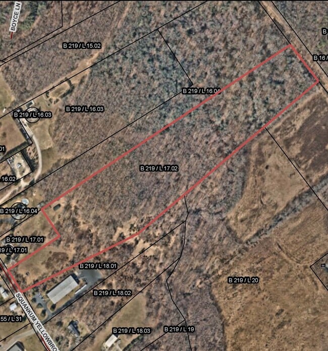
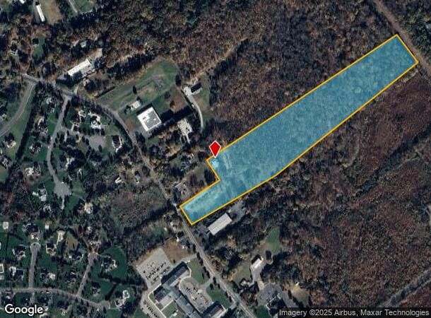
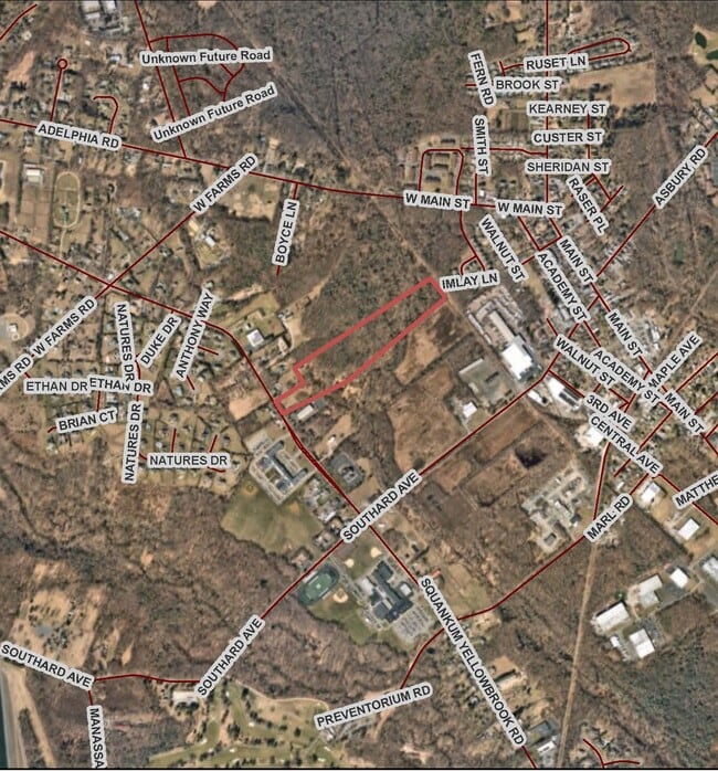
Squankum Yellowbrook Rd
21-00219-0000-00017-02-QFARM
Monmouth
Farms
New Jersey
X
17.2
34025C0310F
18.57 AC
2024
Western Monmouth
2025
Northern New Jersey
811600
New York-Jersey City-White Plains, NY-NJ
DEMOGRAPHICS near Squankum Yellowbrook Rd
1 Mile
3 Mile
5 Mile
2024 Total Population
2,314
12,906
52,852
2029 Population
2,345
12,871
52,255
Pop Growth 2024-2029
+ 1.34%
(0.27%)
(1.13%)
Average Age
40
43
42
2024 Total Households
868
4,597
19,064
HH Growth 2024-2029
+ 1.04%
(0.35%)
(1.32%)
Median Household Inc
$96,249
$121,845
$112,411
Avg Household Size
2.60
2.70
2.70
2024 Avg HH Vehicles
2.00
2.00
2.00
Median Home Value
$464,942
$515,868
$424,243
Median Year Built
1976
1985
1984
Nearby Places
Map Layers
Map Styles
 Street
 Aerial
- Restaurants
- Banks
- Shops
- Fitness
- Groceries
SALE & LEASE HISTORY
LISTING DATE
SALE/LEASE

Oct 19, 2018
For Sale
Dec 01, 2021
For Sale
Nearby Properties
Address
Land Use
TOTAL SIZE
Lot Size
Zoning
Address
Land Use
TOTAL SIZE
Lot Size
Zoning
192,708 SF
33.36 AC
OR10
Address
Land Use
TOTAL SIZE
Lot Size
Zoning
13 AC
R-40
Address
Land Use
TOTAL SIZE
Lot Size
Zoning
120,000 SF
77 AC
ARE2
Address
Land Use
TOTAL SIZE
Lot Size
Zoning
912 SF
201.36 AC
RRC
Address
Land Use
TOTAL SIZE
Lot Size
Zoning
240,362 SF
61.13 AC
ARE6
Address
Land Use
TOTAL SIZE
Lot Size
Zoning
13,350 SF
71.10 AC
ARE6
Address
Land Use
TOTAL SIZE
Lot Size
Zoning
161,000 SF
21.60 AC
ARE2
Address
Land Use
TOTAL SIZE
Lot Size
Zoning
55,984 SF
16.11 AC
LI
Address
Land Use
TOTAL SIZE
Lot Size
Zoning
10.11 AC
SED
Address
Land Use
TOTAL SIZE
Lot Size
Zoning
91,180 SF
27.20 AC
SED
Address
Land Use
TOTAL SIZE
Lot Size
Zoning
86,936 SF
3.42 AC
LI
Address
Land Use
TOTAL SIZE
Lot Size
Zoning
42.76 AC
SED
Address
Land Use
TOTAL SIZE
Lot Size
Zoning
33,128 SF
12.68 AC
ARE6
Address
Land Use
TOTAL SIZE
Lot Size
Zoning
212.49 AC
ARE6
Address
Land Use
TOTAL SIZE
Lot Size
Zoning
13.33 AC
SED
Address
Land Use
TOTAL SIZE
Lot Size
Zoning
7.04 AC
SED
Address
Land Use
TOTAL SIZE
Lot Size
Zoning
6.24 AC
SED
Address
Land Use
TOTAL SIZE
Lot Size
Zoning
13,832 SF
11.60 AC
SED
Address
Land Use
TOTAL SIZE
Lot Size
Zoning
4,909 SF
12 AC
OP-2
Address
Land Use
TOTAL SIZE
Lot Size
Zoning
92,983 SF
13 AC
ARE6
Address
Land Use
TOTAL SIZE
Lot Size
Zoning
191.14 AC
ARE6
Address
Land Use
TOTAL SIZE
Lot Size
Zoning
2,738 SF
26.03 AC
SEAR
Address
Land Use
TOTAL SIZE
Lot Size
Zoning
7.04 AC
GI-2
Address
Land Use
TOTAL SIZE
Lot Size
Zoning
9,212 SF
36.45 AC
SED
Address
Land Use
TOTAL SIZE
Lot Size
Zoning
40,222 SF
17.77 AC
SED
Address
Land Use
TOTAL SIZE
Lot Size
Zoning
3,480 SF
2 AC
VC
Address
Land Use
TOTAL SIZE
Lot Size
Zoning
51,450 SF
5.22 AC
SED
Address
Land Use
TOTAL SIZE
Lot Size
Zoning
50,400 SF
5.57 AC
SED
Address
Land Use
TOTAL SIZE
Lot Size
Zoning
4,172 SF
136.12 AC
SED
Address
Land Use
TOTAL SIZE
Lot Size
Zoning
1.06 AC
SED
The World's #1 Commercial Real Estate Marketplace
Connect with us
© 2025 CoStar Group
The information above has been obtained from sources believed reliable. While we do not doubt its accuracy we have not verified it and make no guarantee, warranty or representation about it. It is your responsibility to independently confirm its accuracy and completeness. Any projections, opinions, assumptions, or estimates used are for example only and do not represent the current or future performance of the property. The value of this transaction to you depends on tax and other factors which should be evaluated by your tax, financial, and legal advisors. You and your advisors should conduct a careful, independent investigation of the property to determine to your satisfaction the suitability of the property for your needs.