Property Record
Cornerstone North Blvd, Dayton, OH 45440

NEARBY LISTINGS FOR SALE OR LEASE
Property Detail
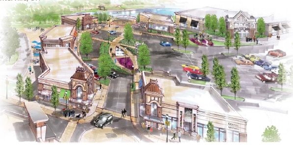
Cornerstone North Blvd
Cincinnati/Dayton
Cornerstone Section Six
Dayton, OH
CORNERSTONE SEC SIX REPLAT LOT 1D 2.889AC CORNERSTONE NORTH BLVD
L49-0001-0001-0-0042-00
Greene
Parkingstructure
Ohio
2025
1d
2024
2.89 AC
021602
South Central Dayton
DEMOGRAPHICS near Cornerstone North Blvd
1 mile
3 mile
5 mile
2024 Total Population
5,017
61,029
137,143
2029 Population
5,065
61,040
136,266
Pop Growth 2024-2029
+ 0.96%
+ 0.02%
(0.64%)
Average Age
42
42
43
2024 Total Households
2,059
26,178
59,301
HH Growth 2024-2029
+ 0.49%
(0.02%)
(0.70%)
Median Household Inc
$92,111
$82,107
$81,991
Avg Household Size
2.40
2.30
2.30
2024 Avg HH Vehicles
2.00
2.00
2.00
Median Home Value
$229,226
$225,291
$222,572
Median Year Built
1968
1971
1968
Nearby Places
Map Layers
Map Styles
 Street
 Aerial
Transit
 Traffic
 Biking
Places
Listings with unknown addresses are not visible on the map
- Restaurants
- Banks
- Shops
- Fitness
- Groceries
PUBLIC TRANSPORTATION
AIRPORT
James M Cox Dayton International
Drive
Walk
Distance
James M Cox Dayton International
35 min
21.0 mi
SALE & LEASE HISTORY
LISTING DATE
SALE/LEASE

Jun 14, 2019
For Sale
Nearby Properties
Address
Land Use
TOTAL SIZE
Lot Size
Zoning
Address
Land Use
TOTAL SIZE
Lot Size
Zoning
508,366 SF
114.86 AC
Address
Land Use
TOTAL SIZE
Lot Size
Zoning
462,864 SF
38.86 AC
Address
Land Use
TOTAL SIZE
Lot Size
Zoning
191,667 SF
35.98 AC
Address
Land Use
TOTAL SIZE
Lot Size
Zoning
490,354 SF
60 AC
Address
Land Use
TOTAL SIZE
Lot Size
Zoning
5,461 SF
10.35 AC
Address
Land Use
TOTAL SIZE
Lot Size
Zoning
1,951 SF
56.54 AC
Address
Land Use
TOTAL SIZE
Lot Size
Zoning
240,090 SF
1.93 AC
MXPUD02
Address
Land Use
TOTAL SIZE
Lot Size
Zoning
1,180 SF
23.28 AC
Address
Land Use
TOTAL SIZE
Lot Size
Zoning
203,122 SF
4.63 AC
Address
Land Use
TOTAL SIZE
Lot Size
Zoning
18.33 AC
Address
Land Use
TOTAL SIZE
Lot Size
Zoning
9,233 SF
22.26 AC
Address
Land Use
TOTAL SIZE
Lot Size
Zoning
38,832 SF
30.51 AC
R-PUD 03-7
Address
Land Use
TOTAL SIZE
Lot Size
Zoning
161,615 SF
23.20 AC
Address
Land Use
TOTAL SIZE
Lot Size
Zoning
81,787 SF
45.38 AC
Address
Land Use
TOTAL SIZE
Lot Size
Zoning
1,008 SF
7 AC
R1A
Address
Land Use
TOTAL SIZE
Lot Size
Zoning
198,030 SF
22.32 AC
Address
Land Use
TOTAL SIZE
Lot Size
Zoning
109,680 SF
32.24 AC
R4
Address
Land Use
TOTAL SIZE
Lot Size
Zoning
187,824 SF
27.52 AC
Address
Land Use
TOTAL SIZE
Lot Size
Zoning
10.33 AC
Address
Land Use
TOTAL SIZE
Lot Size
Zoning
130,766 SF
1.68 AC
Address
Land Use
TOTAL SIZE
Lot Size
Zoning
152,844 SF
14.80 AC
Address
Land Use
TOTAL SIZE
Lot Size
Zoning
137,948 SF
4.60 AC
Address
Land Use
TOTAL SIZE
Lot Size
Zoning
70,754 SF
75.48 AC
Address
Land Use
TOTAL SIZE
Lot Size
Zoning
119,701 SF
71.85 AC
Address
Land Use
TOTAL SIZE
Lot Size
Zoning
100,450 SF
1.66 AC
MXPUD02
Address
Land Use
TOTAL SIZE
Lot Size
Zoning
109,775 SF
1.25 AC
Address
Land Use
TOTAL SIZE
Lot Size
Zoning
148,309 SF
1.50 AC
MXPUD02
Address
Land Use
TOTAL SIZE
Lot Size
Zoning
24.77 AC
Address
Land Use
TOTAL SIZE
Lot Size
Zoning
9,344 SF
9.08 AC
Address
Land Use
TOTAL SIZE
Lot Size
Zoning
124,197 SF
13.72 AC
The World's #1 Commercial Real Estate Marketplace
Connect with us
© 2026 CoStar Group
The information above has been obtained from sources believed reliable. While we do not doubt its accuracy we have not verified it and make no guarantee, warranty or representation about it. It is your responsibility to independently confirm its accuracy and completeness. Any projections, opinions, assumptions, or estimates used are for example only and do not represent the current or future performance of the property. The value of this transaction to you depends on tax and other factors which should be evaluated by your tax, financial, and legal advisors. You and your advisors should conduct a careful, independent investigation of the property to determine to your satisfaction the suitability of the property for your needs.