Property Record
5260 Millertown Pike, Knoxville, TN 37924


NEARBY LISTINGS FOR SALE OR LEASE
Property Detail
5260 Millertown Pike
Knoxville, TN
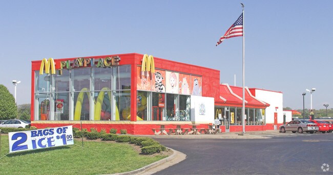
Mcdonalds Resturant
060IA-007
DIMENSIONS 300.59 X 182.87 X IRR LOWLOT 1 SUBDIVISIONNA ME MCDONALDS RESTURANT PLATNUMBER 201707140002837 MAPPL ATB 20170714
Restaurantdrivein
Knox
X
Tennessee
47093C0161G
1
2025
1.80 AC
2025
East
005202
Knoxville
4,741 SF
DEMOGRAPHICS near 5260 Millertown Pike
1 Mile
3 Mile
5 Mile
2024 Total Population
3,736
36,966
103,297
2029 Population
4,067
40,278
112,937
Pop Growth 2024-2029
+ 8.86%
+ 8.96%
+ 9.33%
Average Age
41
41
40
2024 Total Households
1,644
15,597
44,667
HH Growth 2024-2029
+ 9.00%
+ 9.07%
+ 9.51%
Median Household Inc
$50,034
$53,353
$47,410
Avg Household Size
2.20
2.30
2.20
2024 Avg HH Vehicles
2.00
2.00
2.00
Median Home Value
$183,965
$207,326
$193,995
Median Year Built
1987
1974
1971
Nearby Places
Map Layers
Map Styles
 Street
 Aerial
- Restaurants
- Banks
- Shops
- Fitness
- Groceries
PUBLIC TRANSPORTATION
AIRPORT
McGhee Tyson
DRIVE
WALK
Distance
McGhee Tyson
41 min
24.2 mi
Nearby Properties
Address
Land Use
TOTAL SIZE
Lot Size
Zoning
Address
Land Use
TOTAL SIZE
Lot Size
Zoning
224,536 SF
81.84 AC
Address
Land Use
TOTAL SIZE
Lot Size
Zoning
3,196 SF
28.14 AC
Address
Land Use
TOTAL SIZE
Lot Size
Zoning
1,134 SF
6.97 AC
Address
Land Use
TOTAL SIZE
Lot Size
Zoning
2,700 SF
22.24 AC
Address
Land Use
TOTAL SIZE
Lot Size
Zoning
1,822 SF
6.85 AC
Address
Land Use
TOTAL SIZE
Lot Size
Zoning
3,550 SF
8 AC
Address
Land Use
TOTAL SIZE
Lot Size
Zoning
27,420 SF
1.16 AC
Address
Land Use
TOTAL SIZE
Lot Size
Zoning
105,408 SF
9.33 AC
Address
Land Use
TOTAL SIZE
Lot Size
Zoning
89,492 SF
5.88 AC
Address
Land Use
TOTAL SIZE
Lot Size
Zoning
227,592 SF
22.25 AC
Address
Land Use
TOTAL SIZE
Lot Size
Zoning
2,922 SF
10.94 AC
Address
Land Use
TOTAL SIZE
Lot Size
Zoning
23,927 SF
1.91 AC
Address
Land Use
TOTAL SIZE
Lot Size
Zoning
160,000 SF
39.50 AC
Address
Land Use
TOTAL SIZE
Lot Size
Zoning
26,484 SF
6.77 AC
Address
Land Use
TOTAL SIZE
Lot Size
Zoning
6,120 SF
16.39 AC
Address
Land Use
TOTAL SIZE
Lot Size
Zoning
106,946 SF
12.57 AC
Address
Land Use
TOTAL SIZE
Lot Size
Zoning
59,410 SF
6 AC
Address
Land Use
TOTAL SIZE
Lot Size
Zoning
142,092 SF
13.90 AC
Address
Land Use
TOTAL SIZE
Lot Size
Zoning
128,639 SF
12.39 AC
Address
Land Use
TOTAL SIZE
Lot Size
Zoning
100 SF
423.35 AC
Address
Land Use
TOTAL SIZE
Lot Size
Zoning
87,256 SF
21.45 AC
Address
Land Use
TOTAL SIZE
Lot Size
Zoning
30,956 SF
8.31 AC
Address
Land Use
TOTAL SIZE
Lot Size
Zoning
4,740 SF
90.57 AC
Address
Land Use
TOTAL SIZE
Lot Size
Zoning
107,290 SF
8.03 AC
Address
Land Use
TOTAL SIZE
Lot Size
Zoning
114,636 SF
10.89 AC
Address
Land Use
TOTAL SIZE
Lot Size
Zoning
63,149 SF
6.30 AC
Address
Land Use
TOTAL SIZE
Lot Size
Zoning
92,592 SF
1.89 AC
Address
Land Use
TOTAL SIZE
Lot Size
Zoning
93,427 SF
15.54 AC
Address
Land Use
TOTAL SIZE
Lot Size
Zoning
56,700 SF
5.20 AC
Address
Land Use
TOTAL SIZE
Lot Size
Zoning
28,612 SF
4.40 AC
The World's #1 Commercial Real Estate Marketplace
Connect with us
© 2026 CoStar Group
The information above has been obtained from sources believed reliable. While we do not doubt its accuracy we have not verified it and make no guarantee, warranty or representation about it. It is your responsibility to independently confirm its accuracy and completeness. Any projections, opinions, assumptions, or estimates used are for example only and do not represent the current or future performance of the property. The value of this transaction to you depends on tax and other factors which should be evaluated by your tax, financial, and legal advisors. You and your advisors should conduct a careful, independent investigation of the property to determine to your satisfaction the suitability of the property for your needs.