Property Record
5261 High Point Rd, High Point, NC 27265
Property Detail
5261 High Point Rd
6882-68-1577
LO:053A BL:5608
Commercialnec
Forsyth
GB-S,HB-S
North Carolina
B and X Area of moderate flood hazard, usually the area between the limits of the 100-year and 500-year floods.
53a
2024
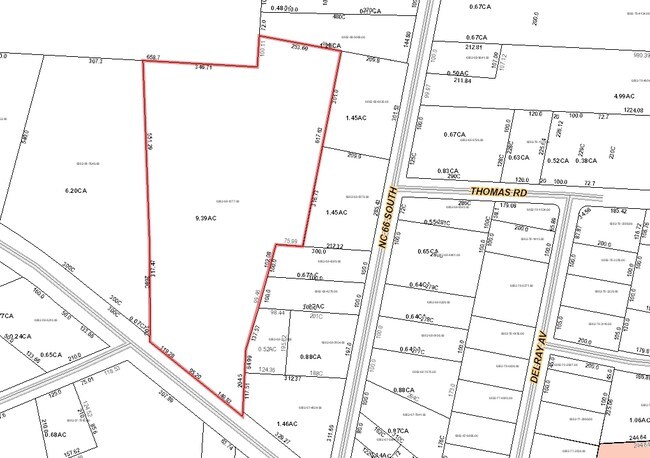
9.39 AC
2025
SE Forsyth County
003201
Greensboro/Winston-Salem
24,052 SF
Winston-Salem, NC
NEARBY LISTINGS FOR SALE OR LEASE
-
-
View all High Point listings for sale on LoopNet.com
DEMOGRAPHICS near 5261 High Point Rd
1 mile
3 mile
5 mile
2025 Total Population
1,474
23,039
78,846
2030 Population
1,559
23,805
81,707
Pop Growth 2025-2030
+ 5.77%
+ 3.32%
+ 3.63%
Average Age
43
42
41
2025 Total Households
580
9,606
30,933
HH Growth 2025-2030
+ 6.03%
+ 3.48%
+ 3.87%
Median Household Inc
$67,430
$73,986
$74,869
Avg Household Size
2.50
2.40
2.40
2025 Avg HH Vehicles
2.00
2.00
2.00
Median Home Value
$273,663
$262,400
$286,313
Median Year Built
1995
1992
1989
Nearby Places
Map Layers
Map Styles
 Street
 Aerial
Transit
 Traffic
 Biking
Places
Listings with unknown addresses are not visible on the map
- Restaurants
- Banks
- Shops
- Fitness
- Groceries
PUBLIC TRANSPORTATION
COMMUTER RAIL
High Point Station (Piedmont - North Carolina by Train (NC Train))
Drive
Walk
Distance
High Point Station (Piedmont - North Carolina by Train (NC Train))
12 min
6.3 mi
AIRPORT
Piedmont Triad International
Drive
Walk
Distance
Piedmont Triad International
29 min
15.0 mi
Freight Ports
Port of Wilmington
Drive
Walk
Distance
Port of Wilmington
258 min
219.5 mi
Nearby Properties
Address
Land Use
TOTAL SIZE
Lot Size
Zoning
Address
Land Use
TOTAL SIZE
Lot Size
Zoning
1,045,775 SF
114.96 AC
CZ-LI-HP
Address
Land Use
TOTAL SIZE
Lot Size
Zoning
25,648 SF
40.16 AC
PDR
Address
Land Use
TOTAL SIZE
Lot Size
Zoning
109,457 SF
39.03 AC
AG
Address
Land Use
TOTAL SIZE
Lot Size
Zoning
74,792 SF
8.30 AC
IP
Address
Land Use
TOTAL SIZE
Lot Size
Zoning
29,777 SF
32.71 AC
AG
Address
Land Use
TOTAL SIZE
Lot Size
Zoning
99,064 SF
10 AC
RM-16
Address
Land Use
TOTAL SIZE
Lot Size
Zoning
119,536 SF
16.35 AC
RM-16
Address
Land Use
TOTAL SIZE
Lot Size
Zoning
92,304 SF
10.57 AC
RM-16
Address
Land Use
TOTAL SIZE
Lot Size
Zoning
136.66 AC
MU-C
Address
Land Use
TOTAL SIZE
Lot Size
Zoning
28,366 SF
5.77 AC
RM16
Address
Land Use
TOTAL SIZE
Lot Size
Zoning
62,073 SF
4.17 AC
GB
Address
Land Use
TOTAL SIZE
Lot Size
Zoning
2,060 SF
10.95 AC
RM16
Address
Land Use
TOTAL SIZE
Lot Size
Zoning
60,259 SF
5.06 AC
RA3
Address
Land Use
TOTAL SIZE
Lot Size
Zoning
18,782 SF
2.33 AC
GB
Address
Land Use
TOTAL SIZE
Lot Size
Zoning
81,636 SF
25.14 AC
R-3
Address
Land Use
TOTAL SIZE
Lot Size
Zoning
93,453 SF
6.23 AC
RM-26
Address
Land Use
TOTAL SIZE
Lot Size
Zoning
1,600 SF
169.82 AC
GI-S
Address
Land Use
TOTAL SIZE
Lot Size
Zoning
6,464 SF
1.93 AC
GB
Address
Land Use
TOTAL SIZE
Lot Size
Zoning
4,468 SF
1.11 AC
GB
Address
Land Use
TOTAL SIZE
Lot Size
Zoning
26,081 SF
4.19 AC
RS20
Address
Land Use
TOTAL SIZE
Lot Size
Zoning
5,669 SF
2.37 AC
GB
Address
Land Use
TOTAL SIZE
Lot Size
Zoning
18,003 SF
5.04 AC
HB
Address
Land Use
TOTAL SIZE
Lot Size
Zoning
38,808 SF
3.27 AC
HB-L
Address
Land Use
TOTAL SIZE
Lot Size
Zoning
30,440 SF
14.63 AC
RA3
Address
Land Use
TOTAL SIZE
Lot Size
Zoning
37,432 SF
3.45 AC
CU-GB
Address
Land Use
TOTAL SIZE
Lot Size
Zoning
51,205 SF
6.27 AC
HB
Address
Land Use
TOTAL SIZE
Lot Size
Zoning
600 SF
117.69 AC
GI-S
Address
Land Use
TOTAL SIZE
Lot Size
Zoning
20,036 SF
3.43 AC
AG
Address
Land Use
TOTAL SIZE
Lot Size
Zoning
5,158 SF
1.54 AC
GB
The World's #1 Commercial Real Estate Marketplace
Connect with us
© 2026 CoStar Group
The information above has been obtained from sources believed reliable. While we do not doubt its accuracy we have not verified it and make no guarantee, warranty or representation about it. It is your responsibility to independently confirm its accuracy and completeness. Any projections, opinions, assumptions, or estimates used are for example only and do not represent the current or future performance of the property. The value of this transaction to you depends on tax and other factors which should be evaluated by your tax, financial, and legal advisors. You and your advisors should conduct a careful, independent investigation of the property to determine to your satisfaction the suitability of the property for your needs.