Property Record
5265 State Highway 121, The Colony, TX 75056


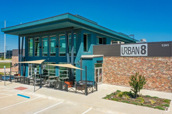

Property Detail
5265 State Highway 121
Dallas-Fort Worth-Arlington, TX
EAST OAK WOOD VILLAGE BLK A LOT 6R
R728527
Denton
Commercialnec
Texas
B and X Area of moderate flood hazard, usually the area between the limits of the 100-year and 500-year floods.
6r
2024
1.34 AC
2025
West Frisco
021530
Dallas/Ft Worth
8,318 SF
NEARBY LISTINGS FOR SALE OR LEASE
DEMOGRAPHICS near 5265 State Highway 121
1 mile
3 mile
5 mile
2024 Total Population
8,745
99,661
265,949
2029 Population
10,505
120,845
322,147
Pop Growth 2024-2029
+ 20.13%
+ 21.26%
+ 21.13%
Average Age
36
38
38
2024 Total Households
3,476
40,621
109,286
HH Growth 2024-2029
+ 20.60%
+ 21.92%
+ 21.77%
Median Household Inc
$108,823
$106,331
$99,930
Avg Household Size
2.50
2.40
2.40
2024 Avg HH Vehicles
2.00
2.00
2.00
Median Home Value
$349,738
$409,985
$450,451
Median Year Built
2005
2005
2002
Nearby Places
Map Layers
Map Styles
 Street
 Aerial
Transit
 Traffic
 Biking
Places
Listings with unknown addresses are not visible on the map
- Restaurants
- Banks
- Shops
- Fitness
- Groceries
PUBLIC TRANSPORTATION
COMMUTER RAIL
Drive
Walk
Distance
11 min
6.7 mi
Drive
Walk
Distance
12 min
7.6 mi
AIRPORT
Dallas-Fort Worth International
Drive
Walk
Distance
Dallas-Fort Worth International
22 min
17.9 mi
Dallas Love Field
Drive
Walk
Distance
Dallas Love Field
33 min
22.3 mi
SALE & LEASE HISTORY
LISTING DATE
SALE/LEASE

Oct 26, 2021
For Sale
Feb 27, 2020
For Lease
Nearby Properties
Address
Land Use
TOTAL SIZE
Lot Size
Zoning
Address
Land Use
TOTAL SIZE
Lot Size
Zoning
1,622,342 SF
48.59 AC
Address
Land Use
TOTAL SIZE
Lot Size
Zoning
1,508,248 SF
49.26 AC
CE
Address
Land Use
TOTAL SIZE
Lot Size
Zoning
1,929,059 SF
55.12 AC
CE
Address
Land Use
TOTAL SIZE
Lot Size
Zoning
4,575,402 SF
51.93 AC
Address
Land Use
TOTAL SIZE
Lot Size
Zoning
725,987 SF
34.18 AC
CE
Address
Land Use
TOTAL SIZE
Lot Size
Zoning
542,570 SF
75.67 AC
Address
Land Use
TOTAL SIZE
Lot Size
Zoning
333,321 SF
5.80 AC
CE
Address
Land Use
TOTAL SIZE
Lot Size
Zoning
518,210 SF
38.11 AC
CE
Address
Land Use
TOTAL SIZE
Lot Size
Zoning
526,369 SF
45.84 AC
Address
Land Use
TOTAL SIZE
Lot Size
Zoning
598,569 SF
86.50 AC
Address
Land Use
TOTAL SIZE
Lot Size
Zoning
1,817,951 SF
82 AC
Address
Land Use
TOTAL SIZE
Lot Size
Zoning
537,274 SF
20.91 AC
Address
Land Use
TOTAL SIZE
Lot Size
Zoning
559,657 SF
30.49 AC
Address
Land Use
TOTAL SIZE
Lot Size
Zoning
554,780 SF
23.81 AC
Address
Land Use
TOTAL SIZE
Lot Size
Zoning
512,903 SF
18 AC
Address
Land Use
TOTAL SIZE
Lot Size
Zoning
500,844 SF
24.36 AC
2B
Address
Land Use
TOTAL SIZE
Lot Size
Zoning
460,403 SF
19.26 AC
Address
Land Use
TOTAL SIZE
Lot Size
Zoning
389,014 SF
20.91 AC
Address
Land Use
TOTAL SIZE
Lot Size
Zoning
479,145 SF
17.08 AC
Address
Land Use
TOTAL SIZE
Lot Size
Zoning
448,915 SF
20.37 AC
Address
Land Use
TOTAL SIZE
Lot Size
Zoning
284,305 SF
9.74 AC
COMM
Address
Land Use
TOTAL SIZE
Lot Size
Zoning
452,164 SF
15.70 AC
2B
Address
Land Use
TOTAL SIZE
Lot Size
Zoning
376,139 SF
3.58 AC
Address
Land Use
TOTAL SIZE
Lot Size
Zoning
419,464 SF
22.05 AC
MF-3
Address
Land Use
TOTAL SIZE
Lot Size
Zoning
264,896 SF
20.83 AC
CE
Address
Land Use
TOTAL SIZE
Lot Size
Zoning
294,218 SF
20.54 AC
CE
Address
Land Use
TOTAL SIZE
Lot Size
Zoning
273,360 SF
12.89 AC
CE/CB
Address
Land Use
TOTAL SIZE
Lot Size
Zoning
462,888 SF
20.17 AC
Address
Land Use
TOTAL SIZE
Lot Size
Zoning
346,269 SF
15.14 AC
Address
Land Use
TOTAL SIZE
Lot Size
Zoning
809,451 SF
94.32 AC
The World's #1 Commercial Real Estate Marketplace
Connect with us
© 2026 CoStar Group
The information above has been obtained from sources believed reliable. While we do not doubt its accuracy we have not verified it and make no guarantee, warranty or representation about it. It is your responsibility to independently confirm its accuracy and completeness. Any projections, opinions, assumptions, or estimates used are for example only and do not represent the current or future performance of the property. The value of this transaction to you depends on tax and other factors which should be evaluated by your tax, financial, and legal advisors. You and your advisors should conduct a careful, independent investigation of the property to determine to your satisfaction the suitability of the property for your needs.