Property Record
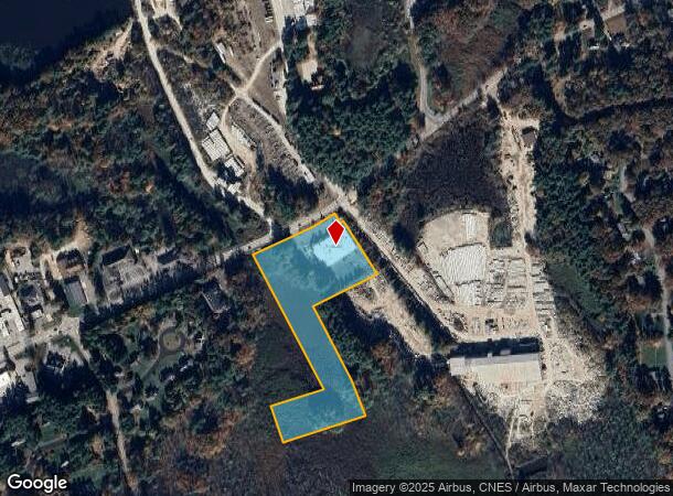
527 Groton Rd, Westford, MA 01886


NEARBY LISTINGS FOR SALE OR LEASE
Property Detail
527 Groton Rd
Regionalshoppingcenterormallwithanchorstore
Middlesex
A
Massachusetts
25017C0118F
7.82 AC
2025
Groton/Townsend
2025
Boston
318100
Boston-Cambridge-Newton, MA-NH
22,170 SF
WFOR-000046-000016
DEMOGRAPHICS near 527 Groton Rd
1 Mile
3 Mile
5 Mile
2024 Total Population
3,779
38,325
124,618
2029 Population
3,770
38,061
122,914
Pop Growth 2024-2029
(0.24%)
(0.69%)
(1.37%)
Average Age
43
42
40
2024 Total Households
1,393
14,222
44,888
HH Growth 2024-2029
(0.43%)
(0.87%)
(1.45%)
Median Household Inc
$136,559
$123,011
$101,687
Avg Household Size
2.60
2.60
2.70
2024 Avg HH Vehicles
2.00
2.00
2.00
Median Home Value
$541,262
$560,129
$483,461
Median Year Built
1969
1979
1970
Nearby Places
Map Layers
Map Styles
 Street
 Aerial
- Restaurants
- Banks
- Shops
- Fitness
- Groceries
PUBLIC TRANSPORTATION
COMMUTER RAIL
Lowell (Lowell Line - Massachusetts Bay Transportation Authority Commuter Rail (Purple Line))
DRIVE
WALK
Distance
Lowell (Lowell Line - Massachusetts Bay Transportation Authority Commuter Rail (Purple Line))
11 min
5.9 mi
North Billerica (Lowell Line - Massachusetts Bay Transportation Authority Commuter Rail (Purple Line))
DRIVE
WALK
Distance
North Billerica (Lowell Line - Massachusetts Bay Transportation Authority Commuter Rail (Purple Line))
15 min
9.8 mi
AIRPORT
Manchester Boston Regional
DRIVE
WALK
Distance
Manchester Boston Regional
38 min
26.0 mi
General Edward Lawrence Logan International
DRIVE
WALK
Distance
General Edward Lawrence Logan International
52 min
39.0 mi
Freight Ports
Port of Boston
DRIVE
WALK
Distance
Port of Boston
53 min
38.8 mi
Nearby Properties
Address
Land Use
TOTAL SIZE
Lot Size
Zoning
Address
Land Use
TOTAL SIZE
Lot Size
Zoning
23,251 SF
18.20 AC
SMF
Address
Land Use
TOTAL SIZE
Lot Size
Zoning
269,952 SF
18.11 AC
P
Address
Land Use
TOTAL SIZE
Lot Size
Zoning
68.15 AC
R1
Address
Land Use
TOTAL SIZE
Lot Size
Zoning
38.26 AC
P
Address
Land Use
TOTAL SIZE
Lot Size
Zoning
63,768 SF
8.83 AC
SMU
Address
Land Use
TOTAL SIZE
Lot Size
Zoning
44.39 AC
SMU
Address
Land Use
TOTAL SIZE
Lot Size
Zoning
18.50 AC
CC
Address
Land Use
TOTAL SIZE
Lot Size
Zoning
119,130 SF
22.36 AC
RA
Address
Land Use
TOTAL SIZE
Lot Size
Zoning
85,450 SF
32.07 AC
RA
Address
Land Use
TOTAL SIZE
Lot Size
Zoning
3.85 AC
SMF
Address
Land Use
TOTAL SIZE
Lot Size
Zoning
4.67 AC
IA
Address
Land Use
TOTAL SIZE
Lot Size
Zoning
8.30 AC
B3
Address
Land Use
TOTAL SIZE
Lot Size
Zoning
135,324 SF
70.07 AC
R1
Address
Land Use
TOTAL SIZE
Lot Size
Zoning
90,463 SF
8.56 AC
RA
Address
Land Use
TOTAL SIZE
Lot Size
Zoning
177.27 AC
R1
Address
Land Use
TOTAL SIZE
Lot Size
Zoning
10,240 SF
0.15 AC
SMU
Address
Land Use
TOTAL SIZE
Lot Size
Zoning
2.71 AC
SMF
Address
Land Use
TOTAL SIZE
Lot Size
Zoning
12.26 AC
P
Address
Land Use
TOTAL SIZE
Lot Size
Zoning
82,182 SF
13.86 AC
P
Address
Land Use
TOTAL SIZE
Lot Size
Zoning
31.92 AC
RB
Address
Land Use
TOTAL SIZE
Lot Size
Zoning
58,766 SF
21.98 AC
RA
Address
Land Use
TOTAL SIZE
Lot Size
Zoning
42,419 SF
2.80 AC
SSF
Address
Land Use
TOTAL SIZE
Lot Size
Zoning
74,816 SF
3.01 AC
RR
Address
Land Use
TOTAL SIZE
Lot Size
Zoning
50,000 SF
33.40 AC
IA
Address
Land Use
TOTAL SIZE
Lot Size
Zoning
27.80 AC
P
Address
Land Use
TOTAL SIZE
Lot Size
Zoning
8.20 AC
SSF
Address
Land Use
TOTAL SIZE
Lot Size
Zoning
71,911 SF
31.55 AC
SSF
Address
Land Use
TOTAL SIZE
Lot Size
Zoning
43,200 SF
2.82 AC
IA
Address
Land Use
TOTAL SIZE
Lot Size
Zoning
1.66 AC
SMF
Address
Land Use
TOTAL SIZE
Lot Size
Zoning
The World's #1 Commercial Real Estate Marketplace
Connect with us
© 2025 CoStar Group
The information above has been obtained from sources believed reliable. While we do not doubt its accuracy we have not verified it and make no guarantee, warranty or representation about it. It is your responsibility to independently confirm its accuracy and completeness. Any projections, opinions, assumptions, or estimates used are for example only and do not represent the current or future performance of the property. The value of this transaction to you depends on tax and other factors which should be evaluated by your tax, financial, and legal advisors. You and your advisors should conduct a careful, independent investigation of the property to determine to your satisfaction the suitability of the property for your needs.