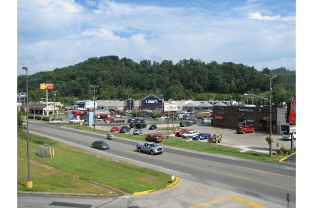
Property Record
527 N Mayo Trl, Paintsville, KY 41240


NEARBY LISTINGS FOR SALE OR LEASE
Property Detail
527 N Mayo Trl
Homeimprovementgardencenterhomedepotlowes
LOWES 13.050 AC TRACT 2 A
AE
Johnson
21115C0179E
Kentucky
2024
9.53 AC
2024
Kentucky East Area
960401
Other Market Areas
95,022 SF
P45-00-00-005.07
DEMOGRAPHICS near 527 N Mayo Trl
1 Mile
3 Mile
5 Mile
2024 Total Population
547
7,144
13,442
2029 Population
535
6,999
13,134
Pop Growth 2024-2029
(2.19%)
(2.03%)
(2.29%)
Average Age
43
42
42
2024 Total Households
235
3,021
5,539
HH Growth 2024-2029
(2.13%)
(1.85%)
(2.13%)
Median Household Inc
$64,853
$46,489
$45,920
Avg Household Size
2.30
2.30
2.30
2024 Avg HH Vehicles
2.00
2.00
2.00
Median Home Value
$218,182
$175,442
$152,256
Median Year Built
1981
1981
1983
Nearby Places
Map Layers
Map Styles
 Street
 Aerial
- Restaurants
- Banks
- Shops
- Fitness
- Groceries
SALE & LEASE HISTORY
LISTING DATE
SALE/LEASE

Sep 06, 2017
For Sale
Nov 30, 2017
For Sale
Mar 18, 2019
For Sale
Mar 12, 2019
For Sale
Feb 13, 2018
For Sale
Aug 11, 2017
For Sale
Nearby Properties
Address
Land Use
TOTAL SIZE
Lot Size
Zoning
Address
Land Use
TOTAL SIZE
Lot Size
Zoning
207,000 SF
20.31 AC
Address
Land Use
TOTAL SIZE
Lot Size
Zoning
17,016 SF
4.41 AC
Address
Land Use
TOTAL SIZE
Lot Size
Zoning
1.60 AC
Address
Land Use
TOTAL SIZE
Lot Size
Zoning
53,496 SF
6 AC
Address
Land Use
TOTAL SIZE
Lot Size
Zoning
Address
Land Use
TOTAL SIZE
Lot Size
Zoning
27.42 AC
Address
Land Use
TOTAL SIZE
Lot Size
Zoning
0.13 AC
Address
Land Use
TOTAL SIZE
Lot Size
Zoning
Address
Land Use
TOTAL SIZE
Lot Size
Zoning
67,507 SF
3.83 AC
Address
Land Use
TOTAL SIZE
Lot Size
Zoning
Address
Land Use
TOTAL SIZE
Lot Size
Zoning
12.50 AC
Address
Land Use
TOTAL SIZE
Lot Size
Zoning
5.49 AC
Address
Land Use
TOTAL SIZE
Lot Size
Zoning
36.33 AC
Address
Land Use
TOTAL SIZE
Lot Size
Zoning
1,828 SF
8.85 AC
Address
Land Use
TOTAL SIZE
Lot Size
Zoning
16,561 SF
0.42 AC
Address
Land Use
TOTAL SIZE
Lot Size
Zoning
8.29 AC
Address
Land Use
TOTAL SIZE
Lot Size
Zoning
Address
Land Use
TOTAL SIZE
Lot Size
Zoning
4.90 AC
Address
Land Use
TOTAL SIZE
Lot Size
Zoning
20,072 SF
9.98 AC
Address
Land Use
TOTAL SIZE
Lot Size
Zoning
80,165 SF
9.73 AC
Address
Land Use
TOTAL SIZE
Lot Size
Zoning
3.50 AC
Address
Land Use
TOTAL SIZE
Lot Size
Zoning
39,600 SF
5.11 AC
Address
Land Use
TOTAL SIZE
Lot Size
Zoning
11,643 SF
2.65 AC
COMMERCIAL
Address
Land Use
TOTAL SIZE
Lot Size
Zoning
3,075 SF
3.48 AC
Address
Land Use
TOTAL SIZE
Lot Size
Zoning
34,800 SF
2.75 AC
Address
Land Use
TOTAL SIZE
Lot Size
Zoning
1,260 SF
Address
Land Use
TOTAL SIZE
Lot Size
Zoning
3,484 SF
1.03 AC
Address
Land Use
TOTAL SIZE
Lot Size
Zoning
91,609 SF
7.11 AC
Address
Land Use
TOTAL SIZE
Lot Size
Zoning
8,211 SF
0.36 AC
The World's #1 Commercial Real Estate Marketplace
Connect with us
© 2025 CoStar Group
The information above has been obtained from sources believed reliable. While we do not doubt its accuracy we have not verified it and make no guarantee, warranty or representation about it. It is your responsibility to independently confirm its accuracy and completeness. Any projections, opinions, assumptions, or estimates used are for example only and do not represent the current or future performance of the property. The value of this transaction to you depends on tax and other factors which should be evaluated by your tax, financial, and legal advisors. You and your advisors should conduct a careful, independent investigation of the property to determine to your satisfaction the suitability of the property for your needs.