Property Record
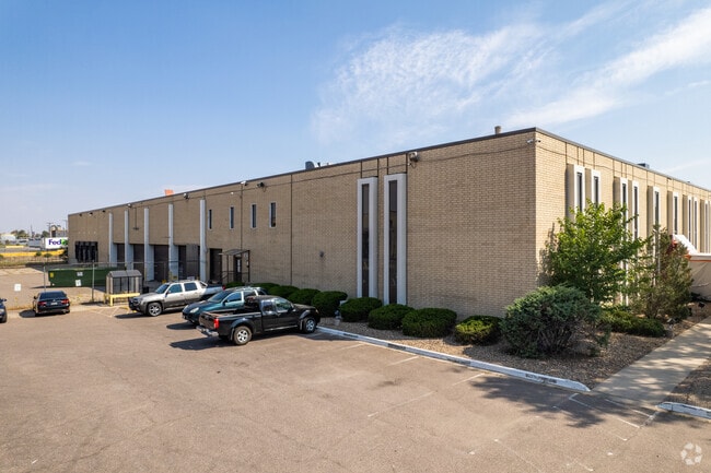
5270 Fox St, Denver, CO 80216


Property Detail
5270 Fox St
1825-15-2-06-003
SUB:BURLINGTON INDUSTRIAL PARK NO 5 FIRST FL BLK:1 LOT:1
Warehouse
Adams
I2
Colorado
B and X Area of moderate flood hazard, usually the area between the limits of the 100-year and 500-year floods.
1
2024
5 AC
2025
Northwest Denver
009553
Denver
130,296 SF
Denver-Aurora-Centennial, CO
NEARBY LISTINGS FOR SALE OR LEASE
DEMOGRAPHICS near 5270 Fox St
1 mile
3 mile
5 mile
2024 Total Population
5,012
137,926
430,643
2029 Population
5,190
143,380
443,274
Pop Growth 2024-2029
+ 3.55%
+ 3.95%
+ 2.93%
Average Age
38
37
38
2024 Total Households
1,757
62,870
195,763
HH Growth 2024-2029
+ 3.47%
+ 3.97%
+ 3.04%
Median Household Inc
$88,841
$105,298
$92,851
Avg Household Size
2.70
2.10
2.10
2024 Avg HH Vehicles
2.00
2.00
2.00
Median Home Value
$500,539
$686,285
$617,337
Median Year Built
1957
1989
1971
Nearby Places
Map Layers
Map Styles
 Street
 Aerial
Transit
 Traffic
 Biking
Places
Listings with unknown addresses are not visible on the map
- Restaurants
- Banks
- Shops
- Fitness
- Groceries
PUBLIC TRANSPORTATION
COMMUTER RAIL
41St & Fox Station Track 1 (Union Station to Westminster Station - Regional Transportation District, Union Station to Wheat Ridge Ward Station - Regional Transportation District)
Drive
Walk
Distance
41St & Fox Station Track 1 (Union Station to Westminster Station - Regional Transportation District, Union Station to Wheat Ridge Ward Station - Regional Transportation District)
6 min
2.2 mi
Pecos Junction Station Track 1 (Union Station to Westminster Station - Regional Transportation District, Union Station to Wheat Ridge Ward Station - Regional Transportation District)
Drive
Walk
Distance
Pecos Junction Station Track 1 (Union Station to Westminster Station - Regional Transportation District, Union Station to Wheat Ridge Ward Station - Regional Transportation District)
8 min
2.8 mi
AIRPORT
Denver International
Drive
Walk
Distance
Denver International
33 min
23.4 mi
Freight Ports
Tulsa Port Of Catoosa
Drive
Walk
Distance
Tulsa Port Of Catoosa
730 min
708.9 mi
SALE & LEASE HISTORY
LISTING DATE
SALE/LEASE

Mar 17, 2021
For Sale
Jun 17, 2020
For Sale
Apr 04, 2019
For Lease
Nearby Properties
Address
Land Use
TOTAL SIZE
Lot Size
Zoning
Address
Land Use
TOTAL SIZE
Lot Size
Zoning
921,863 SF
2.01 AC
C-MX
Address
Land Use
TOTAL SIZE
Lot Size
Zoning
396,741 SF
8.12 AC
A1
Address
Land Use
TOTAL SIZE
Lot Size
Zoning
552,279 SF
2.22 AC
C-RX
Address
Land Use
TOTAL SIZE
Lot Size
Zoning
798,837 SF
1.67 AC
C-MX
Address
Land Use
TOTAL SIZE
Lot Size
Zoning
565,418 SF
4.07 AC
C-RX
Address
Land Use
TOTAL SIZE
Lot Size
Zoning
657,947 SF
5.02 AC
C-RX
Address
Land Use
TOTAL SIZE
Lot Size
Zoning
6,252 SF
1.05 AC
C-MX
Address
Land Use
TOTAL SIZE
Lot Size
Zoning
694,425 SF
1.92 AC
C-MX
Address
Land Use
TOTAL SIZE
Lot Size
Zoning
299,368 SF
0.71 AC
C-MX
Address
Land Use
TOTAL SIZE
Lot Size
Zoning
311,406 SF
1.74 AC
C-MX
Address
Land Use
TOTAL SIZE
Lot Size
Zoning
294,950 SF
6.91 AC
C-RX-12
Address
Land Use
TOTAL SIZE
Lot Size
Zoning
310,267 SF
1.69 AC
C-MX
Address
Land Use
TOTAL SIZE
Lot Size
Zoning
402,700 SF
1.15 AC
C-RX
Address
Land Use
TOTAL SIZE
Lot Size
Zoning
411,031 SF
1.66 AC
I-MX
Address
Land Use
TOTAL SIZE
Lot Size
Zoning
352,226 SF
1.01 AC
ASQ
Address
Land Use
TOTAL SIZE
Lot Size
Zoning
412,345 SF
0.82 AC
C-MX
Address
Land Use
TOTAL SIZE
Lot Size
Zoning
318,052 SF
2.73 AC
C-MX
Address
Land Use
TOTAL SIZE
Lot Size
Zoning
424,200 SF
1.15 AC
C-RX
Address
Land Use
TOTAL SIZE
Lot Size
Zoning
611,828 SF
0.94 AC
PUD
Address
Land Use
TOTAL SIZE
Lot Size
Zoning
545,292 SF
1.15 AC
D-C
Address
Land Use
TOTAL SIZE
Lot Size
Zoning
724,981 SF
1.26 AC
D-C
Address
Land Use
TOTAL SIZE
Lot Size
Zoning
175,933 SF
0.82 AC
C-MX
Address
Land Use
TOTAL SIZE
Lot Size
Zoning
150,202 SF
13.24 AC
T-MU-30
Address
Land Use
TOTAL SIZE
Lot Size
Zoning
858,528 SF
2.53 AC
D-C
Address
Land Use
TOTAL SIZE
Lot Size
Zoning
352,600 SF
18.21 AC
I-B
Address
Land Use
TOTAL SIZE
Lot Size
Zoning
187,817 SF
1.02 AC
C-MX
Address
Land Use
TOTAL SIZE
Lot Size
Zoning
298,387 SF
0.88 AC
PUD
Address
Land Use
TOTAL SIZE
Lot Size
Zoning
162,639 SF
1.44 AC
C-MX
Address
Land Use
TOTAL SIZE
Lot Size
Zoning
290,821 SF
1.16 AC
PUD
Address
Land Use
TOTAL SIZE
Lot Size
Zoning
1.64 AC
CMP
The World's #1 Commercial Real Estate Marketplace
Connect with us
© 2026 CoStar Group
The information above has been obtained from sources believed reliable. While we do not doubt its accuracy we have not verified it and make no guarantee, warranty or representation about it. It is your responsibility to independently confirm its accuracy and completeness. Any projections, opinions, assumptions, or estimates used are for example only and do not represent the current or future performance of the property. The value of this transaction to you depends on tax and other factors which should be evaluated by your tax, financial, and legal advisors. You and your advisors should conduct a careful, independent investigation of the property to determine to your satisfaction the suitability of the property for your needs.