Property Record
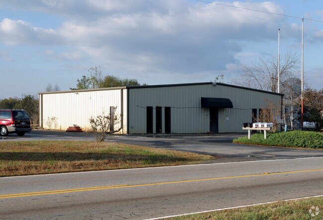
5271 Highway 9, Inman, SC 29349

Property Detail
5271 Highway 9
2-36-00-086.06
S SIDE HWY 9 E OF SEAY RD PB 109-113 114-70 PB 170-632 ROAD R/W TAKEN DB 95P-75 HWY RW TAKEN 42.0
Commercialnec
Spartanburg
B and X Area of moderate flood hazard, usually the area between the limits of the 100-year and 500-year floods.
South Carolina
2024
1.85 AC
2025
North Side/Rt 9 Corr
022405
Greenville/Spartanburg
3,000 SF
Spartanburg, SC
NEARBY LISTINGS FOR SALE OR LEASE
DEMOGRAPHICS near 5271 Highway 9
1 mile
3 mile
5 mile
2025 Total Population
2,575
22,035
66,121
2030 Population
2,922
24,797
74,075
Pop Growth 2025-2030
+ 13.48%
+ 12.53%
+ 12.03%
Average Age
40
40
39
2025 Total Households
939
8,183
24,896
HH Growth 2025-2030
+ 13.53%
+ 12.60%
+ 12.13%
Median Household Inc
$88,109
$78,736
$70,788
Avg Household Size
2.70
2.60
2.60
2025 Avg HH Vehicles
2.00
2.00
2.00
Median Home Value
$285,444
$269,237
$253,516
Median Year Built
2005
2002
1999
Nearby Places
Map Layers
Map Styles
 Street
 Aerial
Layers
 Traffic
 Biking
Places
Listings with unknown addresses are not visible on the map
- Restaurants
- Banks
- Shops
- Fitness
- Groceries
PUBLIC TRANSPORTATION
COMMUTER RAIL
Spartanburg Amtrak Station (Crescent - Amtrak)
Drive
Walk
Distance
Spartanburg Amtrak Station (Crescent - Amtrak)
19 min
9.6 mi
AIRPORT
Greenville Spartanburg International
Drive
Walk
Distance
Greenville Spartanburg International
36 min
26.6 mi
Freight Ports
North Charleston Terminal
Drive
Walk
Distance
North Charleston Terminal
232 min
207.4 mi
Nearby Properties
Address
Land Use
TOTAL SIZE
Lot Size
Zoning
Address
Land Use
TOTAL SIZE
Lot Size
Zoning
3,406 SF
13.10 AC
Address
Land Use
TOTAL SIZE
Lot Size
Zoning
7,218 SF
16 AC
Address
Land Use
TOTAL SIZE
Lot Size
Zoning
3,412 SF
21.60 AC
Address
Land Use
TOTAL SIZE
Lot Size
Zoning
24,738 SF
34.52 AC
Address
Land Use
TOTAL SIZE
Lot Size
Zoning
62,000 SF
10.17 AC
Address
Land Use
TOTAL SIZE
Lot Size
Zoning
184,015 SF
19.23 AC
Address
Land Use
TOTAL SIZE
Lot Size
Zoning
42,657 SF
11.57 AC
Address
Land Use
TOTAL SIZE
Lot Size
Zoning
641,891 SF
16.26 AC
Address
Land Use
TOTAL SIZE
Lot Size
Zoning
108,060 SF
2.95 AC
Address
Land Use
TOTAL SIZE
Lot Size
Zoning
Address
Land Use
TOTAL SIZE
Lot Size
Zoning
5,236 SF
0.65 AC
Address
Land Use
TOTAL SIZE
Lot Size
Zoning
4,956 SF
0.80 AC
Address
Land Use
TOTAL SIZE
Lot Size
Zoning
3,960 SF
0.36 AC
Address
Land Use
TOTAL SIZE
Lot Size
Zoning
4,129 SF
0.34 AC
Address
Land Use
TOTAL SIZE
Lot Size
Zoning
6,945 SF
0.65 AC
Address
Land Use
TOTAL SIZE
Lot Size
Zoning
172,332 SF
15.01 AC
Address
Land Use
TOTAL SIZE
Lot Size
Zoning
4,283 SF
0.50 AC
Address
Land Use
TOTAL SIZE
Lot Size
Zoning
3,620 SF
0.67 AC
Address
Land Use
TOTAL SIZE
Lot Size
Zoning
3,683 SF
0.21 AC
Address
Land Use
TOTAL SIZE
Lot Size
Zoning
1,380 SF
12 AC
Address
Land Use
TOTAL SIZE
Lot Size
Zoning
2,877 SF
0.55 AC
Address
Land Use
TOTAL SIZE
Lot Size
Zoning
4,398 SF
0.25 AC
Address
Land Use
TOTAL SIZE
Lot Size
Zoning
4,260 SF
0.66 AC
Address
Land Use
TOTAL SIZE
Lot Size
Zoning
5,267 SF
1.18 AC
Address
Land Use
TOTAL SIZE
Lot Size
Zoning
5,190 SF
0.93 AC
Address
Land Use
TOTAL SIZE
Lot Size
Zoning
Address
Land Use
TOTAL SIZE
Lot Size
Zoning
3,663 SF
11.40 AC
Address
Land Use
TOTAL SIZE
Lot Size
Zoning
4,294 SF
0.81 AC
Address
Land Use
TOTAL SIZE
Lot Size
Zoning
44 SF
23.59 AC
Address
Land Use
TOTAL SIZE
Lot Size
Zoning
3,591 SF
0.78 AC
The World's #1 Commercial Real Estate Marketplace
Connect with us
© 2026 CoStar Group
The information above has been obtained from sources believed reliable. While we do not doubt its accuracy we have not verified it and make no guarantee, warranty or representation about it. It is your responsibility to independently confirm its accuracy and completeness. Any projections, opinions, assumptions, or estimates used are for example only and do not represent the current or future performance of the property. The value of this transaction to you depends on tax and other factors which should be evaluated by your tax, financial, and legal advisors. You and your advisors should conduct a careful, independent investigation of the property to determine to your satisfaction the suitability of the property for your needs.