Property Record
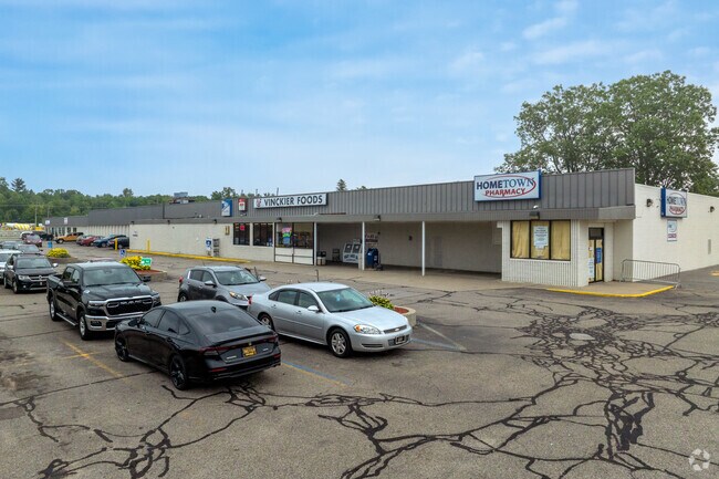
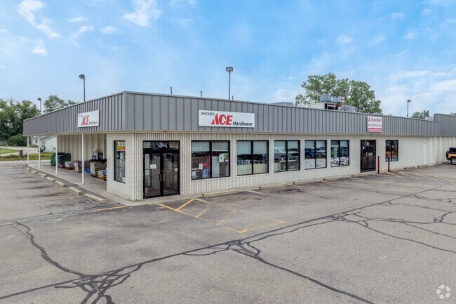
5273 Lapeer Rd, Kimball, MI 48074

Property Detail
5273 Lapeer Rd
25-002-4012-000
WLY 229.07' OF ELY 442' OF NLY 340' OF W 1/2 OF SEC 2 MEAS ALG S EDGE OF PAVEMENT & AT RT ANG TO M-21 SEC 2 T6N R16E 1.79 A
Stripcommercialcenter
Saint Clair
C-2 COMM
Michigan
B and X Area of moderate flood hazard, usually the area between the limits of the 100-year and 500-year floods.
1.79 AC
2025
St Clair & Lapeer Counties
2025
Detroit
634600
Detroit-Warren-Dearborn, MI
40,927 SF
NEARBY LISTINGS FOR SALE OR LEASE
DEMOGRAPHICS near 5273 Lapeer Rd
1 mile
3 mile
5 mile
2025 Total Population
1,048
14,167
41,579
2030 Population
1,045
14,074
41,315
Pop Growth 2025-2030
(0.29%)
(0.66%)
(0.63%)
Average Age
44
43
42
2025 Total Households
421
5,612
16,294
HH Growth 2025-2030
(0.24%)
(0.73%)
(0.76%)
Median Household Inc
$77,851
$74,618
$67,369
Avg Household Size
2.40
2.50
2.50
2025 Avg HH Vehicles
2.00
2.00
2.00
Median Home Value
$243,299
$227,526
$198,351
Median Year Built
1989
1977
1974
Nearby Places
Map Layers
Map Styles
 Street
 Aerial
Layers
 Traffic
 Biking
Places
Listings with unknown addresses are not visible on the map
- Restaurants
- Banks
- Shops
- Fitness
- Groceries
Nearby Properties
Address
Land Use
TOTAL SIZE
Lot Size
Zoning
Address
Land Use
TOTAL SIZE
Lot Size
Zoning
39,747 SF
3.11 AC
R-2 RES
Address
Land Use
TOTAL SIZE
Lot Size
Zoning
10,991 SF
119.58 AC
MIXED
Address
Land Use
TOTAL SIZE
Lot Size
Zoning
20,736 SF
10.20 AC
R-1
Address
Land Use
TOTAL SIZE
Lot Size
Zoning
5,359 SF
42.87 AC
R-4 RES
Address
Land Use
TOTAL SIZE
Lot Size
Zoning
7,785 SF
35.62 AC
C-2 COMM
Address
Land Use
TOTAL SIZE
Lot Size
Zoning
42,720 SF
6.21 AC
C-2 COMM
Address
Land Use
TOTAL SIZE
Lot Size
Zoning
25,756 SF
4.79 AC
R-1
Address
Land Use
TOTAL SIZE
Lot Size
Zoning
12,832 SF
116.08 AC
AG
Address
Land Use
TOTAL SIZE
Lot Size
Zoning
20,520 SF
60.04 AC
R-1
Address
Land Use
TOTAL SIZE
Lot Size
Zoning
92,819 SF
31.18 AC
C-2 COMM
Address
Land Use
TOTAL SIZE
Lot Size
Zoning
44,576 SF
4.40 AC
B-3
Address
Land Use
TOTAL SIZE
Lot Size
Zoning
76,760 SF
29 AC
C-2 COMM
Address
Land Use
TOTAL SIZE
Lot Size
Zoning
21,432 SF
6.69 AC
R-1
Address
Land Use
TOTAL SIZE
Lot Size
Zoning
3,387 SF
83.39 AC
AG
Address
Land Use
TOTAL SIZE
Lot Size
Zoning
27,719 SF
9.08 AC
MIXED
Address
Land Use
TOTAL SIZE
Lot Size
Zoning
23,519 SF
4.97 AC
C-2 COMM
Address
Land Use
TOTAL SIZE
Lot Size
Zoning
5,829 SF
65.90 AC
MHP
Address
Land Use
TOTAL SIZE
Lot Size
Zoning
18,540 SF
2 AC
R-1
Address
Land Use
TOTAL SIZE
Lot Size
Zoning
11,987 SF
5 AC
R-1
Address
Land Use
TOTAL SIZE
Lot Size
Zoning
393 AC
AG
Address
Land Use
TOTAL SIZE
Lot Size
Zoning
3.29 AC
C-2 COMM
Address
Land Use
TOTAL SIZE
Lot Size
Zoning
50 AC
MIXED
Address
Land Use
TOTAL SIZE
Lot Size
Zoning
3.07 AC
MIXED
Address
Land Use
TOTAL SIZE
Lot Size
Zoning
9,185 SF
4.31 AC
C-1 COMM
Address
Land Use
TOTAL SIZE
Lot Size
Zoning
12,544 SF
1.86 AC
R-1
Address
Land Use
TOTAL SIZE
Lot Size
Zoning
1,684 SF
15 AC
R-4 RES
Address
Land Use
TOTAL SIZE
Lot Size
Zoning
7,150 SF
2.41 AC
C-2 COMM
Address
Land Use
TOTAL SIZE
Lot Size
Zoning
8,849 SF
3.11 AC
R-1
Address
Land Use
TOTAL SIZE
Lot Size
Zoning
9,687 SF
1.27 AC
C-2 COMM
The World's #1 Commercial Real Estate Marketplace
Connect with us
© 2026 CoStar Group
The information above has been obtained from sources believed reliable. While we do not doubt its accuracy we have not verified it and make no guarantee, warranty or representation about it. It is your responsibility to independently confirm its accuracy and completeness. Any projections, opinions, assumptions, or estimates used are for example only and do not represent the current or future performance of the property. The value of this transaction to you depends on tax and other factors which should be evaluated by your tax, financial, and legal advisors. You and your advisors should conduct a careful, independent investigation of the property to determine to your satisfaction the suitability of the property for your needs.