Property Record
528 E Branch St, Arroyo Grande, CA 93420
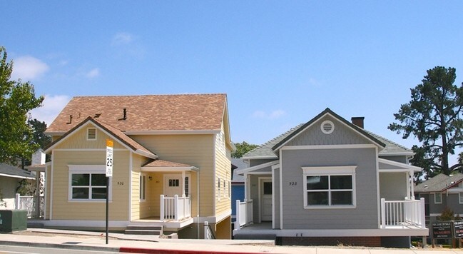

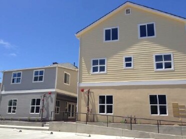

Property Detail
528 E Branch St
007-501-040
CY AG PM 56-43 PAR 5
Miscresidentialimprovement
San Luis Obispo
VC
California
B and X Area of moderate flood hazard, usually the area between the limits of the 100-year and 500-year floods.
5
2024
0.20 AC
2025
Arroyo Grande/Nipomo
011800
San Luis Obispo/Paso Robles
5,111 SF
San Luis Obispo-Paso Robles, CA
NEARBY LISTINGS FOR SALE OR LEASE
DEMOGRAPHICS near 528 E Branch St
1 mile
3 mile
5 mile
2025 Total Population
5,351
39,896
52,339
2030 Population
5,307
39,555
52,069
Pop Growth 2025-2030
(0.82%)
(0.85%)
(0.52%)
Average Age
46
43
44
2025 Total Households
2,155
15,795
21,200
HH Growth 2025-2030
(1.07%)
(1.06%)
(0.58%)
Median Household Inc
$122,601
$92,424
$96,222
Avg Household Size
2.40
2.50
2.40
2025 Avg HH Vehicles
2.00
2.00
2.00
Median Home Value
$931,680
$787,320
$823,969
Median Year Built
1979
1980
1981
Nearby Places
Map Layers
Map Styles
 Street
 Aerial
Layers
 Traffic
 Biking
Places
Listings with unknown addresses are not visible on the map
- Restaurants
- Banks
- Shops
- Fitness
- Groceries
PUBLIC TRANSPORTATION
COMMUTER RAIL
Grover Beach Amtrak (Pacific Surfliner - Amtrak)
Drive
Walk
Distance
Grover Beach Amtrak (Pacific Surfliner - Amtrak)
7 min
3.3 mi
AIRPORT
San Luis County Regional
Drive
Walk
Distance
San Luis County Regional
16 min
9.7 mi
Freight Ports
The Port of Hueneme
Drive
Walk
Distance
The Port of Hueneme
153 min
117.7 mi
SALE & LEASE HISTORY
LISTING DATE
SALE/LEASE

Jul 25, 2025
For Lease
Nearby Properties
Address
Land Use
TOTAL SIZE
Lot Size
Zoning
Address
Land Use
TOTAL SIZE
Lot Size
Zoning
52,717 SF
6.30 AC
VR
Address
Land Use
TOTAL SIZE
Lot Size
Zoning
84,460 SF
4.12 AC
RRH
Address
Land Use
TOTAL SIZE
Lot Size
Zoning
66,455 SF
22.18 AC
GC
Address
Land Use
TOTAL SIZE
Lot Size
Zoning
21,865 SF
1.10 AC
C2
Address
Land Use
TOTAL SIZE
Lot Size
Zoning
85,866 SF
7.18 AC
GC
Address
Land Use
TOTAL SIZE
Lot Size
Zoning
74,553 SF
6.14 AC
CBD
Address
Land Use
TOTAL SIZE
Lot Size
Zoning
44,067 SF
2.38 AC
O
Address
Land Use
TOTAL SIZE
Lot Size
Zoning
99,676 SF
3.12 AC
RC
Address
Land Use
TOTAL SIZE
Lot Size
Zoning
816 SF
4.09 AC
CPC
Address
Land Use
TOTAL SIZE
Lot Size
Zoning
5,264 SF
7.91 AC
RMF
Address
Land Use
TOTAL SIZE
Lot Size
Zoning
2.60 AC
R3
Address
Land Use
TOTAL SIZE
Lot Size
Zoning
43,040 SF
3.08 AC
PC
Address
Land Use
TOTAL SIZE
Lot Size
Zoning
34,122 SF
7.68 AC
GC
Address
Land Use
TOTAL SIZE
Lot Size
Zoning
86,620 SF
6.40 AC
PD
Address
Land Use
TOTAL SIZE
Lot Size
Zoning
4.82 AC
R4
Address
Land Use
TOTAL SIZE
Lot Size
Zoning
62,984 SF
1.50 AC
GC
Address
Land Use
TOTAL SIZE
Lot Size
Zoning
56,280 SF
2.28 AC
Address
Land Use
TOTAL SIZE
Lot Size
Zoning
36,054 SF
2.90 AC
CRS
Address
Land Use
TOTAL SIZE
Lot Size
Zoning
3.22 AC
GC
Address
Land Use
TOTAL SIZE
Lot Size
Zoning
10.50 AC
PF
Address
Land Use
TOTAL SIZE
Lot Size
Zoning
28,215 SF
2.81 AC
GC
Address
Land Use
TOTAL SIZE
Lot Size
Zoning
4.77 AC
CR
Address
Land Use
TOTAL SIZE
Lot Size
Zoning
31,565 SF
2.01 AC
VC
Address
Land Use
TOTAL SIZE
Lot Size
Zoning
200 AC
AG
Address
Land Use
TOTAL SIZE
Lot Size
Zoning
24,346 SF
2.60 AC
GC
Address
Land Use
TOTAL SIZE
Lot Size
Zoning
27,169 SF
2.81 AC
VC
Address
Land Use
TOTAL SIZE
Lot Size
Zoning
30,568 SF
2 AC
O
Address
Land Use
TOTAL SIZE
Lot Size
Zoning
3.87 AC
GC
Address
Land Use
TOTAL SIZE
Lot Size
Zoning
16,064 SF
0.41 AC
CP
Address
Land Use
TOTAL SIZE
Lot Size
Zoning
2,070 SF
18.90 AC
IND
The World's #1 Commercial Real Estate Marketplace
Connect with us
© 2026 CoStar Group
The information above has been obtained from sources believed reliable. While we do not doubt its accuracy we have not verified it and make no guarantee, warranty or representation about it. It is your responsibility to independently confirm its accuracy and completeness. Any projections, opinions, assumptions, or estimates used are for example only and do not represent the current or future performance of the property. The value of this transaction to you depends on tax and other factors which should be evaluated by your tax, financial, and legal advisors. You and your advisors should conduct a careful, independent investigation of the property to determine to your satisfaction the suitability of the property for your needs.