Property Record
5280 Beechmont Ave, Cincinnati, OH 45230
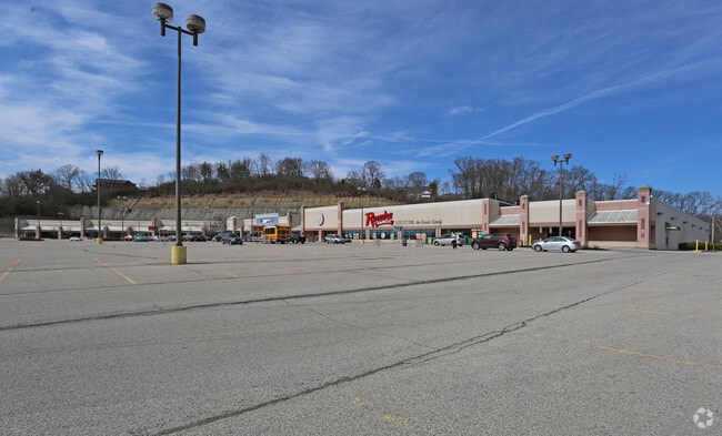

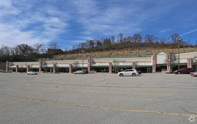
Property Detail
5280 Beechmont Ave
Cincinnati, OH-KY-IN
NE BEECHMONT AVE12.4571 AC MS 2204
500-0430-0207
HAMILTON
Apartment
Ohio
B and X Area of moderate flood hazard, usually the area between the limits of the 100-year and 500-year floods.
12.46 AC
2025
Eastgate/Anderson Twp
2025
Cincinnati/Dayton
004605
NEARBY LISTINGS FOR SALE OR LEASE
DEMOGRAPHICS near 5280 Beechmont Ave
1 mile
3 mile
5 mile
2025 Total Population
4,014
52,798
174,517
2030 Population
4,071
52,893
176,092
Pop Growth 2025-2030
+ 1.42%
+ 0.18%
+ 0.90%
Average Age
39
40
40
2025 Total Households
1,994
22,754
76,843
HH Growth 2025-2030
+ 1.76%
+ 0.28%
+ 0.96%
Median Household Inc
$66,860
$99,994
$90,178
Avg Household Size
2.00
2.30
2.20
2025 Avg HH Vehicles
2.00
2.00
2.00
Median Home Value
$293,957
$366,976
$338,564
Median Year Built
1973
1962
1956
Nearby Places
Map Layers
Map Styles
 Street
 Aerial
Layers
 Traffic
 Biking
Places
Listings with unknown addresses are not visible on the map
- Restaurants
- Banks
- Shops
- Fitness
- Groceries
PUBLIC TRANSPORTATION
AIRPORT
Cincinnati/Northern Kentucky International
Drive
Walk
Distance
Cincinnati/Northern Kentucky International
40 min
21.5 mi
Freight Ports
Port of Toledo
Drive
Walk
Distance
Port of Toledo
248 min
209.0 mi
SALE & LEASE HISTORY
LISTING DATE
SALE/LEASE

Sep 25, 2016
For Lease
Apr 07, 2020
For Sale
Nearby Properties
Address
Land Use
TOTAL SIZE
Lot Size
Zoning
Address
Land Use
TOTAL SIZE
Lot Size
Zoning
26.42 AC
Address
Land Use
TOTAL SIZE
Lot Size
Zoning
24,572 SF
4.70 AC
Address
Land Use
TOTAL SIZE
Lot Size
Zoning
1,205 SF
41.47 AC
Address
Land Use
TOTAL SIZE
Lot Size
Zoning
259.50 AC
RFR
Address
Land Use
TOTAL SIZE
Lot Size
Zoning
11.04 AC
SF20
Address
Land Use
TOTAL SIZE
Lot Size
Zoning
12,505 SF
37.33 AC
SF6
Address
Land Use
TOTAL SIZE
Lot Size
Zoning
20.38 AC
Address
Land Use
TOTAL SIZE
Lot Size
Zoning
1,680 SF
13.55 AC
Address
Land Use
TOTAL SIZE
Lot Size
Zoning
8.99 AC
Address
Land Use
TOTAL SIZE
Lot Size
Zoning
1,134,029 SF
229.73 AC
Address
Land Use
TOTAL SIZE
Lot Size
Zoning
8.98 AC
SF6
Address
Land Use
TOTAL SIZE
Lot Size
Zoning
19.33 AC
OG
Address
Land Use
TOTAL SIZE
Lot Size
Zoning
21.90 AC
SF6
Address
Land Use
TOTAL SIZE
Lot Size
Zoning
7.49 AC
Address
Land Use
TOTAL SIZE
Lot Size
Zoning
28.27 AC
Address
Land Use
TOTAL SIZE
Lot Size
Zoning
6.55 AC
Address
Land Use
TOTAL SIZE
Lot Size
Zoning
55,848 SF
12.51 AC
Address
Land Use
TOTAL SIZE
Lot Size
Zoning
Address
Land Use
TOTAL SIZE
Lot Size
Zoning
9.16 AC
RMX
Address
Land Use
TOTAL SIZE
Lot Size
Zoning
1.13 AC
Address
Land Use
TOTAL SIZE
Lot Size
Zoning
43.56 AC
Address
Land Use
TOTAL SIZE
Lot Size
Zoning
16.40 AC
Address
Land Use
TOTAL SIZE
Lot Size
Zoning
0.19 AC
RM20
Address
Land Use
TOTAL SIZE
Lot Size
Zoning
5.58 AC
RM20
Address
Land Use
TOTAL SIZE
Lot Size
Zoning
30,640 SF
5.52 AC
Address
Land Use
TOTAL SIZE
Lot Size
Zoning
3,774 SF
21.32 AC
SF20
Address
Land Use
TOTAL SIZE
Lot Size
Zoning
3,118 SF
5.20 AC
SF10
Address
Land Use
TOTAL SIZE
Lot Size
Zoning
1,628 SF
43.10 AC
SF6
Address
Land Use
TOTAL SIZE
Lot Size
Zoning
The World's #1 Commercial Real Estate Marketplace
Connect with us
© 2026 CoStar Group
The information above has been obtained from sources believed reliable. While we do not doubt its accuracy we have not verified it and make no guarantee, warranty or representation about it. It is your responsibility to independently confirm its accuracy and completeness. Any projections, opinions, assumptions, or estimates used are for example only and do not represent the current or future performance of the property. The value of this transaction to you depends on tax and other factors which should be evaluated by your tax, financial, and legal advisors. You and your advisors should conduct a careful, independent investigation of the property to determine to your satisfaction the suitability of the property for your needs.