Property Record
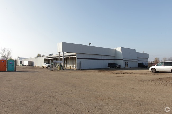
5280 E N Ave, Kalamazoo, MI 49048


Property Detail
5280 E N Ave
11-06-120-010
SEC 6-3-10 BEG IN N LI 750.8 FT ELY OF NW COR TH E ALG SD N LI 650 FT TH S AT RT ANG 800 FT TH W PAR N LI 355.58 FT TO ELY LI
Commercialnec
Kalamazoo
B and X Area of moderate flood hazard, usually the area between the limits of the 100-year and 500-year floods.
Michigan
2025
9.80 AC
2025
Southern Kalamazoo County
003302
West Michigan
26,000 SF
Kalamazoo-Portage, MI
NEARBY LISTINGS FOR SALE OR LEASE
DEMOGRAPHICS near 5280 E N Ave
1 mile
3 mile
5 mile
2025 Total Population
2,672
21,328
85,637
2030 Population
2,706
21,235
86,382
Pop Growth 2025-2030
+ 1.27%
(0.44%)
+ 0.87%
Average Age
37
38
38
2025 Total Households
1,213
8,722
36,100
HH Growth 2025-2030
+ 0.58%
(0.65%)
+ 0.94%
Median Household Inc
$53,421
$61,673
$61,518
Avg Household Size
2.10
2.30
2.20
2025 Avg HH Vehicles
1.00
2.00
2.00
Median Home Value
$116,946
$151,423
$188,966
Median Year Built
1968
1958
1960
Nearby Places
Map Layers
Map Styles
 Street
 Aerial
Layers
 Traffic
 Biking
Places
Listings with unknown addresses are not visible on the map
- Restaurants
- Banks
- Shops
- Fitness
- Groceries
PUBLIC TRANSPORTATION
COMMUTER RAIL
Drive
Walk
Distance
12 min
5.8 mi
AIRPORT
Kalamazoo/Battle Creek International
Drive
Walk
Distance
Kalamazoo/Battle Creek International
9 min
2.0 mi
Nearby Properties
Address
Land Use
TOTAL SIZE
Lot Size
Zoning
Address
Land Use
TOTAL SIZE
Lot Size
Zoning
435.98 AC
I-2
Address
Land Use
TOTAL SIZE
Lot Size
Zoning
Address
Land Use
TOTAL SIZE
Lot Size
Zoning
Address
Land Use
TOTAL SIZE
Lot Size
Zoning
82,520 SF
39.35 AC
I-1
Address
Land Use
TOTAL SIZE
Lot Size
Zoning
33.60 AC
Address
Land Use
TOTAL SIZE
Lot Size
Zoning
Address
Land Use
TOTAL SIZE
Lot Size
Zoning
Address
Land Use
TOTAL SIZE
Lot Size
Zoning
37.40 AC
I-2
Address
Land Use
TOTAL SIZE
Lot Size
Zoning
61.61 AC
Address
Land Use
TOTAL SIZE
Lot Size
Zoning
19.39 AC
OTR
Address
Land Use
TOTAL SIZE
Lot Size
Zoning
37.40 AC
I-2
Address
Land Use
TOTAL SIZE
Lot Size
Zoning
255,452 SF
20.57 AC
Address
Land Use
TOTAL SIZE
Lot Size
Zoning
134,876 SF
16.45 AC
RM-15
Address
Land Use
TOTAL SIZE
Lot Size
Zoning
35.87 AC
I-1
Address
Land Use
TOTAL SIZE
Lot Size
Zoning
17,858 SF
15.27 AC
RM-1
Address
Land Use
TOTAL SIZE
Lot Size
Zoning
498,424 SF
41.72 AC
M-2
Address
Land Use
TOTAL SIZE
Lot Size
Zoning
298,908 SF
40.33 AC
Address
Land Use
TOTAL SIZE
Lot Size
Zoning
228,368 SF
9.60 AC
PUD
Address
Land Use
TOTAL SIZE
Lot Size
Zoning
606,439 SF
34.61 AC
M-2
Address
Land Use
TOTAL SIZE
Lot Size
Zoning
Address
Land Use
TOTAL SIZE
Lot Size
Zoning
202,798 SF
17.67 AC
I-1
Address
Land Use
TOTAL SIZE
Lot Size
Zoning
Address
Land Use
TOTAL SIZE
Lot Size
Zoning
28.49 AC
I-2
Address
Land Use
TOTAL SIZE
Lot Size
Zoning
291,184 SF
26.35 AC
I-1
Address
Land Use
TOTAL SIZE
Lot Size
Zoning
80,064 SF
6.13 AC
M-1
Address
Land Use
TOTAL SIZE
Lot Size
Zoning
31.79 AC
I-1
Address
Land Use
TOTAL SIZE
Lot Size
Zoning
157,123 SF
M
Address
Land Use
TOTAL SIZE
Lot Size
Zoning
793,429 SF
36.48 AC
M
Address
Land Use
TOTAL SIZE
Lot Size
Zoning
393,522 SF
33.31 AC
M-2
Address
Land Use
TOTAL SIZE
Lot Size
Zoning
98,401 SF
2.94 AC
RM-15
The World's #1 Commercial Real Estate Marketplace
Connect with us
© 2026 CoStar Group
The information above has been obtained from sources believed reliable. While we do not doubt its accuracy we have not verified it and make no guarantee, warranty or representation about it. It is your responsibility to independently confirm its accuracy and completeness. Any projections, opinions, assumptions, or estimates used are for example only and do not represent the current or future performance of the property. The value of this transaction to you depends on tax and other factors which should be evaluated by your tax, financial, and legal advisors. You and your advisors should conduct a careful, independent investigation of the property to determine to your satisfaction the suitability of the property for your needs.