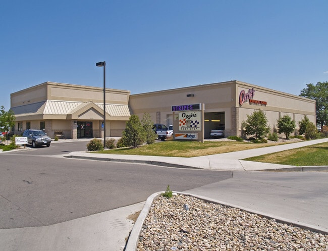
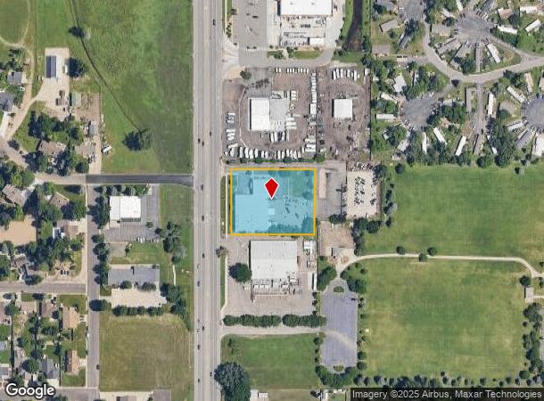
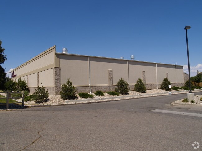
Property Record
5280 N Garfield Ave, Loveland, CO 80538
NEARBY LISTINGS FOR SALE OR LEASE
Property Detail
5280 N Garfield Ave
Fort Collins-Loveland, CO
Ozzie's First Subdivision
96362-42-001
LOT 1, BLK 1, OZZIES FIRST SUB, LOV (20030106541)
Commercialnec
Larimer
X
Colorado
08069C1200F
1
2024
1.42 AC
2025
Fort Collins
001707
Denver
15,590 SF
DEMOGRAPHICS near 5280 N Garfield Ave
1 mile
3 mile
5 mile
2024 Total Population
10,778
44,799
101,882
2029 Population
11,423
47,202
107,515
Pop Growth 2024-2029
+ 5.98%
+ 5.36%
+ 5.53%
Average Age
41
43
42
2024 Total Households
4,308
18,251
41,929
HH Growth 2024-2029
+ 6.31%
+ 5.65%
+ 5.79%
Median Household Inc
$67,019
$77,480
$80,135
Avg Household Size
2.50
2.40
2.40
2024 Avg HH Vehicles
2.00
2.00
2.00
Median Home Value
$395,173
$430,565
$450,607
Median Year Built
1996
1992
1994
Nearby Places
Map Layers
Map Styles
 Street
 Aerial
Transit
 Traffic
 Biking
Places
Listings with unknown addresses are not visible on the map
- Restaurants
- Banks
- Shops
- Fitness
- Groceries
Nearby Properties
Address
Land Use
TOTAL SIZE
Lot Size
Zoning
Address
Land Use
TOTAL SIZE
Lot Size
Zoning
366,684 SF
29.44 AC
R3
Address
Land Use
TOTAL SIZE
Lot Size
Zoning
201,500 SF
28.43 AC
R1E
Address
Land Use
TOTAL SIZE
Lot Size
Zoning
573.74 AC
FA1
Address
Land Use
TOTAL SIZE
Lot Size
Zoning
117,434 SF
29.34 AC
R1
Address
Land Use
TOTAL SIZE
Lot Size
Zoning
137,225 SF
25.76 AC
R1
Address
Land Use
TOTAL SIZE
Lot Size
Zoning
222,636 SF
26.89 AC
P65
Address
Land Use
TOTAL SIZE
Lot Size
Zoning
82,749 SF
25.54 AC
R2
Address
Land Use
TOTAL SIZE
Lot Size
Zoning
117,157 SF
117.61 AC
Address
Land Use
TOTAL SIZE
Lot Size
Zoning
137,432 SF
12.89 AC
B
Address
Land Use
TOTAL SIZE
Lot Size
Zoning
75,000 SF
2.96 AC
B
Address
Land Use
TOTAL SIZE
Lot Size
Zoning
123,130 SF
4.17 AC
Address
Land Use
TOTAL SIZE
Lot Size
Zoning
332,645 SF
14.16 AC
BUD
Address
Land Use
TOTAL SIZE
Lot Size
Zoning
162,703 SF
14.92 AC
B
Address
Land Use
TOTAL SIZE
Lot Size
Zoning
101,362 SF
4.80 AC
Address
Land Use
TOTAL SIZE
Lot Size
Zoning
117,496 SF
6.24 AC
Address
Land Use
TOTAL SIZE
Lot Size
Zoning
125,250 SF
9.55 AC
P93
Address
Land Use
TOTAL SIZE
Lot Size
Zoning
54,300 SF
4.05 AC
FA1
Address
Land Use
TOTAL SIZE
Lot Size
Zoning
41,580 SF
1.83 AC
B
Address
Land Use
TOTAL SIZE
Lot Size
Zoning
3,571 SF
60.67 AC
Address
Land Use
TOTAL SIZE
Lot Size
Zoning
48,000 SF
10 AC
P58
Address
Land Use
TOTAL SIZE
Lot Size
Zoning
164,619 SF
11.54 AC
Address
Land Use
TOTAL SIZE
Lot Size
Zoning
58,901 SF
3.64 AC
B
Address
Land Use
TOTAL SIZE
Lot Size
Zoning
34,430 SF
2.59 AC
B
Address
Land Use
TOTAL SIZE
Lot Size
Zoning
54,950 SF
12.37 AC
P73
Address
Land Use
TOTAL SIZE
Lot Size
Zoning
387,075 SF
17.61 AC
Address
Land Use
TOTAL SIZE
Lot Size
Zoning
51,000 SF
4.21 AC
I
Address
Land Use
TOTAL SIZE
Lot Size
Zoning
107,715 SF
5.23 AC
Address
Land Use
TOTAL SIZE
Lot Size
Zoning
53,300 SF
6.64 AC
R3E
Address
Land Use
TOTAL SIZE
Lot Size
Zoning
97,318 SF
8.81 AC
B
Address
Land Use
TOTAL SIZE
Lot Size
Zoning
33,500 SF
7.18 AC
R1
The World's #1 Commercial Real Estate Marketplace
Connect with us
© 2026 CoStar Group
The information above has been obtained from sources believed reliable. While we do not doubt its accuracy we have not verified it and make no guarantee, warranty or representation about it. It is your responsibility to independently confirm its accuracy and completeness. Any projections, opinions, assumptions, or estimates used are for example only and do not represent the current or future performance of the property. The value of this transaction to you depends on tax and other factors which should be evaluated by your tax, financial, and legal advisors. You and your advisors should conduct a careful, independent investigation of the property to determine to your satisfaction the suitability of the property for your needs.