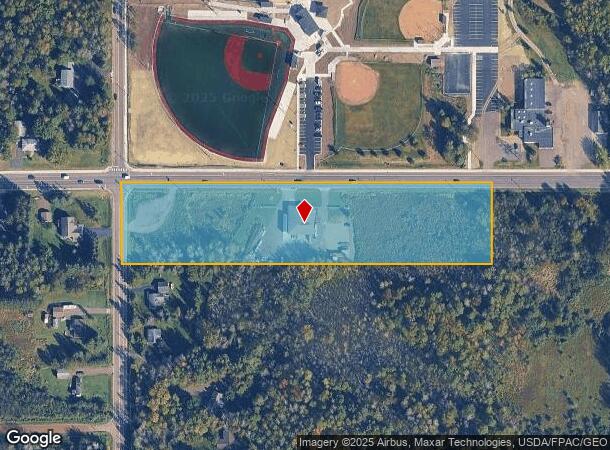
Property Record
5282 Maple Grove Rd, Hermantown, MN 55811

NEARBY LISTINGS FOR SALE OR LEASE
Property Detail
5282 Maple Grove Rd
395001005920
Hermantown City Of
Commercialnec
N 220 FT OF W 990 FT OF NW 1/4 OF NW 1/4 SERIAL #
X
St Louis
27137C3761E
Minnesota
2025
5 AC
2024
South St Louis County
010302
Duluth
4,680 SF
Duluth, MN-WI
DEMOGRAPHICS near 5282 Maple Grove Rd
1 Mile
3 Mile
5 Mile
2024 Total Population
789
8,586
25,743
2029 Population
791
8,560
25,469
Pop Growth 2024-2029
+ 0.25%
(0.30%)
(1.06%)
Average Age
40
41
43
2024 Total Households
280
3,245
10,238
HH Growth 2024-2029
0.00%
(0.40%)
(1.29%)
Median Household Inc
$119,575
$88,983
$79,887
Avg Household Size
2.70
2.50
2.30
2024 Avg HH Vehicles
2.00
2.00
2.00
Median Home Value
$408,696
$354,388
$256,744
Median Year Built
1994
1992
1978
Nearby Places
Map Layers
Map Styles
 Street
 Aerial
- Restaurants
- Banks
- Shops
- Fitness
- Groceries
PUBLIC TRANSPORTATION
AIRPORT
Duluth International
DRIVE
WALK
Distance
Duluth International
13 min
4.3 mi
Freight Ports
Port Milwaukee
DRIVE
WALK
Distance
Port Milwaukee
462 min
404.6 mi
Nearby Properties
Address
Land Use
TOTAL SIZE
Lot Size
Zoning
Address
Land Use
TOTAL SIZE
Lot Size
Zoning
322,819 SF
139.41 AC
Address
Land Use
TOTAL SIZE
Lot Size
Zoning
222,050 SF
5 AC
Address
Land Use
TOTAL SIZE
Lot Size
Zoning
20,388 SF
20 AC
Address
Land Use
TOTAL SIZE
Lot Size
Zoning
7,300 SF
19.85 AC
Address
Land Use
TOTAL SIZE
Lot Size
Zoning
113,448 SF
10 AC
Address
Land Use
TOTAL SIZE
Lot Size
Zoning
183,097 SF
27.58 AC
Address
Land Use
TOTAL SIZE
Lot Size
Zoning
57,230 SF
4.67 AC
Address
Land Use
TOTAL SIZE
Lot Size
Zoning
172,700 SF
33.34 AC
Address
Land Use
TOTAL SIZE
Lot Size
Zoning
164,720 SF
19.81 AC
Address
Land Use
TOTAL SIZE
Lot Size
Zoning
123,720 SF
2.65 AC
Address
Land Use
TOTAL SIZE
Lot Size
Zoning
21,204 SF
26.34 AC
Address
Land Use
TOTAL SIZE
Lot Size
Zoning
114,112 SF
8.59 AC
Address
Land Use
TOTAL SIZE
Lot Size
Zoning
51,765 SF
3.03 AC
Address
Land Use
TOTAL SIZE
Lot Size
Zoning
20,388 SF
7.78 AC
Address
Land Use
TOTAL SIZE
Lot Size
Zoning
35,448 SF
1.15 AC
Address
Land Use
TOTAL SIZE
Lot Size
Zoning
75,274 SF
10 AC
Address
Land Use
TOTAL SIZE
Lot Size
Zoning
57,012 SF
1.67 AC
Address
Land Use
TOTAL SIZE
Lot Size
Zoning
7,668 SF
63.27 AC
Address
Land Use
TOTAL SIZE
Lot Size
Zoning
174,292 SF
3.41 AC
Address
Land Use
TOTAL SIZE
Lot Size
Zoning
137,223 SF
10.22 AC
Address
Land Use
TOTAL SIZE
Lot Size
Zoning
19,507 SF
10 AC
Address
Land Use
TOTAL SIZE
Lot Size
Zoning
110,216 SF
9.76 AC
Address
Land Use
TOTAL SIZE
Lot Size
Zoning
3,356 SF
6.03 AC
Address
Land Use
TOTAL SIZE
Lot Size
Zoning
19,520 SF
10 AC
Address
Land Use
TOTAL SIZE
Lot Size
Zoning
20,296 SF
3.30 AC
Address
Land Use
TOTAL SIZE
Lot Size
Zoning
65,972 SF
4.61 AC
Address
Land Use
TOTAL SIZE
Lot Size
Zoning
24,962 SF
1.14 AC
Address
Land Use
TOTAL SIZE
Lot Size
Zoning
60,260 SF
1.66 AC
Address
Land Use
TOTAL SIZE
Lot Size
Zoning
2,304 SF
33.44 AC
Address
Land Use
TOTAL SIZE
Lot Size
Zoning
24,000 SF
11.77 AC
The World's #1 Commercial Real Estate Marketplace
Connect with us
© 2025 CoStar Group
The information above has been obtained from sources believed reliable. While we do not doubt its accuracy we have not verified it and make no guarantee, warranty or representation about it. It is your responsibility to independently confirm its accuracy and completeness. Any projections, opinions, assumptions, or estimates used are for example only and do not represent the current or future performance of the property. The value of this transaction to you depends on tax and other factors which should be evaluated by your tax, financial, and legal advisors. You and your advisors should conduct a careful, independent investigation of the property to determine to your satisfaction the suitability of the property for your needs.