Property Record
52820 Indiana State Route 933, South Bend, IN 46637

NEARBY LISTINGS FOR SALE OR LEASE
Property Detail
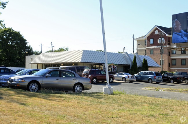
52820 Indiana State Route 933
South Bend-Mishawaka, IN-MI
Paxson Park
71-03-24-376-003.000-003
LOT 6A PAXSON PARK SECOND REPLAT 22/23 RP #1178 7/01/2021
Restaurantbuilding
St Joseph
X
Indiana
18141C0201D
6a
2023
0.75 AC
2024
Outlying St Joseph County
011303
South Bend/Mishawaka
4,050 SF
DEMOGRAPHICS near 52820 Indiana State Route 933
1 Mile
3 Mile
5 Mile
2024 Total Population
4,722
60,465
147,852
2029 Population
4,768
60,608
148,120
Pop Growth 2024-2029
+ 0.97%
+ 0.24%
+ 0.18%
Average Age
41
37
38
2024 Total Households
2,048
22,113
57,569
HH Growth 2024-2029
+ 1.07%
+ 0.28%
+ 0.17%
Median Household Inc
$55,503
$64,034
$54,705
Avg Household Size
2.20
2.30
2.30
2024 Avg HH Vehicles
2.00
2.00
2.00
Median Home Value
$154,968
$170,091
$156,489
Median Year Built
1962
1972
1966
Nearby Places
Map Layers
Map Styles
 Street
 Aerial
- Restaurants
- Banks
- Shops
- Fitness
- Groceries
PUBLIC TRANSPORTATION
COMMUTER RAIL
South Bend Airport Station (South Shore Line - Northern Indiana Commuter Transportation District (South Shore Line))
DRIVE
WALK
Distance
South Bend Airport Station (South Shore Line - Northern Indiana Commuter Transportation District (South Shore Line))
13 min
5.2 mi
DRIVE
WALK
Distance
13 min
5.2 mi
AIRPORT
South Bend International
DRIVE
WALK
Distance
South Bend International
23 min
8.2 mi
SALE & LEASE HISTORY
LISTING DATE
SALE/LEASE

Oct 09, 2020
For Sale
Jan 23, 2018
For Lease
Nearby Properties
Address
Land Use
TOTAL SIZE
Lot Size
Zoning
Address
Land Use
TOTAL SIZE
Lot Size
Zoning
3,879,729 SF
436.76 AC
Address
Land Use
TOTAL SIZE
Lot Size
Zoning
685,709 SF
44 SF
Address
Land Use
TOTAL SIZE
Lot Size
Zoning
808,463 SF
30.51 AC
Address
Land Use
TOTAL SIZE
Lot Size
Zoning
24,392 SF
48.07 AC
Address
Land Use
TOTAL SIZE
Lot Size
Zoning
966,201 SF
0.01 AC
Address
Land Use
TOTAL SIZE
Lot Size
Zoning
294,502 SF
87 SF
Address
Land Use
TOTAL SIZE
Lot Size
Zoning
369,116 SF
19.80 AC
Address
Land Use
TOTAL SIZE
Lot Size
Zoning
168,997 SF
9.62 AC
Address
Land Use
TOTAL SIZE
Lot Size
Zoning
394,459 SF
44 SF
Address
Land Use
TOTAL SIZE
Lot Size
Zoning
538,338 SF
0.01 AC
Address
Land Use
TOTAL SIZE
Lot Size
Zoning
160,546 SF
Address
Land Use
TOTAL SIZE
Lot Size
Zoning
319,715 SF
2.57 AC
Address
Land Use
TOTAL SIZE
Lot Size
Zoning
151,377 SF
0.01 AC
Address
Land Use
TOTAL SIZE
Lot Size
Zoning
206,651 SF
1.68 AC
Address
Land Use
TOTAL SIZE
Lot Size
Zoning
393,123 SF
2.91 AC
Address
Land Use
TOTAL SIZE
Lot Size
Zoning
207,846 SF
2.33 AC
Address
Land Use
TOTAL SIZE
Lot Size
Zoning
799,664 SF
0.01 AC
Address
Land Use
TOTAL SIZE
Lot Size
Zoning
148,524 SF
1.66 AC
Address
Land Use
TOTAL SIZE
Lot Size
Zoning
25,756 SF
337.40 AC
Address
Land Use
TOTAL SIZE
Lot Size
Zoning
356,520 SF
28.07 AC
Address
Land Use
TOTAL SIZE
Lot Size
Zoning
174,997 SF
0.70 AC
Address
Land Use
TOTAL SIZE
Lot Size
Zoning
128,298 SF
0.84 AC
Address
Land Use
TOTAL SIZE
Lot Size
Zoning
187,073 SF
11.52 AC
Address
Land Use
TOTAL SIZE
Lot Size
Zoning
73,254 SF
96.72 AC
Address
Land Use
TOTAL SIZE
Lot Size
Zoning
167,261 SF
1.58 AC
Address
Land Use
TOTAL SIZE
Lot Size
Zoning
747,842 SF
30.05 AC
Address
Land Use
TOTAL SIZE
Lot Size
Zoning
142,065 SF
44 SF
Address
Land Use
TOTAL SIZE
Lot Size
Zoning
151,852 SF
0.86 AC
Address
Land Use
TOTAL SIZE
Lot Size
Zoning
140,994 SF
13.58 AC
Address
Land Use
TOTAL SIZE
Lot Size
Zoning
159,834 SF
44 SF
The World's #1 Commercial Real Estate Marketplace
Connect with us
© 2025 CoStar Group
The information above has been obtained from sources believed reliable. While we do not doubt its accuracy we have not verified it and make no guarantee, warranty or representation about it. It is your responsibility to independently confirm its accuracy and completeness. Any projections, opinions, assumptions, or estimates used are for example only and do not represent the current or future performance of the property. The value of this transaction to you depends on tax and other factors which should be evaluated by your tax, financial, and legal advisors. You and your advisors should conduct a careful, independent investigation of the property to determine to your satisfaction the suitability of the property for your needs.