Property Record
5285 Crookshank Rd, Cincinnati, OH 45238


Property Detail
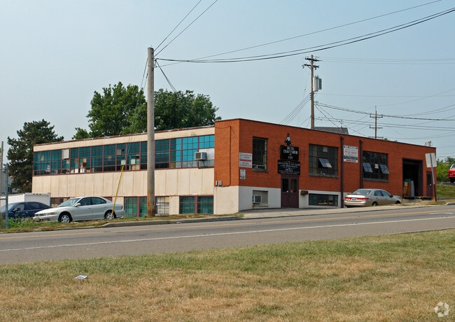
5285 Crookshank Rd
550-0042-0321
SS CROOKSHANK RD 0.395 ACPT LTS 16 TH 18 CASA LOMA PK BLK F PRS 321 TH 323 CON
Industrialgeneral
Hamilton
F
Ohio
B and X Area of moderate flood hazard, usually the area between the limits of the 100-year and 500-year floods.
16
2025
0.40 AC
2025
Central/Midtown
010700
Cincinnati/Dayton
6,561 SF
Cincinnati, OH-KY-IN
NEARBY LISTINGS FOR SALE OR LEASE
-
-
View all Cincinnati listings for sale on LoopNet.com
DEMOGRAPHICS near 5285 Crookshank Rd
1 mile
3 mile
5 mile
2025 Total Population
14,538
118,859
217,374
2030 Population
14,457
119,495
220,110
Pop Growth 2025-2030
(0.56%)
+ 0.54%
+ 1.26%
Average Age
40
38
38
2025 Total Households
6,034
48,156
89,662
HH Growth 2025-2030
(0.51%)
+ 0.57%
+ 1.28%
Median Household Inc
$58,581
$59,743
$59,179
Avg Household Size
2.30
2.40
2.30
2025 Avg HH Vehicles
2.00
2.00
2.00
Median Home Value
$182,600
$183,126
$205,073
Median Year Built
1957
1959
1961
Nearby Places
Map Layers
Map Styles
 Street
 Aerial
Layers
 Traffic
 Biking
Places
Listings with unknown addresses are not visible on the map
- Restaurants
- Banks
- Shops
- Fitness
- Groceries
PUBLIC TRANSPORTATION
COMMUTER RAIL
Drive
Walk
Distance
15 min
6.4 mi
AIRPORT
Cincinnati/Northern Kentucky International
Drive
Walk
Distance
Cincinnati/Northern Kentucky International
39 min
19.8 mi
SALE & LEASE HISTORY
LISTING DATE
SALE/LEASE

Mar 18, 2024
For Sale
Nearby Properties
Address
Land Use
TOTAL SIZE
Lot Size
Zoning
Address
Land Use
TOTAL SIZE
Lot Size
Zoning
30.43 AC
AA
Address
Land Use
TOTAL SIZE
Lot Size
Zoning
9.52 AC
B
Address
Land Use
TOTAL SIZE
Lot Size
Zoning
17,857 SF
26.60 AC
CGA
Address
Land Use
TOTAL SIZE
Lot Size
Zoning
12.28 AC
AA
Address
Land Use
TOTAL SIZE
Lot Size
Zoning
8.18 AC
SF4
Address
Land Use
TOTAL SIZE
Lot Size
Zoning
13.44 AC
Address
Land Use
TOTAL SIZE
Lot Size
Zoning
6,537 SF
12.55 AC
Address
Land Use
TOTAL SIZE
Lot Size
Zoning
1,873 SF
12.20 AC
Address
Land Use
TOTAL SIZE
Lot Size
Zoning
25,795 SF
31.93 AC
DD
Address
Land Use
TOTAL SIZE
Lot Size
Zoning
12.72 AC
DD
Address
Land Use
TOTAL SIZE
Lot Size
Zoning
125,405 SF
16.69 AC
SF6
Address
Land Use
TOTAL SIZE
Lot Size
Zoning
6,000 SF
11.92 AC
G
Address
Land Use
TOTAL SIZE
Lot Size
Zoning
62,160 SF
13.70 AC
RM20
Address
Land Use
TOTAL SIZE
Lot Size
Zoning
55,572 SF
6.12 AC
C
Address
Land Use
TOTAL SIZE
Lot Size
Zoning
14.01 AC
CGA
Address
Land Use
TOTAL SIZE
Lot Size
Zoning
1,329 SF
3.16 AC
SF4
Address
Land Use
TOTAL SIZE
Lot Size
Zoning
30.39 AC
A2
Address
Land Use
TOTAL SIZE
Lot Size
Zoning
19,730 SF
0.16 AC
SF2
Address
Land Use
TOTAL SIZE
Lot Size
Zoning
3,654 SF
10.82 AC
E
Address
Land Use
TOTAL SIZE
Lot Size
Zoning
40,080 SF
4.14 AC
SF6
Address
Land Use
TOTAL SIZE
Lot Size
Zoning
76,739 SF
11.44 AC
SF6
Address
Land Use
TOTAL SIZE
Lot Size
Zoning
24,222 SF
3.91 AC
CGA
Address
Land Use
TOTAL SIZE
Lot Size
Zoning
47,504 SF
14.37 AC
RM20
Address
Land Use
TOTAL SIZE
Lot Size
Zoning
60,751 SF
9.57 AC
C
Address
Land Use
TOTAL SIZE
Lot Size
Zoning
11.81 AC
RM20
Address
Land Use
TOTAL SIZE
Lot Size
Zoning
15,998 SF
13.71 AC
SF10
Address
Land Use
TOTAL SIZE
Lot Size
Zoning
9.43 AC
CGA
Address
Land Use
TOTAL SIZE
Lot Size
Zoning
13,068 SF
16.75 AC
RM20
Address
Land Use
TOTAL SIZE
Lot Size
Zoning
1,987 SF
3.71 AC
C
Address
Land Use
TOTAL SIZE
Lot Size
Zoning
2,224 SF
0.13 AC
PR
The World's #1 Commercial Real Estate Marketplace
Connect with us
© 2026 CoStar Group
The information above has been obtained from sources believed reliable. While we do not doubt its accuracy we have not verified it and make no guarantee, warranty or representation about it. It is your responsibility to independently confirm its accuracy and completeness. Any projections, opinions, assumptions, or estimates used are for example only and do not represent the current or future performance of the property. The value of this transaction to you depends on tax and other factors which should be evaluated by your tax, financial, and legal advisors. You and your advisors should conduct a careful, independent investigation of the property to determine to your satisfaction the suitability of the property for your needs.