Property Record
529 Hampton Ave, Pickens, SC 29671
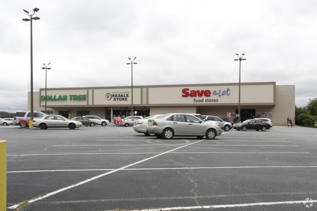

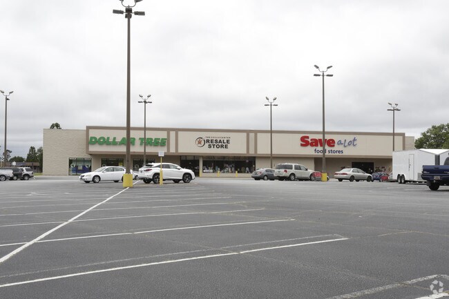
Property Detail
529 Hampton Ave
4181-20-91-8580
E/SIDE HAMPTON AVE
Supermarket
PICKENS
GBD
South Carolina
B and X Area of moderate flood hazard, usually the area between the limits of the 100-year and 500-year floods.
7 AC
2025
Pickens County
2025
Greenville/Spartanburg
010404
Greenville-Anderson-Greer, SC
47,636 SF
NEARBY LISTINGS FOR SALE OR LEASE
DEMOGRAPHICS near 529 Hampton Ave
1 mile
3 mile
5 mile
2025 Total Population
3,045
11,647
22,997
2030 Population
3,222
12,314
24,318
Pop Growth 2025-2030
+ 5.81%
+ 5.73%
+ 5.74%
Average Age
42
42
42
2025 Total Households
1,127
4,588
9,032
HH Growth 2025-2030
+ 6.21%
+ 6.04%
+ 6.05%
Median Household Inc
$48,408
$61,362
$58,665
Avg Household Size
2.40
2.40
2.50
2025 Avg HH Vehicles
2.00
2.00
2.00
Median Home Value
$214,493
$232,121
$215,678
Median Year Built
1974
1984
1988
Nearby Places
Map Layers
Map Styles
 Street
 Aerial
Transit
 Traffic
 Biking
Places
Listings with unknown addresses are not visible on the map
- Restaurants
- Banks
- Shops
- Fitness
- Groceries
PUBLIC TRANSPORTATION
AIRPORT
Greenville Spartanburg International
Drive
Walk
Distance
Greenville Spartanburg International
56 min
35.1 mi
Freight Ports
North Charleston Terminal
Drive
Walk
Distance
North Charleston Terminal
259 min
221.5 mi
SALE & LEASE HISTORY
LISTING DATE
SALE/LEASE

Sep 25, 2016
For Lease
Sep 24, 2016
For Sale
Nearby Properties
Address
Land Use
TOTAL SIZE
Lot Size
Zoning
Address
Land Use
TOTAL SIZE
Lot Size
Zoning
13,376 SF
12.36 AC
Address
Land Use
TOTAL SIZE
Lot Size
Zoning
56,599 SF
8.02 AC
RM16
Address
Land Use
TOTAL SIZE
Lot Size
Zoning
4,829 SF
2 AC
Address
Land Use
TOTAL SIZE
Lot Size
Zoning
5,356 SF
17.33 AC
Address
Land Use
TOTAL SIZE
Lot Size
Zoning
51,730 SF
6.75 AC
RM16
Address
Land Use
TOTAL SIZE
Lot Size
Zoning
12,466 SF
2.32 AC
R12
Address
Land Use
TOTAL SIZE
Lot Size
Zoning
5,645 SF
0.67 AC
Address
Land Use
TOTAL SIZE
Lot Size
Zoning
37,388 SF
4.29 AC
RM16
Address
Land Use
TOTAL SIZE
Lot Size
Zoning
6,070 SF
1 AC
CBD
Address
Land Use
TOTAL SIZE
Lot Size
Zoning
138.86 AC
GBD
Address
Land Use
TOTAL SIZE
Lot Size
Zoning
5,250 SF
1.35 AC
GBD
Address
Land Use
TOTAL SIZE
Lot Size
Zoning
5,468 SF
0.75 AC
CBD
Address
Land Use
TOTAL SIZE
Lot Size
Zoning
4,133 SF
5.15 AC
R12
Address
Land Use
TOTAL SIZE
Lot Size
Zoning
4,080 SF
2.56 AC
GBD
Address
Land Use
TOTAL SIZE
Lot Size
Zoning
19,852 SF
47.45 AC
GBD
Address
Land Use
TOTAL SIZE
Lot Size
Zoning
2,434 SF
6.19 AC
Address
Land Use
TOTAL SIZE
Lot Size
Zoning
10,190 SF
0.21 AC
CBD
Address
Land Use
TOTAL SIZE
Lot Size
Zoning
43,412 SF
8.17 AC
R12
Address
Land Use
TOTAL SIZE
Lot Size
Zoning
2,997 SF
1.50 AC
GBD
Address
Land Use
TOTAL SIZE
Lot Size
Zoning
4,140 SF
0.06 AC
CBD
Address
Land Use
TOTAL SIZE
Lot Size
Zoning
5,400 SF
2.20 AC
GBD
Address
Land Use
TOTAL SIZE
Lot Size
Zoning
20,652 SF
3.89 AC
Address
Land Use
TOTAL SIZE
Lot Size
Zoning
1,514 SF
0.34 AC
Address
Land Use
TOTAL SIZE
Lot Size
Zoning
1,716 SF
1.01 AC
GBD
Address
Land Use
TOTAL SIZE
Lot Size
Zoning
5,876 SF
2.15 AC
R12
Address
Land Use
TOTAL SIZE
Lot Size
Zoning
2,968 SF
0.26 AC
CBD
Address
Land Use
TOTAL SIZE
Lot Size
Zoning
91,940 SF
15.07 AC
GBD
Address
Land Use
TOTAL SIZE
Lot Size
Zoning
96,571 SF
12.80 AC
GBD
Address
Land Use
TOTAL SIZE
Lot Size
Zoning
10,000 SF
0.27 AC
CBD
Address
Land Use
TOTAL SIZE
Lot Size
Zoning
1,056 SF
34.54 AC
R12
The World's #1 Commercial Real Estate Marketplace
Connect with us
© 2026 CoStar Group
The information above has been obtained from sources believed reliable. While we do not doubt its accuracy we have not verified it and make no guarantee, warranty or representation about it. It is your responsibility to independently confirm its accuracy and completeness. Any projections, opinions, assumptions, or estimates used are for example only and do not represent the current or future performance of the property. The value of this transaction to you depends on tax and other factors which should be evaluated by your tax, financial, and legal advisors. You and your advisors should conduct a careful, independent investigation of the property to determine to your satisfaction the suitability of the property for your needs.