Property Record
529 S Main St, Standish, MI 48658
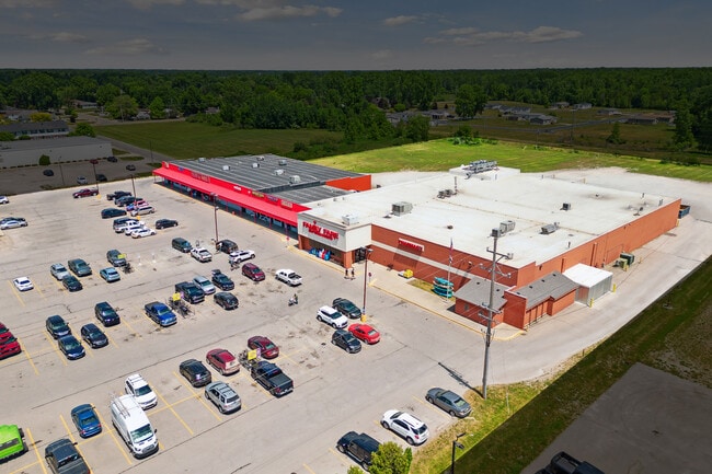

Property Detail
529 S Main St
040-3-000-000-820-26
T 18N R 4E SEC 11 A PAR COM AT N 1/4 COR OF SD SEC, TH S AL C/L GRCVE ST 1591.90' TH W AL ELM ST 651.13' TH S AL ELY R/W LM
Miscellaneous
Arenac
B and X Area of moderate flood hazard, usually the area between the limits of the 100-year and 500-year floods.
Michigan
0
8.44 AC
2026
Midland/Flint
970500
Other Market Areas
NEARBY LISTINGS FOR SALE OR LEASE
DEMOGRAPHICS near 529 S Main St
1 mile
3 mile
5 mile
2025 Total Population
1,456
2,990
4,984
2030 Population
1,416
2,931
4,930
Pop Growth 2025-2030
(2.75%)
(1.97%)
(1.08%)
Average Age
42
43
43
2025 Total Households
625
1,252
2,097
HH Growth 2025-2030
(3.20%)
(2.24%)
(1.29%)
Median Household Inc
$39,999
$53,723
$56,659
Avg Household Size
2.10
2.30
2.30
2025 Avg HH Vehicles
1.00
2.00
2.00
Median Home Value
$96,072
$123,578
$132,946
Median Year Built
1971
1974
1974
Nearby Places
Map Layers
Map Styles
 Street
 Aerial
Layers
 Traffic
 Biking
Places
Listings with unknown addresses are not visible on the map
- Restaurants
- Banks
- Shops
- Fitness
- Groceries
PUBLIC TRANSPORTATION
AIRPORT
MBS International
Drive
Walk
Distance
MBS International
51 min
41.8 mi
Nearby Properties
Address
Land Use
TOTAL SIZE
Lot Size
Zoning
Address
Land Use
TOTAL SIZE
Lot Size
Zoning
20.48 AC
Address
Land Use
TOTAL SIZE
Lot Size
Zoning
Address
Land Use
TOTAL SIZE
Lot Size
Zoning
7.36 AC
Address
Land Use
TOTAL SIZE
Lot Size
Zoning
8.20 AC
Address
Land Use
TOTAL SIZE
Lot Size
Zoning
Address
Land Use
TOTAL SIZE
Lot Size
Zoning
4.20 AC
Address
Land Use
TOTAL SIZE
Lot Size
Zoning
22.97 AC
Address
Land Use
TOTAL SIZE
Lot Size
Zoning
4.74 AC
Address
Land Use
TOTAL SIZE
Lot Size
Zoning
12.07 AC
Address
Land Use
TOTAL SIZE
Lot Size
Zoning
5.62 AC
Address
Land Use
TOTAL SIZE
Lot Size
Zoning
23,644 SF
4.86 AC
Address
Land Use
TOTAL SIZE
Lot Size
Zoning
5.43 AC
Address
Land Use
TOTAL SIZE
Lot Size
Zoning
5.38 AC
Address
Land Use
TOTAL SIZE
Lot Size
Zoning
0.76 AC
Address
Land Use
TOTAL SIZE
Lot Size
Zoning
8.10 AC
Address
Land Use
TOTAL SIZE
Lot Size
Zoning
2.39 AC
Address
Land Use
TOTAL SIZE
Lot Size
Zoning
Address
Land Use
TOTAL SIZE
Lot Size
Zoning
Address
Land Use
TOTAL SIZE
Lot Size
Zoning
7.93 AC
Address
Land Use
TOTAL SIZE
Lot Size
Zoning
1.37 AC
Address
Land Use
TOTAL SIZE
Lot Size
Zoning
Address
Land Use
TOTAL SIZE
Lot Size
Zoning
3.96 AC
Address
Land Use
TOTAL SIZE
Lot Size
Zoning
1.29 AC
Address
Land Use
TOTAL SIZE
Lot Size
Zoning
151.50 AC
Address
Land Use
TOTAL SIZE
Lot Size
Zoning
12.75 AC
Address
Land Use
TOTAL SIZE
Lot Size
Zoning
0.41 AC
Address
Land Use
TOTAL SIZE
Lot Size
Zoning
3.85 AC
Address
Land Use
TOTAL SIZE
Lot Size
Zoning
71.20 AC
Address
Land Use
TOTAL SIZE
Lot Size
Zoning
2.60 AC
The World's #1 Commercial Real Estate Marketplace
Connect with us
© 2026 CoStar Group
The information above has been obtained from sources believed reliable. While we do not doubt its accuracy we have not verified it and make no guarantee, warranty or representation about it. It is your responsibility to independently confirm its accuracy and completeness. Any projections, opinions, assumptions, or estimates used are for example only and do not represent the current or future performance of the property. The value of this transaction to you depends on tax and other factors which should be evaluated by your tax, financial, and legal advisors. You and your advisors should conduct a careful, independent investigation of the property to determine to your satisfaction the suitability of the property for your needs.