Property Record
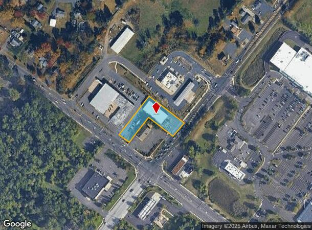
529 W Butler Ave, Chalfont, PA 18914

NEARBY LISTINGS FOR SALE OR LEASE
Property Detail
529 W Butler Ave
26-006-101-002
1.0615A N S US202 250 FT E COUNTY LINE RD
Storemultistory
Bucks
X
Pennsylvania
42017C0288K
1.06 AC
2024
Upper Bucks County
2025
Philadelphia
102003
Philadelphia-Camden-Wilmington, PA-NJ-DE-MD
9,629 SF
DEMOGRAPHICS near 529 W Butler Ave
1 Mile
3 Mile
5 Mile
2024 Total Population
8,546
52,228
139,833
2029 Population
8,535
52,609
141,407
Pop Growth 2024-2029
(0.13%)
+ 0.73%
+ 1.13%
Average Age
42
42
42
2024 Total Households
3,273
19,138
52,112
HH Growth 2024-2029
(0.21%)
+ 0.72%
+ 1.07%
Median Household Inc
$114,020
$120,625
$110,440
Avg Household Size
2.60
2.70
2.60
2024 Avg HH Vehicles
2.00
2.00
2.00
Median Home Value
$390,686
$408,484
$409,585
Median Year Built
1985
1985
1981
Nearby Places
Map Layers
Map Styles
 Street
 Aerial
- Restaurants
- Banks
- Shops
- Fitness
- Groceries
PUBLIC TRANSPORTATION
COMMUTER RAIL
Link Belt (R5 - Southeastern Pennsylvania Transportation Authority Regional Rail (SEPTA Regional Rail))
DRIVE
WALK
Distance
Link Belt (R5 - Southeastern Pennsylvania Transportation Authority Regional Rail (SEPTA Regional Rail))
3 min
1.2 mi
Colmar (R5 - Southeastern Pennsylvania Transportation Authority Regional Rail (SEPTA Regional Rail))
DRIVE
WALK
Distance
Colmar (R5 - Southeastern Pennsylvania Transportation Authority Regional Rail (SEPTA Regional Rail))
5 min
1.8 mi
AIRPORT
Trenton Mercer
DRIVE
WALK
Distance
Trenton Mercer
52 min
29.0 mi
Lehigh Valley International
DRIVE
WALK
Distance
Lehigh Valley International
54 min
32.7 mi
Philadelphia International
DRIVE
WALK
Distance
Philadelphia International
61 min
36.0 mi
Freight Ports
Port of Philadelphia
DRIVE
WALK
Distance
Port of Philadelphia
42 min
24.7 mi
Nearby Properties
Address
Land Use
TOTAL SIZE
Lot Size
Zoning
Address
Land Use
TOTAL SIZE
Lot Size
Zoning
258,179 SF
65.34 AC
IN
Address
Land Use
TOTAL SIZE
Lot Size
Zoning
1,127,663 SF
14.16 AC
RS
Address
Land Use
TOTAL SIZE
Lot Size
Zoning
319,136 SF
18.35 AC
HDR
Address
Land Use
TOTAL SIZE
Lot Size
Zoning
301,431 SF
41.90 AC
S
Address
Land Use
TOTAL SIZE
Lot Size
Zoning
517,834 SF
31.33 AC
GA
Address
Land Use
TOTAL SIZE
Lot Size
Zoning
245,104 SF
31.21 AC
C
Address
Land Use
TOTAL SIZE
Lot Size
Zoning
199,368 SF
24.65 AC
RC
Address
Land Use
TOTAL SIZE
Lot Size
Zoning
767,474 SF
64.82 AC
RC
Address
Land Use
TOTAL SIZE
Lot Size
Zoning
334,450 SF
18.86 AC
GA
Address
Land Use
TOTAL SIZE
Lot Size
Zoning
142,336 SF
3.17 AC
RS
Address
Land Use
TOTAL SIZE
Lot Size
Zoning
333,600 SF
24.72 AC
LI
Address
Land Use
TOTAL SIZE
Lot Size
Zoning
135,540 SF
27.77 AC
A1
Address
Land Use
TOTAL SIZE
Lot Size
Zoning
89,349 SF
18.11 AC
R1
Address
Land Use
TOTAL SIZE
Lot Size
Zoning
87,819 SF
1.82 AC
S
Address
Land Use
TOTAL SIZE
Lot Size
Zoning
77,875 SF
18.59 AC
RA
Address
Land Use
TOTAL SIZE
Lot Size
Zoning
119,740 SF
9.80 AC
BP
Address
Land Use
TOTAL SIZE
Lot Size
Zoning
136,473 SF
9.44 AC
LI
Address
Land Use
TOTAL SIZE
Lot Size
Zoning
88,060 SF
20.74 AC
R1
Address
Land Use
TOTAL SIZE
Lot Size
Zoning
76,464 SF
21.67 AC
A1
Address
Land Use
TOTAL SIZE
Lot Size
Zoning
77,805 SF
21.18 AC
R2
Address
Land Use
TOTAL SIZE
Lot Size
Zoning
148,670 SF
4.63 AC
C
Address
Land Use
TOTAL SIZE
Lot Size
Zoning
134,272 SF
3.11 AC
S
Address
Land Use
TOTAL SIZE
Lot Size
Zoning
38,713 SF
12.89 AC
LI
Address
Land Use
TOTAL SIZE
Lot Size
Zoning
164,376 SF
12.87 AC
LI
Address
Land Use
TOTAL SIZE
Lot Size
Zoning
57,420 SF
2 AC
IN
Address
Land Use
TOTAL SIZE
Lot Size
Zoning
65,890 SF
5.01 AC
LI
Address
Land Use
TOTAL SIZE
Lot Size
Zoning
137,652 SF
12.41 AC
RC
Address
Land Use
TOTAL SIZE
Lot Size
Zoning
183,600 SF
18.26 AC
LI
Address
Land Use
TOTAL SIZE
Lot Size
Zoning
9.43 AC
LI
Address
Land Use
TOTAL SIZE
Lot Size
Zoning
380,875 SF
40.10 AC
LI
The World's #1 Commercial Real Estate Marketplace
Connect with us
© 2025 CoStar Group
The information above has been obtained from sources believed reliable. While we do not doubt its accuracy we have not verified it and make no guarantee, warranty or representation about it. It is your responsibility to independently confirm its accuracy and completeness. Any projections, opinions, assumptions, or estimates used are for example only and do not represent the current or future performance of the property. The value of this transaction to you depends on tax and other factors which should be evaluated by your tax, financial, and legal advisors. You and your advisors should conduct a careful, independent investigation of the property to determine to your satisfaction the suitability of the property for your needs.