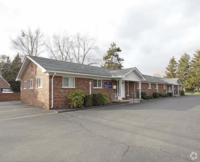
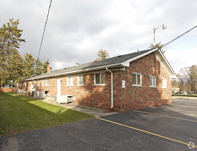
Property Record
52935 Mound Rd, Shelby Township, MI 48316

Current Lease Availabilities
NEARBY LISTINGS FOR SALE OR LEASE
Property Detail
52935 Mound Rd
Detroit-Warren-Dearborn, MI
Brookside Manor
23-07-17-226-015
L 17, L 18, L 16B, 1993 COMBINATION COMBINE 5007 143 129 10, 5007 143 130 00, 5007 143 131 00 BROOKSIDE MANOR NO 3 LOTS 130,
Medicalbuilding
Macomb
X
Michigan
26099C0216H
129-131
2025
0.85 AC
2025
Macomb West
225500
Detroit
5,400 SF
DEMOGRAPHICS near 52935 Mound Rd
1 Mile
3 Mile
5 Mile
2024 Total Population
6,546
57,352
170,245
2029 Population
6,448
56,824
168,572
Pop Growth 2024-2029
(1.50%)
(0.92%)
(0.98%)
Average Age
44
42
42
2024 Total Households
2,509
22,262
68,031
HH Growth 2024-2029
(1.55%)
(0.90%)
(1.03%)
Median Household Inc
$94,303
$90,555
$89,210
Avg Household Size
2.50
2.50
2.50
2024 Avg HH Vehicles
2.00
2.00
2.00
Median Home Value
$295,087
$334,147
$326,732
Median Year Built
1968
1990
1989
Nearby Places
Map Layers
Map Styles
 Street
 Aerial
- Restaurants
- Banks
- Shops
- Fitness
- Groceries
PUBLIC TRANSPORTATION
AIRPORT
Windsor International
DRIVE
WALK
Distance
Windsor International
66 min
40.0 mi
Bishop International
DRIVE
WALK
Distance
Bishop International
75 min
49.2 mi
Detroit Metro Wayne County
DRIVE
WALK
Distance
Detroit Metro Wayne County
71 min
49.5 mi
Nearby Properties
Address
Land Use
TOTAL SIZE
Lot Size
Zoning
Address
Land Use
TOTAL SIZE
Lot Size
Zoning
998,316 SF
85.99 AC
CK MAP
Address
Land Use
TOTAL SIZE
Lot Size
Zoning
57.84 AC
AV
Address
Land Use
TOTAL SIZE
Lot Size
Zoning
332,286 SF
CK MAP
Address
Land Use
TOTAL SIZE
Lot Size
Zoning
371,520 SF
21.91 AC
CK MAP
Address
Land Use
TOTAL SIZE
Lot Size
Zoning
13.61 AC
C-2
Address
Land Use
TOTAL SIZE
Lot Size
Zoning
35.60 AC
R-12
Address
Land Use
TOTAL SIZE
Lot Size
Zoning
257,878 SF
30 AC
Address
Land Use
TOTAL SIZE
Lot Size
Zoning
190,996 SF
33.80 AC
LM
Address
Land Use
TOTAL SIZE
Lot Size
Zoning
29,394 SF
33.83 AC
CK MAP
Address
Land Use
TOTAL SIZE
Lot Size
Zoning
19.47 AC
R-8
Address
Land Use
TOTAL SIZE
Lot Size
Zoning
119.30 AC
Address
Land Use
TOTAL SIZE
Lot Size
Zoning
181,725 SF
CK MAP
Address
Land Use
TOTAL SIZE
Lot Size
Zoning
224,323 SF
22.15 AC
C-3
Address
Land Use
TOTAL SIZE
Lot Size
Zoning
167,747 SF
CK MAP
Address
Land Use
TOTAL SIZE
Lot Size
Zoning
73.49 AC
CK MAP
Address
Land Use
TOTAL SIZE
Lot Size
Zoning
Address
Land Use
TOTAL SIZE
Lot Size
Zoning
10.28 AC
CK MAP
Address
Land Use
TOTAL SIZE
Lot Size
Zoning
9.47 AC
R-9
Address
Land Use
TOTAL SIZE
Lot Size
Zoning
217,654 SF
26.88 AC
CONSENT-GC
Address
Land Use
TOTAL SIZE
Lot Size
Zoning
117,856 SF
13.51 AC
C-3
Address
Land Use
TOTAL SIZE
Lot Size
Zoning
234,542 SF
37.18 AC
LM
Address
Land Use
TOTAL SIZE
Lot Size
Zoning
51.98 AC
MHP
Address
Land Use
TOTAL SIZE
Lot Size
Zoning
8.81 AC
C-6
Address
Land Use
TOTAL SIZE
Lot Size
Zoning
118,844 SF
17.80 AC
C-2
Address
Land Use
TOTAL SIZE
Lot Size
Zoning
134,400 SF
7.55 AC
CK MAP
Address
Land Use
TOTAL SIZE
Lot Size
Zoning
960 SF
18.63 AC
R-8
Address
Land Use
TOTAL SIZE
Lot Size
Zoning
125,426 SF
11.87 AC
R-1-B
Address
Land Use
TOTAL SIZE
Lot Size
Zoning
96,460 SF
17.50 AC
Address
Land Use
TOTAL SIZE
Lot Size
Zoning
122,540 SF
CK MAP
Address
Land Use
TOTAL SIZE
Lot Size
Zoning
8.90 AC
R-1-B
The World's #1 Commercial Real Estate Marketplace
Connect with us
© 2026 CoStar Group
The information above has been obtained from sources believed reliable. While we do not doubt its accuracy we have not verified it and make no guarantee, warranty or representation about it. It is your responsibility to independently confirm its accuracy and completeness. Any projections, opinions, assumptions, or estimates used are for example only and do not represent the current or future performance of the property. The value of this transaction to you depends on tax and other factors which should be evaluated by your tax, financial, and legal advisors. You and your advisors should conduct a careful, independent investigation of the property to determine to your satisfaction the suitability of the property for your needs.