Property Record
53 Brook St, Acton, MA 01720
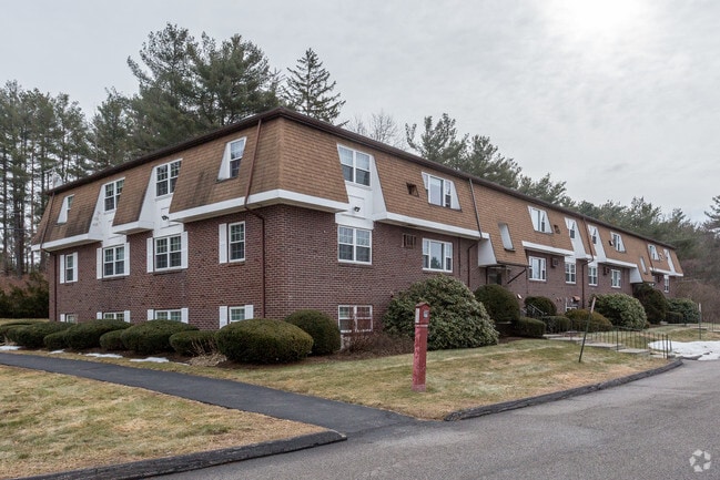

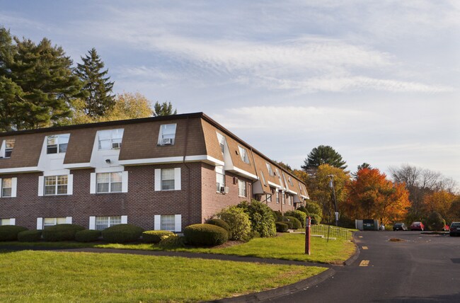

Property Detail
53 Brook St
ACTO-000004E-000035
Middlesex
Apartment
Massachusetts
RA
3.85 AC
AE The base floodplain where base flood elevations are provided. AE Zones are now used on new format FIRMs instead of A1-A30 Zones.
Acton
2025
Boston
2025
Boston-Cambridge-Newton, MA-NH
363105
NEARBY LISTINGS FOR SALE OR LEASE
-
-
View all Acton listings for sale on LoopNet.com
DEMOGRAPHICS near 53 Brook St
1 mile
3 mile
5 mile
2025 Total Population
4,366
28,497
70,912
2030 Population
4,562
29,786
74,015
Pop Growth 2025-2030
+ 4.49%
+ 4.52%
+ 4.38%
Average Age
42
43
43
2025 Total Households
1,668
10,620
26,770
HH Growth 2025-2030
+ 4.56%
+ 4.71%
+ 4.51%
Median Household Inc
$131,771
$165,251
$168,404
Avg Household Size
2.60
2.60
2.60
2025 Avg HH Vehicles
2.00
2.00
2.00
Median Home Value
$830,724
$820,543
$821,779
Median Year Built
1979
1977
1974
Nearby Places
Map Layers
Map Styles
 Street
 Aerial
Layers
 Traffic
 Biking
Places
Listings with unknown addresses are not visible on the map
- Restaurants
- Banks
- Shops
- Fitness
- Groceries
PUBLIC TRANSPORTATION
COMMUTER RAIL
West Concord (Fitchburg/South Acton Line - Massachusetts Bay Transportation Authority Commuter Rail (Purple Line))
Drive
Walk
Distance
West Concord (Fitchburg/South Acton Line - Massachusetts Bay Transportation Authority Commuter Rail (Purple Line))
7 min
3.2 mi
South Acton (Fitchburg/South Acton Line - Massachusetts Bay Transportation Authority Commuter Rail (Purple Line))
Drive
Walk
Distance
South Acton (Fitchburg/South Acton Line - Massachusetts Bay Transportation Authority Commuter Rail (Purple Line))
9 min
3.6 mi
AIRPORT
General Edward Lawrence Logan International
Drive
Walk
Distance
General Edward Lawrence Logan International
42 min
26.5 mi
Worcester Regional
Drive
Walk
Distance
Worcester Regional
54 min
35.6 mi
Freight Ports
Port of Boston
Drive
Walk
Distance
Port of Boston
42 min
26.5 mi
Nearby Properties
Address
Land Use
TOTAL SIZE
Lot Size
Zoning
Address
Land Use
TOTAL SIZE
Lot Size
Zoning
2,080 SF
289.85 AC
AA
Address
Land Use
TOTAL SIZE
Lot Size
Zoning
417,293 SF
64.97 AC
I
Address
Land Use
TOTAL SIZE
Lot Size
Zoning
22,927 SF
51 AC
IPA
Address
Land Use
TOTAL SIZE
Lot Size
Zoning
8.39 AC
OP1
Address
Land Use
TOTAL SIZE
Lot Size
Zoning
263,589 SF
8.76 AC
R2
Address
Land Use
TOTAL SIZE
Lot Size
Zoning
7.32 AC
R
Address
Land Use
TOTAL SIZE
Lot Size
Zoning
116,968 SF
3.44 AC
WCI
Address
Land Use
TOTAL SIZE
Lot Size
Zoning
25.15 AC
R2
Address
Land Use
TOTAL SIZE
Lot Size
Zoning
14.47 AC
R108
Address
Land Use
TOTAL SIZE
Lot Size
Zoning
7.88 AC
B
Address
Land Use
TOTAL SIZE
Lot Size
Zoning
20,498 SF
25.75 AC
GI
Address
Land Use
TOTAL SIZE
Lot Size
Zoning
9.96 AC
OP1
Address
Land Use
TOTAL SIZE
Lot Size
Zoning
10.34 AC
LB
Address
Land Use
TOTAL SIZE
Lot Size
Zoning
79,254 SF
18.14 AC
RA
Address
Land Use
TOTAL SIZE
Lot Size
Zoning
75,917 SF
28.56 AC
AA
Address
Land Use
TOTAL SIZE
Lot Size
Zoning
50,355 SF
6.38 AC
IPA
Address
Land Use
TOTAL SIZE
Lot Size
Zoning
105,036 SF
6.84 AC
KC
Address
Land Use
TOTAL SIZE
Lot Size
Zoning
396,023 SF
23.53 AC
OP1
Address
Land Use
TOTAL SIZE
Lot Size
Zoning
39,250 SF
0.39 AC
R2
Address
Land Use
TOTAL SIZE
Lot Size
Zoning
76,623 SF
16.59 AC
R2
Address
Land Use
TOTAL SIZE
Lot Size
Zoning
9.61 AC
I
Address
Land Use
TOTAL SIZE
Lot Size
Zoning
63.75 AC
A
Address
Land Use
TOTAL SIZE
Lot Size
Zoning
75,182 SF
6.74 AC
IPA
Address
Land Use
TOTAL SIZE
Lot Size
Zoning
38,552 SF
5.34 AC
LB
Address
Land Use
TOTAL SIZE
Lot Size
Zoning
78,564 SF
3.43 AC
LB
Address
Land Use
TOTAL SIZE
Lot Size
Zoning
119,000 SF
11.19 AC
OP1
Address
Land Use
TOTAL SIZE
Lot Size
Zoning
56,036 SF
17.13 AC
R2
Address
Land Use
TOTAL SIZE
Lot Size
Zoning
78,722 SF
7.54 AC
LB
Address
Land Use
TOTAL SIZE
Lot Size
Zoning
105,163 SF
10.65 AC
OP2
The World's #1 Commercial Real Estate Marketplace
Connect with us
© 2026 CoStar Group
The information above has been obtained from sources believed reliable. While we do not doubt its accuracy we have not verified it and make no guarantee, warranty or representation about it. It is your responsibility to independently confirm its accuracy and completeness. Any projections, opinions, assumptions, or estimates used are for example only and do not represent the current or future performance of the property. The value of this transaction to you depends on tax and other factors which should be evaluated by your tax, financial, and legal advisors. You and your advisors should conduct a careful, independent investigation of the property to determine to your satisfaction the suitability of the property for your needs.