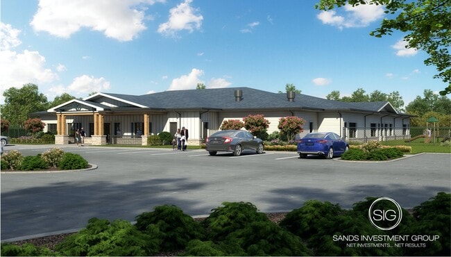
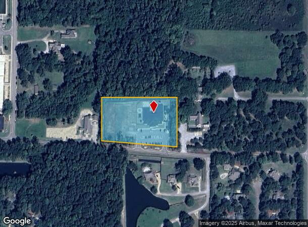
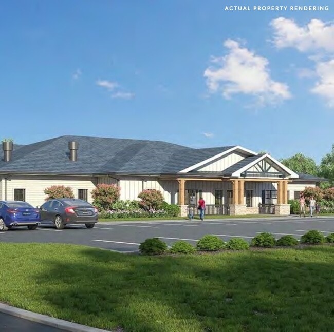
Property Record
530 Antioch Ln N, Pike Road, AL 36064
NEARBY LISTINGS FOR SALE OR LEASE
Property Detail
530 Antioch Ln N
08-04-19-2-002-015.000
COM SE COR OF NW1/4 SEC 19 16 20 W 880FT N 30POB N 340FT W 492FT S 285FT E ALONG N/SIDE PI498FT TO POB 0804192002015000
Recreationalentertainmentgeneral
Montgomery
X
Alabama
01101C0251H
3.50 AC
2025
Outlying Montgomery Cnty
2025
Montgomery
005503
Montgomery, AL
11,903 SF
DEMOGRAPHICS near 530 Antioch Ln N
1 Mile
3 Mile
5 Mile
2024 Total Population
1,732
17,670
40,945
2029 Population
1,674
17,274
39,678
Pop Growth 2024-2029
(3.35%)
(2.24%)
(3.09%)
Average Age
37
39
39
2024 Total Households
624
6,078
15,553
HH Growth 2024-2029
(3.21%)
(2.40%)
(3.41%)
Median Household Inc
$97,726
$96,220
$93,275
Avg Household Size
2.80
2.60
2.50
2024 Avg HH Vehicles
2.00
2.00
2.00
Median Home Value
$248,319
$284,812
$281,951
Median Year Built
2001
2004
2001
Nearby Places
- Restaurants
- Banks
- Shops
- Fitness
- Groceries
PUBLIC TRANSPORTATION
AIRPORT
Montgomery Regional (Dannelly Field)
DRIVE
WALK
Distance
Montgomery Regional (Dannelly Field)
29 min
21.8 mi
Freight Ports
Port of Panama City
DRIVE
WALK
Distance
Port of Panama City
240 min
187.5 mi
SALE & LEASE HISTORY
LISTING DATE
SALE/LEASE

Apr 12, 2022
For Sale
Nearby Properties
Address
Land Use
TOTAL SIZE
Lot Size
Zoning
Address
Land Use
TOTAL SIZE
Lot Size
Zoning
25,762 SF
35.04 AC
PUD
Address
Land Use
TOTAL SIZE
Lot Size
Zoning
208,799 SF
17.34 AC
O-2
Address
Land Use
TOTAL SIZE
Lot Size
Zoning
160,604 SF
35.85 AC
B-2
Address
Land Use
TOTAL SIZE
Lot Size
Zoning
4,142 SF
25.96 AC
PUD
Address
Land Use
TOTAL SIZE
Lot Size
Zoning
344,095 SF
30.02 AC
Address
Land Use
TOTAL SIZE
Lot Size
Zoning
170,644 SF
12.34 AC
Address
Land Use
TOTAL SIZE
Lot Size
Zoning
217,723 SF
23.90 AC
B-2
Address
Land Use
TOTAL SIZE
Lot Size
Zoning
56,956 SF
10.37 AC
B-2
Address
Land Use
TOTAL SIZE
Lot Size
Zoning
52,600 SF
11.63 AC
Address
Land Use
TOTAL SIZE
Lot Size
Zoning
9,792 SF
160 AC
Address
Land Use
TOTAL SIZE
Lot Size
Zoning
117,633 SF
52.48 AC
Address
Land Use
TOTAL SIZE
Lot Size
Zoning
228,855 SF
15.70 AC
M-1
Address
Land Use
TOTAL SIZE
Lot Size
Zoning
96,764 SF
13.64 AC
M-1
Address
Land Use
TOTAL SIZE
Lot Size
Zoning
168,209 SF
21.62 AC
Address
Land Use
TOTAL SIZE
Lot Size
Zoning
55,215 SF
9.78 AC
B-2
Address
Land Use
TOTAL SIZE
Lot Size
Zoning
168,209 SF
21.62 AC
Address
Land Use
TOTAL SIZE
Lot Size
Zoning
64,898 SF
2.65 AC
B-2
Address
Land Use
TOTAL SIZE
Lot Size
Zoning
115,292 SF
49.50 AC
M-1
Address
Land Use
TOTAL SIZE
Lot Size
Zoning
113,724 SF
12.84 AC
B-2
Address
Land Use
TOTAL SIZE
Lot Size
Zoning
123,376 SF
23 AC
Address
Land Use
TOTAL SIZE
Lot Size
Zoning
73,990 SF
8.49 AC
B-2
Address
Land Use
TOTAL SIZE
Lot Size
Zoning
34.70 AC
B-2
Address
Land Use
TOTAL SIZE
Lot Size
Zoning
58,052 SF
2.55 AC
B-2
Address
Land Use
TOTAL SIZE
Lot Size
Zoning
55,345 SF
6.78 AC
Address
Land Use
TOTAL SIZE
Lot Size
Zoning
9,806 SF
119.29 AC
Address
Land Use
TOTAL SIZE
Lot Size
Zoning
11,100 SF
10.50 AC
Address
Land Use
TOTAL SIZE
Lot Size
Zoning
53,827 SF
1.98 AC
B-2
Address
Land Use
TOTAL SIZE
Lot Size
Zoning
139,221 SF
11.77 AC
M-1
Address
Land Use
TOTAL SIZE
Lot Size
Zoning
9,615 SF
4.16 AC
Address
Land Use
TOTAL SIZE
Lot Size
Zoning
49,843 SF
11.99 AC
M-1
The World's #1 Commercial Real Estate Marketplace
Connect with us
© 2025 CoStar Group
The information above has been obtained from sources believed reliable. While we do not doubt its accuracy we have not verified it and make no guarantee, warranty or representation about it. It is your responsibility to independently confirm its accuracy and completeness. Any projections, opinions, assumptions, or estimates used are for example only and do not represent the current or future performance of the property. The value of this transaction to you depends on tax and other factors which should be evaluated by your tax, financial, and legal advisors. You and your advisors should conduct a careful, independent investigation of the property to determine to your satisfaction the suitability of the property for your needs.