Property Record
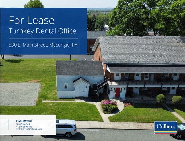
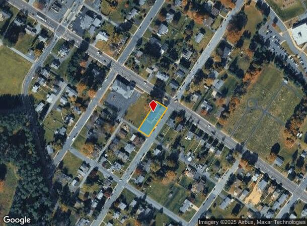
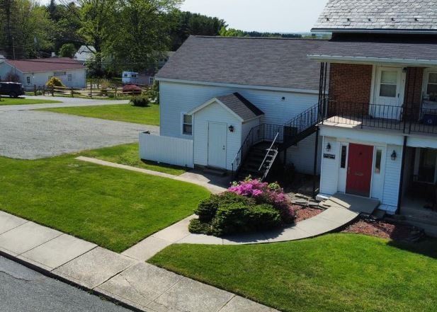
530 E Main St, Macungie, PA 18062
Current Lease Availabilities
NEARBY LISTINGS FOR SALE OR LEASE
Property Detail
530 E Main St
548306872449-1
LOTS: 002
Medicalbuilding
Lehigh
X
Pennsylvania
42011C0250G
2
2025
0.32 AC
2025
Lehigh Valley
006303
Philadelphia
5,570 SF
Allentown-Bethlehem-Easton, PA-NJ
DEMOGRAPHICS near 530 E Main St
1 Mile
3 Mile
5 Mile
2024 Total Population
4,623
34,016
84,613
2029 Population
4,657
34,149
85,168
Pop Growth 2024-2029
+ 0.74%
+ 0.39%
+ 0.66%
Average Age
41
42
42
2024 Total Households
1,945
13,425
33,226
HH Growth 2024-2029
+ 0.67%
+ 0.36%
+ 0.63%
Median Household Inc
$68,959
$95,833
$90,526
Avg Household Size
2.40
2.50
2.50
2024 Avg HH Vehicles
2.00
2.00
2.00
Median Home Value
$292,192
$321,952
$294,475
Median Year Built
1984
1988
1982
Nearby Places
- Restaurants
- Banks
- Shops
- Fitness
- Groceries
PUBLIC TRANSPORTATION
AIRPORT
Lehigh Valley International
DRIVE
WALK
Distance
Lehigh Valley International
27 min
15.2 mi
Freight Ports
Port of Philadelphia
DRIVE
WALK
Distance
Port of Philadelphia
85 min
57.3 mi
Nearby Properties
Address
Land Use
TOTAL SIZE
Lot Size
Zoning
Address
Land Use
TOTAL SIZE
Lot Size
Zoning
413,834 SF
40 AC
R-L
Address
Land Use
TOTAL SIZE
Lot Size
Zoning
199,343 SF
48.68 AC
O
Address
Land Use
TOTAL SIZE
Lot Size
Zoning
698,350 SF
42.82 AC
O
Address
Land Use
TOTAL SIZE
Lot Size
Zoning
7,132 SF
21.72 AC
C
Address
Land Use
TOTAL SIZE
Lot Size
Zoning
535,000 SF
39.49 AC
O
Address
Land Use
TOTAL SIZE
Lot Size
Zoning
580,000 SF
38.42 AC
I
Address
Land Use
TOTAL SIZE
Lot Size
Zoning
493,200 SF
41.29 AC
O
Address
Land Use
TOTAL SIZE
Lot Size
Zoning
32,500 SF
147.04 AC
I
Address
Land Use
TOTAL SIZE
Lot Size
Zoning
400,000 SF
26.46 AC
I
Address
Land Use
TOTAL SIZE
Lot Size
Zoning
314,704 SF
24.70 AC
O
Address
Land Use
TOTAL SIZE
Lot Size
Zoning
44,302 SF
17.25 AC
I-L
Address
Land Use
TOTAL SIZE
Lot Size
Zoning
85,585 SF
24.47 AC
SR
Address
Land Use
TOTAL SIZE
Lot Size
Zoning
269,089 SF
19.49 AC
O
Address
Land Use
TOTAL SIZE
Lot Size
Zoning
210,000 SF
20.53 AC
I
Address
Land Use
TOTAL SIZE
Lot Size
Zoning
15,472 SF
10.40 AC
R-7.
Address
Land Use
TOTAL SIZE
Lot Size
Zoning
1,922 SF
44.40 AC
I
Address
Land Use
TOTAL SIZE
Lot Size
Zoning
41,877 SF
14 AC
C-SC
Address
Land Use
TOTAL SIZE
Lot Size
Zoning
14,330 SF
11.32 AC
R-M
Address
Land Use
TOTAL SIZE
Lot Size
Zoning
2,866 SF
12.21 AC
R-M
Address
Land Use
TOTAL SIZE
Lot Size
Zoning
19,124 SF
14.03 AC
R-P
Address
Land Use
TOTAL SIZE
Lot Size
Zoning
22,380 SF
13.79 AC
R-P
Address
Land Use
TOTAL SIZE
Lot Size
Zoning
70,230 SF
13.07 AC
C
Address
Land Use
TOTAL SIZE
Lot Size
Zoning
6,725 SF
6.13 AC
R-7.
Address
Land Use
TOTAL SIZE
Lot Size
Zoning
40.21 AC
S
Address
Land Use
TOTAL SIZE
Lot Size
Zoning
29,496 SF
22.56 AC
O
Address
Land Use
TOTAL SIZE
Lot Size
Zoning
106,080 SF
9.49 AC
O
Address
Land Use
TOTAL SIZE
Lot Size
Zoning
30,051 SF
4.68 AC
C
Address
Land Use
TOTAL SIZE
Lot Size
Zoning
2,827 SF
6.39 AC
R-A
Address
Land Use
TOTAL SIZE
Lot Size
Zoning
224,173 SF
16.56 AC
M
Address
Land Use
TOTAL SIZE
Lot Size
Zoning
29.10 AC
I
The World's #1 Commercial Real Estate Marketplace
Connect with us
© 2025 CoStar Group
The information above has been obtained from sources believed reliable. While we do not doubt its accuracy we have not verified it and make no guarantee, warranty or representation about it. It is your responsibility to independently confirm its accuracy and completeness. Any projections, opinions, assumptions, or estimates used are for example only and do not represent the current or future performance of the property. The value of this transaction to you depends on tax and other factors which should be evaluated by your tax, financial, and legal advisors. You and your advisors should conduct a careful, independent investigation of the property to determine to your satisfaction the suitability of the property for your needs.