Property Record
530 Fano St, Monrovia, CA 91016
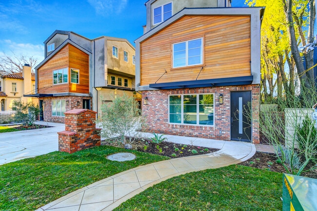
This Property Is For Sale
NEARBY LISTINGS FOR SALE OR LEASE
Property Detail
530 Fano St
Los Angeles-Long Beach-Glendale, CA
Tract 74071
8507-012-099
Los Angeles
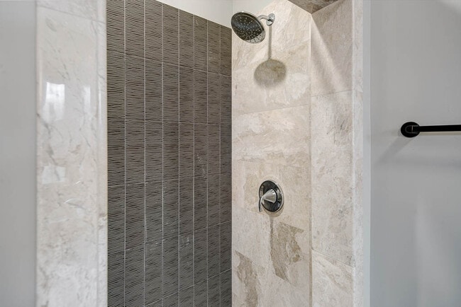
Condominium
California
X
0.52 AC
06037C1400F
Monrovia
1,340 SF
Los Angeles
DEMOGRAPHICS near 530 Fano St
1 Mile
3 Mile
5 Mile
2024 Total Population
25,562
130,194
353,306
2029 Population
24,766
126,260
341,621
Pop Growth 2024-2029
(3.11%)
(3.02%)
(3.31%)
Average Age
41
43
42
2024 Total Households
8,985
44,440
110,451
HH Growth 2024-2029
(3.46%)
(3.38%)
(3.67%)
Median Household Inc
$96,022
$94,340
$87,394
Avg Household Size
2.80
2.80
3.10
2024 Avg HH Vehicles
2.00
2.00
2.00
Median Home Value
$820,147
$893,691
$828,973
Median Year Built
1967
1961
1960
Nearby Places
- Restaurants
- Banks
- Shops
- Fitness
- Groceries
PUBLIC TRANSPORTATION
COMMUTER RAIL
El Monte (San Bernardino Line - Southern California Regional Rail Authority (Metrolink))
DRIVE
WALK
Distance
El Monte (San Bernardino Line - Southern California Regional Rail Authority (Metrolink))
12 min
5.2 mi
Baldwin Park (San Bernardino Line - Southern California Regional Rail Authority (Metrolink))
DRIVE
WALK
Distance
Baldwin Park (San Bernardino Line - Southern California Regional Rail Authority (Metrolink))
14 min
6.4 mi
AIRPORT
Bob Hope
DRIVE
WALK
Distance
Bob Hope
34 min
25.1 mi
Ontario International
DRIVE
WALK
Distance
Ontario International
38 min
28.7 mi
Long Beach (Daugherty Field)
DRIVE
WALK
Distance
Long Beach (Daugherty Field)
41 min
29.9 mi
Freight Ports
Port of Long Beach
DRIVE
WALK
Distance
Port of Long Beach
48 min
35.5 mi
Nearby Properties
Address
Land Use
TOTAL SIZE
Lot Size
Zoning
Address
Land Use
TOTAL SIZE
Lot Size
Zoning
945,101 SF
38.07 AC
ARC2DH-S1-
Address
Land Use
TOTAL SIZE
Lot Size
Zoning
453,050 SF
17.48 AC
DUH*
Address
Land Use
TOTAL SIZE
Lot Size
Zoning
364,848 SF
270.52 AC
ARS1*
Address
Land Use
TOTAL SIZE
Lot Size
Zoning
636,006 SF
27.79 AC
IRM2*
Address
Land Use
TOTAL SIZE
Lot Size
Zoning
165,341 SF
2.70 AC
ARC2YY
Address
Land Use
TOTAL SIZE
Lot Size
Zoning
375,679 SF
39.70 AC
ARM2*
Address
Land Use
TOTAL SIZE
Lot Size
Zoning
3.29 AC
DUSP
Address
Land Use
TOTAL SIZE
Lot Size
Zoning
357,639 SF
4.34 AC
DUSP
Address
Land Use
TOTAL SIZE
Lot Size
Zoning
127,085 SF
1.97 AC
MOCG-P/QP*
Address
Land Use
TOTAL SIZE
Lot Size
Zoning
473,624 SF
4.53 AC
DUH*
Address
Land Use
TOTAL SIZE
Lot Size
Zoning
100,253 SF
0.96 AC
DUH*
Address
Land Use
TOTAL SIZE
Lot Size
Zoning
95,530 SF
1.27 AC
MOM*
Address
Land Use
TOTAL SIZE
Lot Size
Zoning
328,784 SF
14.73 AC
ARM2*
Address
Land Use
TOTAL SIZE
Lot Size
Zoning
888,572 SF
21.68 AC
IRM2*
Address
Land Use
TOTAL SIZE
Lot Size
Zoning
68,417 SF
0.78 AC
ARC2H*
Address
Land Use
TOTAL SIZE
Lot Size
Zoning
358,500 SF
5.11 AC
ARC2DH-S1-
Address
Land Use
TOTAL SIZE
Lot Size
Zoning
206,254 SF
0.77 AC
Address
Land Use
TOTAL SIZE
Lot Size
Zoning
635,556 SF
11.05 AC
ARC2
Address
Land Use
TOTAL SIZE
Lot Size
Zoning
756,195 SF
15.48 AC
ARC2DH-S1-
Address
Land Use
TOTAL SIZE
Lot Size
Zoning
241,189 SF
0.90 AC
ARC2*
Address
Land Use
TOTAL SIZE
Lot Size
Zoning
108,340 SF
2.53 AC
DUH*
Address
Land Use
TOTAL SIZE
Lot Size
Zoning
24,015 SF
3.23 AC
ARCPD1*
Address
Land Use
TOTAL SIZE
Lot Size
Zoning
98,113 SF
6.07 AC
MOCG*
Address
Land Use
TOTAL SIZE
Lot Size
Zoning
465,988 SF
8.03 AC
MOM*
Address
Land Use
TOTAL SIZE
Lot Size
Zoning
134,018 SF
5.97 AC
MORH*
Address
Land Use
TOTAL SIZE
Lot Size
Zoning
53,168 SF
2.15 AC
DUR4*
Address
Land Use
TOTAL SIZE
Lot Size
Zoning
277,264 SF
18.18 AC
LCA1
Address
Land Use
TOTAL SIZE
Lot Size
Zoning
54,546 SF
1 AC
MOM*
Address
Land Use
TOTAL SIZE
Lot Size
Zoning
220,753 SF
3.75 AC
ARCPD1*
Address
Land Use
TOTAL SIZE
Lot Size
Zoning
12,576 SF
5.60 AC
IRM2*
The World's #1 Commercial Real Estate Marketplace
Connect with us
© 2025 CoStar Group
The information above has been obtained from sources believed reliable. While we do not doubt its accuracy we have not verified it and make no guarantee, warranty or representation about it. It is your responsibility to independently confirm its accuracy and completeness. Any projections, opinions, assumptions, or estimates used are for example only and do not represent the current or future performance of the property. The value of this transaction to you depends on tax and other factors which should be evaluated by your tax, financial, and legal advisors. You and your advisors should conduct a careful, independent investigation of the property to determine to your satisfaction the suitability of the property for your needs.