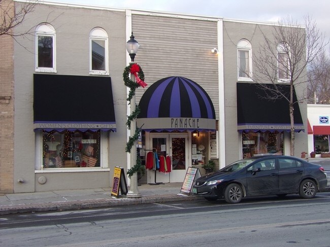
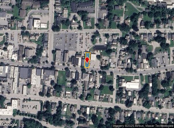
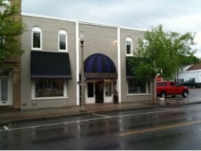
Property Record
530 Main St, Bennington, VT 05201
NEARBY LISTINGS FOR SALE OR LEASE
-
-
View all Bennington listings for lease on LoopNet.com
Property Detail
530 Main St
(015)50-55-34-00
MIXED-USE BLDG & .15A
Commercialofficeresidentialmixeduse
Bennington
AE
Vermont
50003C0414D
0.15 AC
2024
Vermont South Area
2024
Other Market Areas
971200
Bennington, VT
10,252 SF
DEMOGRAPHICS near 530 Main St
1 Mile
3 Mile
5 Mile
2024 Total Population
7,924
13,097
17,847
2029 Population
7,900
13,115
17,811
Pop Growth 2024-2029
(0.30%)
+ 0.14%
(0.20%)
Average Age
44
43
43
2024 Total Households
3,530
5,579
7,331
HH Growth 2024-2029
(0.25%)
+ 0.18%
(0.18%)
Median Household Inc
$50,361
$54,411
$57,127
Avg Household Size
2.10
2.20
2.20
2024 Avg HH Vehicles
1.00
2.00
2.00
Median Home Value
$175,718
$186,730
$199,830
Median Year Built
1949
1960
1961
Nearby Places
Map Layers
Map Styles
 Street
 Aerial
- Restaurants
- Banks
- Shops
- Fitness
- Groceries
PUBLIC TRANSPORTATION
AIRPORT
Albany International
DRIVE
WALK
Distance
Albany International
61 min
37.4 mi
SALE & LEASE HISTORY
LISTING DATE
SALE/LEASE

Sep 25, 2016
For Lease
Nearby Properties
Address
Land Use
TOTAL SIZE
Lot Size
Zoning
Address
Land Use
TOTAL SIZE
Lot Size
Zoning
Address
Land Use
TOTAL SIZE
Lot Size
Zoning
85.76 AC
Address
Land Use
TOTAL SIZE
Lot Size
Zoning
Address
Land Use
TOTAL SIZE
Lot Size
Zoning
82.13 AC
Address
Land Use
TOTAL SIZE
Lot Size
Zoning
44.11 AC
Address
Land Use
TOTAL SIZE
Lot Size
Zoning
150,299 SF
109.97 AC
Address
Land Use
TOTAL SIZE
Lot Size
Zoning
84.32 AC
Address
Land Use
TOTAL SIZE
Lot Size
Zoning
Address
Land Use
TOTAL SIZE
Lot Size
Zoning
88,669 SF
11.47 AC
Address
Land Use
TOTAL SIZE
Lot Size
Zoning
11,373 SF
9 AC
Address
Land Use
TOTAL SIZE
Lot Size
Zoning
10.60 AC
Address
Land Use
TOTAL SIZE
Lot Size
Zoning
112,334 SF
10.92 AC
Address
Land Use
TOTAL SIZE
Lot Size
Zoning
19.20 AC
Address
Land Use
TOTAL SIZE
Lot Size
Zoning
66,622 SF
6.20 AC
Address
Land Use
TOTAL SIZE
Lot Size
Zoning
67,249 SF
Address
Land Use
TOTAL SIZE
Lot Size
Zoning
Address
Land Use
TOTAL SIZE
Lot Size
Zoning
48,821 SF
5.75 AC
Address
Land Use
TOTAL SIZE
Lot Size
Zoning
51,856 SF
7.22 AC
Address
Land Use
TOTAL SIZE
Lot Size
Zoning
6.40 AC
Address
Land Use
TOTAL SIZE
Lot Size
Zoning
24,012 SF
9.44 AC
Address
Land Use
TOTAL SIZE
Lot Size
Zoning
6.17 AC
Address
Land Use
TOTAL SIZE
Lot Size
Zoning
49,358 SF
2.52 AC
Address
Land Use
TOTAL SIZE
Lot Size
Zoning
69,636 SF
6.60 AC
Address
Land Use
TOTAL SIZE
Lot Size
Zoning
4.55 AC
Address
Land Use
TOTAL SIZE
Lot Size
Zoning
31,433 SF
7.51 AC
Address
Land Use
TOTAL SIZE
Lot Size
Zoning
17.13 AC
Address
Land Use
TOTAL SIZE
Lot Size
Zoning
37,857 SF
1.66 AC
Address
Land Use
TOTAL SIZE
Lot Size
Zoning
15.92 AC
Address
Land Use
TOTAL SIZE
Lot Size
Zoning
14,712 SF
1.71 AC
Address
Land Use
TOTAL SIZE
Lot Size
Zoning
17,694 SF
5.70 AC
The World's #1 Commercial Real Estate Marketplace
Connect with us
© 2025 CoStar Group
The information above has been obtained from sources believed reliable. While we do not doubt its accuracy we have not verified it and make no guarantee, warranty or representation about it. It is your responsibility to independently confirm its accuracy and completeness. Any projections, opinions, assumptions, or estimates used are for example only and do not represent the current or future performance of the property. The value of this transaction to you depends on tax and other factors which should be evaluated by your tax, financial, and legal advisors. You and your advisors should conduct a careful, independent investigation of the property to determine to your satisfaction the suitability of the property for your needs.