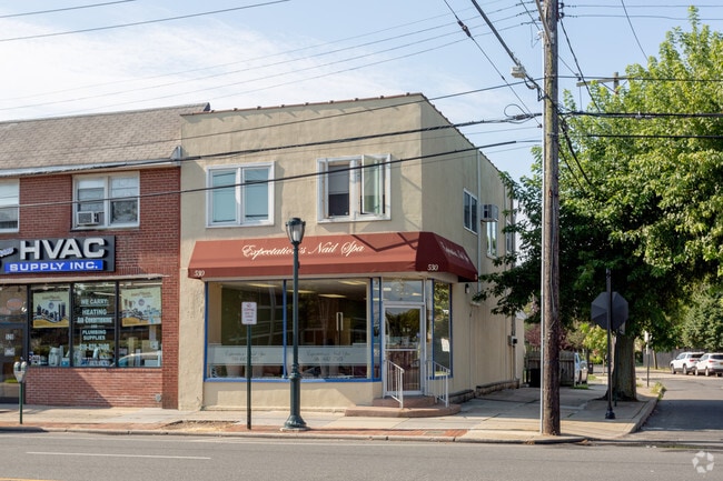
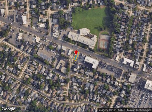
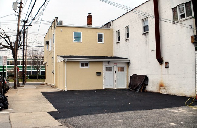
Property Record
530 Merrick Rd, Lynbrook, NY 11563
NEARBY LISTINGS FOR SALE OR LEASE
Property Detail
530 Merrick Rd
2025-37-306-00-0171-0
TOWN #1 SCH DIST 020
Commercialnec
Nassau
X
New York
36059C0216G
171
2025
0.06 AC
2025
Southern Nassau
411800
Long Island (New York)
2,620 SF
Nassau County-Suffolk County, NY
DEMOGRAPHICS near 530 Merrick Rd
1 Mile
3 Mile
5 Mile
2024 Total Population
30,522
229,132
614,091
2029 Population
29,657
222,971
591,198
Pop Growth 2024-2029
(2.83%)
(2.69%)
(3.73%)
Average Age
42
41
41
2024 Total Households
10,672
74,068
193,018
HH Growth 2024-2029
(3.05%)
(2.79%)
(3.90%)
Median Household Inc
$126,575
$123,896
$111,014
Avg Household Size
2.80
3.00
3.10
2024 Avg HH Vehicles
2.00
2.00
2.00
Median Home Value
$638,032
$656,736
$634,287
Median Year Built
1948
1952
1952
Nearby Places
- Restaurants
- Banks
- Shops
- Fitness
- Groceries
PUBLIC TRANSPORTATION
COMMUTER RAIL
Lynbrook Station (Babylon Branch - Long Island Rail Road, Long Beach Branch - Long Island Rail Road)
DRIVE
WALK
Distance
Lynbrook Station (Babylon Branch - Long Island Rail Road, Long Beach Branch - Long Island Rail Road)
1 min
9 min
0.5 mi
Westwood Station (West Hempstead Branch - Long Island Rail Road)
DRIVE
WALK
Distance
Westwood Station (West Hempstead Branch - Long Island Rail Road)
3 min
14 min
0.7 mi
AIRPORT
John F Kennedy International
DRIVE
WALK
Distance
John F Kennedy International
14 min
8.4 mi
LaGuardia
DRIVE
WALK
Distance
LaGuardia
24 min
15.4 mi
Newark Liberty International
DRIVE
WALK
Distance
Newark Liberty International
51 min
35.1 mi
Freight Ports
NY - Red Hook Container Terminal
DRIVE
WALK
Distance
NY - Red Hook Container Terminal
35 min
19.8 mi
SALE & LEASE HISTORY
LISTING DATE
SALE/LEASE

Jan 04, 2018
For Lease
Feb 24, 2018
For Sale
Nearby Properties
Address
Land Use
TOTAL SIZE
Lot Size
Zoning
Address
Land Use
TOTAL SIZE
Lot Size
Zoning
64,618 SF
8.04 AC
Address
Land Use
TOTAL SIZE
Lot Size
Zoning
213,338 SF
2.91 AC
R3X
Address
Land Use
TOTAL SIZE
Lot Size
Zoning
97,190 SF
1.75 AC
R3X
Address
Land Use
TOTAL SIZE
Lot Size
Zoning
260,000 SF
4.14 AC
R2
Address
Land Use
TOTAL SIZE
Lot Size
Zoning
85,330 SF
2.91 AC
R3-2
Address
Land Use
TOTAL SIZE
Lot Size
Zoning
73,300 SF
1.93 AC
R2
Address
Land Use
TOTAL SIZE
Lot Size
Zoning
2,634,357 SF
57.63 AC
Address
Land Use
TOTAL SIZE
Lot Size
Zoning
10,405 SF
4.97 AC
R3-1
Address
Land Use
TOTAL SIZE
Lot Size
Zoning
13,334 SF
2.11 AC
R2
Address
Land Use
TOTAL SIZE
Lot Size
Zoning
3.48 AC
R3-2
Address
Land Use
TOTAL SIZE
Lot Size
Zoning
202.54 AC
Address
Land Use
TOTAL SIZE
Lot Size
Zoning
Address
Land Use
TOTAL SIZE
Lot Size
Zoning
14,966 SF
0.89 AC
R2
Address
Land Use
TOTAL SIZE
Lot Size
Zoning
8,000 SF
0.51 AC
R3X
Address
Land Use
TOTAL SIZE
Lot Size
Zoning
5,800 SF
10.48 AC
Address
Land Use
TOTAL SIZE
Lot Size
Zoning
9,360 SF
0.55 AC
R3X
Address
Land Use
TOTAL SIZE
Lot Size
Zoning
88.30 AC
Address
Land Use
TOTAL SIZE
Lot Size
Zoning
10,250 SF
0.70 AC
R3-2
Address
Land Use
TOTAL SIZE
Lot Size
Zoning
24,381 SF
1.05 AC
R3-2
Address
Land Use
TOTAL SIZE
Lot Size
Zoning
30,700 SF
88.36 AC
Address
Land Use
TOTAL SIZE
Lot Size
Zoning
11,000 SF
0.30 AC
R3X
Address
Land Use
TOTAL SIZE
Lot Size
Zoning
9,300 SF
0.17 AC
R2
Address
Land Use
TOTAL SIZE
Lot Size
Zoning
7,892 SF
0.28 AC
R3-2
Address
Land Use
TOTAL SIZE
Lot Size
Zoning
57,970 SF
1.69 AC
Address
Land Use
TOTAL SIZE
Lot Size
Zoning
0.79 AC
R3-2
Address
Land Use
TOTAL SIZE
Lot Size
Zoning
3,058 SF
0.30 AC
R3-2
Address
Land Use
TOTAL SIZE
Lot Size
Zoning
46,404 SF
38.43 AC
Address
Land Use
TOTAL SIZE
Lot Size
Zoning
2,923 SF
0.51 AC
R2
Address
Land Use
TOTAL SIZE
Lot Size
Zoning
4,800 SF
0.34 AC
R2
Address
Land Use
TOTAL SIZE
Lot Size
Zoning
227,776 SF
16.06 AC
The World's #1 Commercial Real Estate Marketplace
Connect with us
© 2025 CoStar Group
The information above has been obtained from sources believed reliable. While we do not doubt its accuracy we have not verified it and make no guarantee, warranty or representation about it. It is your responsibility to independently confirm its accuracy and completeness. Any projections, opinions, assumptions, or estimates used are for example only and do not represent the current or future performance of the property. The value of this transaction to you depends on tax and other factors which should be evaluated by your tax, financial, and legal advisors. You and your advisors should conduct a careful, independent investigation of the property to determine to your satisfaction the suitability of the property for your needs.