Property Record
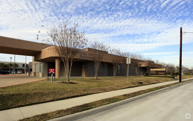
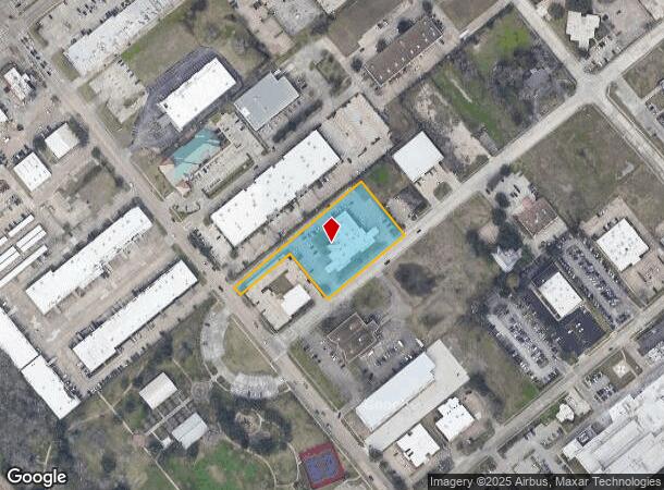
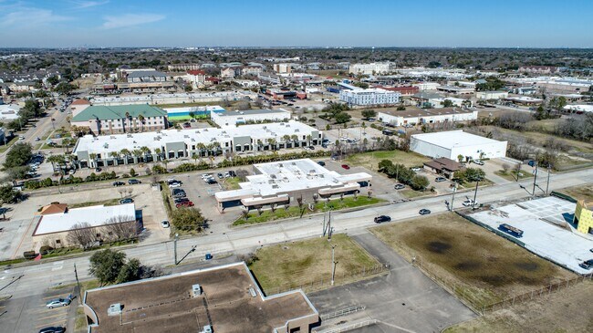
530 Orchard St, Webster, TX 77598
NEARBY LISTINGS FOR SALE OR LEASE
Property Detail
530 Orchard St
1223080010001
Trophy Park R/P
Medicalbuilding
RES 3A BLK 1 TROPHY PARK R/P
X
Harris
48167C0017G
Texas
2024
1.69 AC
2025
NASA/Clear Lake
341101
Houston
13,830 SF
Houston-The Woodlands-Sugar Land, TX
DEMOGRAPHICS near 530 Orchard St
1 Mile
3 Mile
5 Mile
2024 Total Population
7,548
79,754
193,193
2029 Population
7,737
81,243
198,034
Pop Growth 2024-2029
+ 2.50%
+ 1.87%
+ 2.51%
Average Age
37
38
39
2024 Total Households
3,353
33,423
74,879
HH Growth 2024-2029
+ 2.45%
+ 1.84%
+ 2.56%
Median Household Inc
$66,069
$66,707
$89,013
Avg Household Size
2.20
2.30
2.50
2024 Avg HH Vehicles
2.00
2.00
2.00
Median Home Value
$199,999
$239,132
$278,532
Median Year Built
1990
1983
1988
Nearby Places
Map Layers
Map Styles
 Street
 Aerial
- Restaurants
- Banks
- Shops
- Fitness
- Groceries
PUBLIC TRANSPORTATION
AIRPORT
William P Hobby
DRIVE
WALK
Distance
William P Hobby
24 min
12.8 mi
Freight Ports
Port of Houston
DRIVE
WALK
Distance
Port of Houston
29 min
19.3 mi
SALE & LEASE HISTORY
LISTING DATE
SALE/LEASE

Feb 13, 2024
For Sale
Nearby Properties
Address
Land Use
TOTAL SIZE
Lot Size
Zoning
Address
Land Use
TOTAL SIZE
Lot Size
Zoning
481,152 SF
22.69 AC
Address
Land Use
TOTAL SIZE
Lot Size
Zoning
544,605 SF
27.49 AC
Address
Land Use
TOTAL SIZE
Lot Size
Zoning
538,570 SF
16.15 AC
Address
Land Use
TOTAL SIZE
Lot Size
Zoning
645,535 SF
4.40 AC
Address
Land Use
TOTAL SIZE
Lot Size
Zoning
417,465 SF
61.39 AC
Address
Land Use
TOTAL SIZE
Lot Size
Zoning
585,632 SF
7.24 AC
Address
Land Use
TOTAL SIZE
Lot Size
Zoning
614,377 SF
26.06 AC
Address
Land Use
TOTAL SIZE
Lot Size
Zoning
363,876 SF
11.74 AC
Address
Land Use
TOTAL SIZE
Lot Size
Zoning
541,172 SF
25.61 AC
Address
Land Use
TOTAL SIZE
Lot Size
Zoning
218,198 SF
7.27 AC
Address
Land Use
TOTAL SIZE
Lot Size
Zoning
452,269 SF
29.63 AC
Address
Land Use
TOTAL SIZE
Lot Size
Zoning
323,638 SF
25.17 AC
Address
Land Use
TOTAL SIZE
Lot Size
Zoning
530,696 SF
8.57 AC
Address
Land Use
TOTAL SIZE
Lot Size
Zoning
345,470 SF
9.06 AC
Address
Land Use
TOTAL SIZE
Lot Size
Zoning
282,860 SF
8.67 AC
Address
Land Use
TOTAL SIZE
Lot Size
Zoning
366,202 SF
32.55 AC
Address
Land Use
TOTAL SIZE
Lot Size
Zoning
485,863 SF
4.81 AC
Address
Land Use
TOTAL SIZE
Lot Size
Zoning
312,331 SF
16.10 AC
Address
Land Use
TOTAL SIZE
Lot Size
Zoning
185,172 SF
4.15 AC
Address
Land Use
TOTAL SIZE
Lot Size
Zoning
437,909 SF
27.06 AC
Address
Land Use
TOTAL SIZE
Lot Size
Zoning
166,816 SF
18.55 AC
Address
Land Use
TOTAL SIZE
Lot Size
Zoning
298,296 SF
13.31 AC
Address
Land Use
TOTAL SIZE
Lot Size
Zoning
338,667 SF
9.13 AC
Address
Land Use
TOTAL SIZE
Lot Size
Zoning
372,831 SF
20 AC
Address
Land Use
TOTAL SIZE
Lot Size
Zoning
441,889 SF
17.88 AC
Address
Land Use
TOTAL SIZE
Lot Size
Zoning
335,315 SF
20 AC
Address
Land Use
TOTAL SIZE
Lot Size
Zoning
879,410 SF
93.36 AC
Address
Land Use
TOTAL SIZE
Lot Size
Zoning
364,008 SF
21.78 AC
Address
Land Use
TOTAL SIZE
Lot Size
Zoning
126,874 SF
3.92 AC
Address
Land Use
TOTAL SIZE
Lot Size
Zoning
470,930 SF
16.55 AC
The World's #1 Commercial Real Estate Marketplace
Connect with us
© 2025 CoStar Group
The information above has been obtained from sources believed reliable. While we do not doubt its accuracy we have not verified it and make no guarantee, warranty or representation about it. It is your responsibility to independently confirm its accuracy and completeness. Any projections, opinions, assumptions, or estimates used are for example only and do not represent the current or future performance of the property. The value of this transaction to you depends on tax and other factors which should be evaluated by your tax, financial, and legal advisors. You and your advisors should conduct a careful, independent investigation of the property to determine to your satisfaction the suitability of the property for your needs.