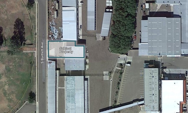
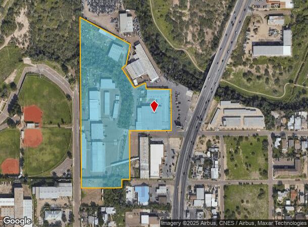
Property Record
530 S Us Highway 83 Hwy, Laredo, TX 78046

NEARBY LISTINGS FOR SALE OR LEASE
Property Detail
530 S Us Highway 83 Hwy
Laredo, TX
Eastern -- Blocks 1251 - 1300
176691
LOT 1A BLK 1292-A ED REPLAT
Commercialnec
Webb
AE
Texas
48479C1380C
1a
2024
10.03 AC
2025
Texas South Area
001822
Other Market Areas
80,704 SF
DEMOGRAPHICS near 530 S Us Highway 83 Hwy
1 Mile
3 Mile
5 Mile
2024 Total Population
13,722
108,445
179,116
2029 Population
13,714
109,254
180,895
Pop Growth 2024-2029
(0.06%)
+ 0.75%
+ 0.99%
Average Age
36
34
34
2024 Total Households
4,089
32,019
52,379
HH Growth 2024-2029
(0.07%)
+ 0.74%
+ 0.97%
Median Household Inc
$38,632
$41,539
$42,338
Avg Household Size
3.20
3.30
3.30
2024 Avg HH Vehicles
2.00
2.00
2.00
Median Home Value
$98,864
$133,929
$131,001
Median Year Built
1981
1990
1990
Nearby Places
Map Layers
Map Styles
 Street
 Aerial
- Restaurants
- Banks
- Shops
- Fitness
- Groceries
PUBLIC TRANSPORTATION
AIRPORT
Laredo International
DRIVE
WALK
Distance
Laredo International
10 min
5.6 mi
Freight Ports
Port of Corpus Christi
DRIVE
WALK
Distance
Port of Corpus Christi
162 min
142.1 mi
SALE & LEASE HISTORY
LISTING DATE
SALE/LEASE

Jul 11, 2023
For Lease
Nearby Properties
Address
Land Use
TOTAL SIZE
Lot Size
Zoning
Address
Land Use
TOTAL SIZE
Lot Size
Zoning
668,900 SF
38.32 AC
B4
Address
Land Use
TOTAL SIZE
Lot Size
Zoning
497,463 SF
1.77 AC
R1
Address
Land Use
TOTAL SIZE
Lot Size
Zoning
423,977 SF
1.27 AC
R2
Address
Land Use
TOTAL SIZE
Lot Size
Zoning
310,346 SF
87.65 AC
R1A
Address
Land Use
TOTAL SIZE
Lot Size
Zoning
347,773 SF
49.74 AC
R1
Address
Land Use
TOTAL SIZE
Lot Size
Zoning
224,926 SF
21.49 AC
R3
Address
Land Use
TOTAL SIZE
Lot Size
Zoning
689,547 SF
2.70 AC
B3
Address
Land Use
TOTAL SIZE
Lot Size
Zoning
165,608 SF
28.50 AC
R2
Address
Land Use
TOTAL SIZE
Lot Size
Zoning
231,146 SF
1.77 AC
R1
Address
Land Use
TOTAL SIZE
Lot Size
Zoning
144,491 SF
3.54 AC
CBD
Address
Land Use
TOTAL SIZE
Lot Size
Zoning
380,420 SF
9.18 AC
B3
Address
Land Use
TOTAL SIZE
Lot Size
Zoning
169,339 SF
28 AC
Address
Land Use
TOTAL SIZE
Lot Size
Zoning
96,991 SF
1.59 AC
CBD
Address
Land Use
TOTAL SIZE
Lot Size
Zoning
127,364 SF
1.60 AC
CBD
Address
Land Use
TOTAL SIZE
Lot Size
Zoning
157,376 SF
25.86 AC
B3
Address
Land Use
TOTAL SIZE
Lot Size
Zoning
137,182 SF
9.67 AC
R1
Address
Land Use
TOTAL SIZE
Lot Size
Zoning
108,994 SF
15.39 AC
Address
Land Use
TOTAL SIZE
Lot Size
Zoning
183,795 SF
10.36 AC
R2
Address
Land Use
TOTAL SIZE
Lot Size
Zoning
25,104 SF
1.42 AC
CBD
Address
Land Use
TOTAL SIZE
Lot Size
Zoning
101,734 SF
1.63 AC
B3
Address
Land Use
TOTAL SIZE
Lot Size
Zoning
66,567 SF
3.81 AC
M1
Address
Land Use
TOTAL SIZE
Lot Size
Zoning
113,687 SF
5.58 AC
R3
Address
Land Use
TOTAL SIZE
Lot Size
Zoning
93,414 SF
8.57 AC
R1
Address
Land Use
TOTAL SIZE
Lot Size
Zoning
107,824 SF
13.38 AC
R1
Address
Land Use
TOTAL SIZE
Lot Size
Zoning
96,665 SF
12.03 AC
R1A
Address
Land Use
TOTAL SIZE
Lot Size
Zoning
102,815 SF
2.23 AC
Address
Land Use
TOTAL SIZE
Lot Size
Zoning
70,980 SF
1.44 AC
CBD
Address
Land Use
TOTAL SIZE
Lot Size
Zoning
97,580 SF
3.89 AC
B1
Address
Land Use
TOTAL SIZE
Lot Size
Zoning
95,769 SF
10 AC
R1
Address
Land Use
TOTAL SIZE
Lot Size
Zoning
79,764 SF
30 AC
R1
The World's #1 Commercial Real Estate Marketplace
Connect with us
© 2025 CoStar Group
The information above has been obtained from sources believed reliable. While we do not doubt its accuracy we have not verified it and make no guarantee, warranty or representation about it. It is your responsibility to independently confirm its accuracy and completeness. Any projections, opinions, assumptions, or estimates used are for example only and do not represent the current or future performance of the property. The value of this transaction to you depends on tax and other factors which should be evaluated by your tax, financial, and legal advisors. You and your advisors should conduct a careful, independent investigation of the property to determine to your satisfaction the suitability of the property for your needs.