Property Record
530 Street Rd, Bensalem, PA 19020
Current Lease Availabilities
NEARBY LISTINGS FOR SALE OR LEASE
Property Detail
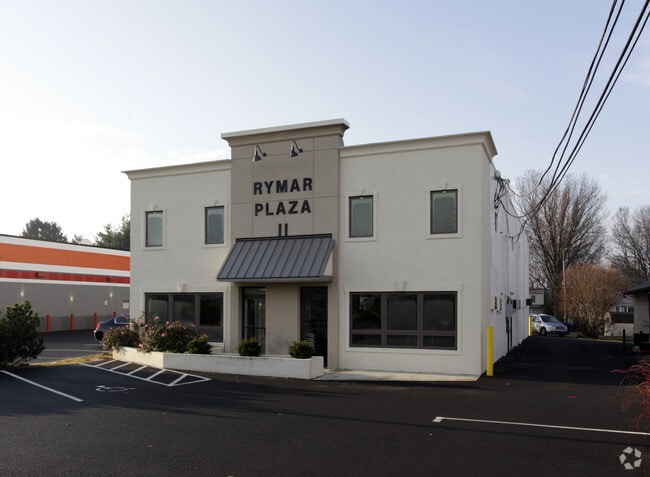
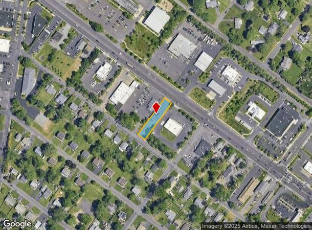
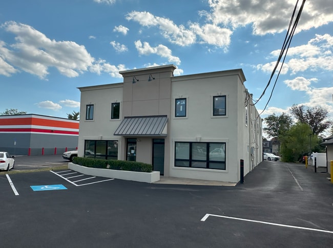
530 Street Rd
Philadelphia-Camden-Wilmington, PA-NJ-DE-MD
Speedway Assn
49-015-285
PHILA MOTOR SPEEDWAY ASSN BLK 24 LOTS #36-37
Officebuilding
Bucks
X
Pennsylvania
42091C0303G
36-37
2024
0.31 AC
2025
Lower Bucks County
100102
Philadelphia
7,200 SF
DEMOGRAPHICS near 530 Street Rd
1 Mile
3 Mile
5 Mile
2024 Total Population
9,315
84,568
175,040
2029 Population
9,430
85,560
176,874
Pop Growth 2024-2029
+ 1.23%
+ 1.17%
+ 1.05%
Average Age
41
44
43
2024 Total Households
3,547
34,192
67,158
HH Growth 2024-2029
+ 1.61%
+ 1.26%
+ 1.16%
Median Household Inc
$95,622
$88,519
$100,727
Avg Household Size
2.60
2.40
2.50
2024 Avg HH Vehicles
2.00
2.00
2.00
Median Home Value
$323,990
$354,109
$383,969
Median Year Built
1969
1970
1972
Nearby Places
Map Layers
Map Styles
 Street
 Aerial
- Restaurants
- Banks
- Shops
- Fitness
- Groceries
PUBLIC TRANSPORTATION
COMMUTER RAIL
Warminster (R2 - Southeastern Pennsylvania Transportation Authority Regional Rail (SEPTA Regional Rail))
DRIVE
WALK
Distance
Warminster (R2 - Southeastern Pennsylvania Transportation Authority Regional Rail (SEPTA Regional Rail))
2 min
1.0 mi
Hatboro (R2 - Southeastern Pennsylvania Transportation Authority Regional Rail (SEPTA Regional Rail))
DRIVE
WALK
Distance
Hatboro (R2 - Southeastern Pennsylvania Transportation Authority Regional Rail (SEPTA Regional Rail))
6 min
2.7 mi
AIRPORT
Trenton Mercer
DRIVE
WALK
Distance
Trenton Mercer
36 min
20.6 mi
Philadelphia International
DRIVE
WALK
Distance
Philadelphia International
58 min
37.4 mi
Lehigh Valley International
DRIVE
WALK
Distance
Lehigh Valley International
71 min
41.7 mi
Freight Ports
Port of Philadelphia
DRIVE
WALK
Distance
Port of Philadelphia
37 min
19.9 mi
Nearby Properties
Address
Land Use
TOTAL SIZE
Lot Size
Zoning
Address
Land Use
TOTAL SIZE
Lot Size
Zoning
1,006.32 AC
I1
Address
Land Use
TOTAL SIZE
Lot Size
Zoning
377,044 SF
58.73 AC
INST
Address
Land Use
TOTAL SIZE
Lot Size
Zoning
571,213 SF
67.31 AC
M
Address
Land Use
TOTAL SIZE
Lot Size
Zoning
251,655 SF
48.95 AC
SC
Address
Land Use
TOTAL SIZE
Lot Size
Zoning
256,679 SF
14 AC
MI
Address
Land Use
TOTAL SIZE
Lot Size
Zoning
420,736 SF
29.47 AC
LI
Address
Land Use
TOTAL SIZE
Lot Size
Zoning
344,636 SF
25.02 AC
R7
Address
Land Use
TOTAL SIZE
Lot Size
Zoning
110,198 SF
12.18 AC
R2
Address
Land Use
TOTAL SIZE
Lot Size
Zoning
94,059 SF
19.22 AC
R4
Address
Land Use
TOTAL SIZE
Lot Size
Zoning
195,534 SF
14.23 AC
I1
Address
Land Use
TOTAL SIZE
Lot Size
Zoning
213,350 SF
11.78 AC
R7
Address
Land Use
TOTAL SIZE
Lot Size
Zoning
182,364 SF
21.06 AC
M
Address
Land Use
TOTAL SIZE
Lot Size
Zoning
160,798 SF
37.55 AC
R4
Address
Land Use
TOTAL SIZE
Lot Size
Zoning
141,532 SF
21.43 AC
R6
Address
Land Use
TOTAL SIZE
Lot Size
Zoning
148,942 SF
34.95 AC
R4
Address
Land Use
TOTAL SIZE
Lot Size
Zoning
240,682 SF
4.81 AC
HI
Address
Land Use
TOTAL SIZE
Lot Size
Zoning
220,338 SF
16.76 AC
M
Address
Land Use
TOTAL SIZE
Lot Size
Zoning
60,945 SF
74.12 AC
Address
Land Use
TOTAL SIZE
Lot Size
Zoning
318,625 SF
19.01 AC
I
Address
Land Use
TOTAL SIZE
Lot Size
Zoning
125,387 SF
4.10 AC
RC2
Address
Land Use
TOTAL SIZE
Lot Size
Zoning
71,680 SF
8.12 AC
C1
Address
Land Use
TOTAL SIZE
Lot Size
Zoning
106,412 SF
13.52 AC
M
Address
Land Use
TOTAL SIZE
Lot Size
Zoning
162,363 SF
2.72 AC
HI
Address
Land Use
TOTAL SIZE
Lot Size
Zoning
91,446 SF
2.53 AC
R7
Address
Land Use
TOTAL SIZE
Lot Size
Zoning
269,481 SF
23.79 AC
SC1
Address
Land Use
TOTAL SIZE
Lot Size
Zoning
82,184 SF
3.85 AC
GC2
Address
Land Use
TOTAL SIZE
Lot Size
Zoning
257,048 SF
36.13 AC
C
Address
Land Use
TOTAL SIZE
Lot Size
Zoning
179,852 SF
4.04 AC
GC2
Address
Land Use
TOTAL SIZE
Lot Size
Zoning
54,976 SF
7 AC
SC1
Address
Land Use
TOTAL SIZE
Lot Size
Zoning
34,588 SF
4 AC
C2
The World's #1 Commercial Real Estate Marketplace
Connect with us
© 2025 CoStar Group
The information above has been obtained from sources believed reliable. While we do not doubt its accuracy we have not verified it and make no guarantee, warranty or representation about it. It is your responsibility to independently confirm its accuracy and completeness. Any projections, opinions, assumptions, or estimates used are for example only and do not represent the current or future performance of the property. The value of this transaction to you depends on tax and other factors which should be evaluated by your tax, financial, and legal advisors. You and your advisors should conduct a careful, independent investigation of the property to determine to your satisfaction the suitability of the property for your needs.