Property Record
5300 Access Undetermined Blvd, Lehigh Acres, FL 33971

NEARBY LISTINGS FOR SALE OR LEASE
Property Detail
5300 Access Undetermined Blvd
Cape Coral-Fort Myers, FL
Lee Blvd Corridor
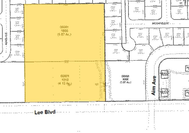
29-44-26-00-00001.1000
BEG SE COR TR A THE N 300 FT E 589 FT S 300 FT W 589 FT TO POB
Commercialacreage
Lee
X
Florida
12071C0475F
5.89 AC
2024
Lehigh
2025
Southwest Florida
040127
DEMOGRAPHICS near 5300 Access Undetermined Blvd
1 Mile
3 Mile
5 Mile
2024 Total Population
6,889
41,569
101,334
2029 Population
8,050
48,824
120,404
Pop Growth 2024-2029
+ 16.85%
+ 17.45%
+ 18.82%
Average Age
34
36
40
2024 Total Households
2,075
13,391
35,643
HH Growth 2024-2029
+ 16.43%
+ 17.09%
+ 18.88%
Median Household Inc
$67,407
$66,370
$69,404
Avg Household Size
3.20
3.00
2.70
2024 Avg HH Vehicles
2.00
2.00
2.00
Median Home Value
$231,625
$263,905
$275,691
Median Year Built
2003
2004
2005
Nearby Places
Map Layers
Map Styles
 Street
 Aerial
- Restaurants
- Banks
- Shops
- Fitness
- Groceries
PUBLIC TRANSPORTATION
AIRPORT
Southwest Florida International
DRIVE
WALK
Distance
Southwest Florida International
16 min
8.5 mi
Punta Gorda
DRIVE
WALK
Distance
Punta Gorda
37 min
29.4 mi
Freight Ports
Port Manatee
DRIVE
WALK
Distance
Port Manatee
117 min
101.1 mi
SALE & LEASE HISTORY
LISTING DATE
SALE/LEASE

Sep 24, 2016
For Sale
Mar 29, 2017
For Sale
Nearby Properties
Address
Land Use
TOTAL SIZE
Lot Size
Zoning
Address
Land Use
TOTAL SIZE
Lot Size
Zoning
24.69 AC
C-1
Address
Land Use
TOTAL SIZE
Lot Size
Zoning
519,706 SF
95.18 AC
RS-1
Address
Land Use
TOTAL SIZE
Lot Size
Zoning
111.70 AC
C1
Address
Land Use
TOTAL SIZE
Lot Size
Zoning
17.50 AC
C1
Address
Land Use
TOTAL SIZE
Lot Size
Zoning
320,566 SF
500.70 AC
AG-2
Address
Land Use
TOTAL SIZE
Lot Size
Zoning
333,614 SF
294.30 AC
AG-2
Address
Land Use
TOTAL SIZE
Lot Size
Zoning
173,791 SF
119.05 AC
AG-2
Address
Land Use
TOTAL SIZE
Lot Size
Zoning
135,503 SF
15.29 AC
AG-2
Address
Land Use
TOTAL SIZE
Lot Size
Zoning
68.11 AC
PUD
Address
Land Use
TOTAL SIZE
Lot Size
Zoning
75,477 SF
13.12 AC
SDA
Address
Land Use
TOTAL SIZE
Lot Size
Zoning
85,812 SF
15.76 AC
PUD
Address
Land Use
TOTAL SIZE
Lot Size
Zoning
95,220 SF
3.23 AC
SDA
Address
Land Use
TOTAL SIZE
Lot Size
Zoning
2.10 AC
C1
Address
Land Use
TOTAL SIZE
Lot Size
Zoning
142,693 SF
5.97 AC
C-2
Address
Land Use
TOTAL SIZE
Lot Size
Zoning
43,676 SF
10.48 AC
CF-2
Address
Land Use
TOTAL SIZE
Lot Size
Zoning
35,579 SF
8.06 AC
SDA
Address
Land Use
TOTAL SIZE
Lot Size
Zoning
108,797 SF
7.39 AC
IL
Address
Land Use
TOTAL SIZE
Lot Size
Zoning
35,974 SF
3.16 AC
IL
Address
Land Use
TOTAL SIZE
Lot Size
Zoning
70,622 SF
2.17 AC
CPD
Address
Land Use
TOTAL SIZE
Lot Size
Zoning
76,999 SF
34.31 AC
C-2
Address
Land Use
TOTAL SIZE
Lot Size
Zoning
11.76 AC
SDA
Address
Land Use
TOTAL SIZE
Lot Size
Zoning
6,710 SF
1.24 AC
SDA
Address
Land Use
TOTAL SIZE
Lot Size
Zoning
35,087 SF
3.34 AC
MU
Address
Land Use
TOTAL SIZE
Lot Size
Zoning
13,953 SF
2.43 AC
MU
Address
Land Use
TOTAL SIZE
Lot Size
Zoning
22,254 SF
2.35 AC
IL
Address
Land Use
TOTAL SIZE
Lot Size
Zoning
19,085 SF
7.30 AC
PUD
Address
Land Use
TOTAL SIZE
Lot Size
Zoning
27,521 SF
3.26 AC
CPD
Address
Land Use
TOTAL SIZE
Lot Size
Zoning
20,220 SF
9.67 AC
CF
Address
Land Use
TOTAL SIZE
Lot Size
Zoning
10,044 SF
1.60 AC
CPD
Address
Land Use
TOTAL SIZE
Lot Size
Zoning
7,060 SF
1.31 AC
CI
The World's #1 Commercial Real Estate Marketplace
Connect with us
© 2025 CoStar Group
The information above has been obtained from sources believed reliable. While we do not doubt its accuracy we have not verified it and make no guarantee, warranty or representation about it. It is your responsibility to independently confirm its accuracy and completeness. Any projections, opinions, assumptions, or estimates used are for example only and do not represent the current or future performance of the property. The value of this transaction to you depends on tax and other factors which should be evaluated by your tax, financial, and legal advisors. You and your advisors should conduct a careful, independent investigation of the property to determine to your satisfaction the suitability of the property for your needs.