Property Record
5300 Bristol St, Duluth, MN 55807
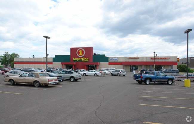

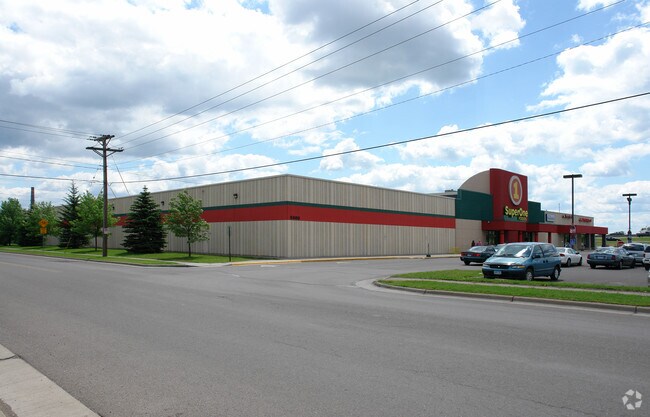
Property Detail
5300 Bristol St
Duluth, MN-WI
ALL OF LOTS 1 THRU 12 & PART OF LOTS 13 THRU16 BLOCK 16 LYING NLY OF A LINE BEG AT SWCOR OF LOT 16 BLK 17; THENCE RUNNING ELYALONG S LINE OF LOT 16 FOR 60 FT; THENCENELY TO SW COR OF LOT 12 BLK 200 ALTEREDPLAT OF WEST DULUTH 3RD DIV INC PART OF VAC S
010447002360
Saint Louis
Commercialnec
Minnesota
B and X Area of moderate flood hazard, usually the area between the limits of the 100-year and 500-year floods.
1-16
2026
1.31 AC
2024
West End
015800
Duluth
66,848 SF
NEARBY LISTINGS FOR SALE OR LEASE
DEMOGRAPHICS near 5300 Bristol St
1 mile
3 mile
5 mile
2025 Total Population
5,727
24,230
59,633
2030 Population
5,564
23,676
58,840
Pop Growth 2025-2030
(2.85%)
(2.29%)
(1.33%)
Average Age
41
41
41
2025 Total Households
2,574
10,612
26,643
HH Growth 2025-2030
(2.84%)
(2.35%)
(1.38%)
Median Household Inc
$61,573
$62,650
$57,075
Avg Household Size
2.10
2.20
2.10
2025 Avg HH Vehicles
2.00
2.00
2.00
Median Home Value
$175,447
$190,781
$215,354
Median Year Built
1946
1948
1953
Nearby Places
Map Layers
Map Styles
 Street
 Aerial
Layers
 Traffic
 Biking
Places
Listings with unknown addresses are not visible on the map
- Restaurants
- Banks
- Shops
- Fitness
- Groceries
PUBLIC TRANSPORTATION
AIRPORT
Duluth International
Drive
Walk
Distance
Duluth International
23 min
10.5 mi
Freight Ports
Port Milwaukee
Drive
Walk
Distance
Port Milwaukee
453 min
400.2 mi
Nearby Properties
Address
Land Use
TOTAL SIZE
Lot Size
Zoning
Address
Land Use
TOTAL SIZE
Lot Size
Zoning
328,704 SF
3.81 AC
Address
Land Use
TOTAL SIZE
Lot Size
Zoning
391,335 SF
53.53 AC
Address
Land Use
TOTAL SIZE
Lot Size
Zoning
175 AC
W1
Address
Land Use
TOTAL SIZE
Lot Size
Zoning
93,584 SF
0.66 AC
Address
Land Use
TOTAL SIZE
Lot Size
Zoning
87,768 SF
2.42 AC
Address
Land Use
TOTAL SIZE
Lot Size
Zoning
107,796 SF
9.19 AC
Address
Land Use
TOTAL SIZE
Lot Size
Zoning
68,296 SF
0.38 AC
Address
Land Use
TOTAL SIZE
Lot Size
Zoning
1,200 SF
10.74 AC
Address
Land Use
TOTAL SIZE
Lot Size
Zoning
71,967 SF
0.16 AC
Address
Land Use
TOTAL SIZE
Lot Size
Zoning
52.06 AC
M2
Address
Land Use
TOTAL SIZE
Lot Size
Zoning
24,389 SF
1.68 AC
Address
Land Use
TOTAL SIZE
Lot Size
Zoning
557,127 SF
37 AC
Address
Land Use
TOTAL SIZE
Lot Size
Zoning
185,313 SF
Address
Land Use
TOTAL SIZE
Lot Size
Zoning
73,973 SF
2.84 AC
Address
Land Use
TOTAL SIZE
Lot Size
Zoning
96,000 SF
1.35 AC
Address
Land Use
TOTAL SIZE
Lot Size
Zoning
169,373 SF
6.54 AC
Address
Land Use
TOTAL SIZE
Lot Size
Zoning
6.01 AC
M2
Address
Land Use
TOTAL SIZE
Lot Size
Zoning
17,638 SF
5.37 AC
Address
Land Use
TOTAL SIZE
Lot Size
Zoning
20.01 AC
Address
Land Use
TOTAL SIZE
Lot Size
Zoning
24,555 SF
1.14 AC
Address
Land Use
TOTAL SIZE
Lot Size
Zoning
71,291 SF
0.61 AC
TND
Address
Land Use
TOTAL SIZE
Lot Size
Zoning
42,000 SF
0.32 AC
Address
Land Use
TOTAL SIZE
Lot Size
Zoning
3.42 AC
R3
Address
Land Use
TOTAL SIZE
Lot Size
Zoning
7.05 AC
M2
Address
Land Use
TOTAL SIZE
Lot Size
Zoning
50,096 SF
5.99 AC
Address
Land Use
TOTAL SIZE
Lot Size
Zoning
4.47 AC
Address
Land Use
TOTAL SIZE
Lot Size
Zoning
28.37 AC
W1
Address
Land Use
TOTAL SIZE
Lot Size
Zoning
1.41 AC
C4
Address
Land Use
TOTAL SIZE
Lot Size
Zoning
83,290 SF
0.58 AC
C2
The World's #1 Commercial Real Estate Marketplace
Connect with us
© 2026 CoStar Group
The information above has been obtained from sources believed reliable. While we do not doubt its accuracy we have not verified it and make no guarantee, warranty or representation about it. It is your responsibility to independently confirm its accuracy and completeness. Any projections, opinions, assumptions, or estimates used are for example only and do not represent the current or future performance of the property. The value of this transaction to you depends on tax and other factors which should be evaluated by your tax, financial, and legal advisors. You and your advisors should conduct a careful, independent investigation of the property to determine to your satisfaction the suitability of the property for your needs.