Property Record
5300 Doniphan Dr, El Paso, TX 79932


NEARBY LISTINGS FOR SALE OR LEASE
Property Detail
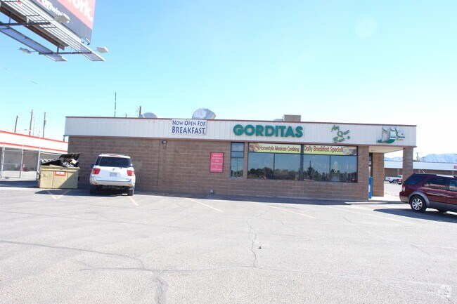
5300 Doniphan Dr
El Paso, TX
S J Larkin Surv 267
X267-999-S00D-0100
S A & M G RR SURV 267 ABST 179 48 (1.7269 AC) & 49 (1.744 AC) & 50-A (0.2001 AC) & 50-C (1.0367 AC) & 72-B (2.8035 AC) (7.5112 AC)
Commercialnec
El Paso
2024
Texas
2025
7.51 AC
001204
West
75,574 SF
El Paso
DEMOGRAPHICS near 5300 Doniphan Dr
1 Mile
3 Mile
5 Mile
2024 Total Population
9,970
84,510
150,121
2029 Population
10,023
85,684
152,867
Pop Growth 2024-2029
+ 0.53%
+ 1.39%
+ 1.83%
Average Age
39
38
37
2024 Total Households
3,689
29,866
53,885
HH Growth 2024-2029
+ 0.52%
+ 1.36%
+ 1.72%
Median Household Inc
$46,231
$72,942
$68,585
Avg Household Size
2.70
2.80
2.70
2024 Avg HH Vehicles
2.00
2.00
2.00
Median Home Value
$177,359
$207,114
$220,315
Median Year Built
1982
1991
1991
Nearby Places
Map Layers
Map Styles
 Street
 Aerial
- Restaurants
- Banks
- Shops
- Fitness
- Groceries
PUBLIC TRANSPORTATION
AIRPORT
El Paso International
DRIVE
WALK
Distance
El Paso International
37 min
23.6 mi
Freight Ports
Port of Corpus Christi
DRIVE
WALK
Distance
Port of Corpus Christi
694 min
704.5 mi
Nearby Properties
Address
Land Use
TOTAL SIZE
Lot Size
Zoning
Address
Land Use
TOTAL SIZE
Lot Size
Zoning
127,552 SF
14.24 AC
C4
Address
Land Use
TOTAL SIZE
Lot Size
Zoning
545,506 SF
50.94 AC
M1
Address
Land Use
TOTAL SIZE
Lot Size
Zoning
236,134 SF
14.49 AC
C1
Address
Land Use
TOTAL SIZE
Lot Size
Zoning
248,997 SF
14.85 AC
C3S
Address
Land Use
TOTAL SIZE
Lot Size
Zoning
234,339 SF
10.03 AC
C3C
Address
Land Use
TOTAL SIZE
Lot Size
Zoning
199,384 SF
17.91 AC
C4
Address
Land Use
TOTAL SIZE
Lot Size
Zoning
243,741 SF
22.80 AC
R3
Address
Land Use
TOTAL SIZE
Lot Size
Zoning
246,802 SF
11.08 AC
C3
Address
Land Use
TOTAL SIZE
Lot Size
Zoning
220,159 SF
29.02 AC
C4
Address
Land Use
TOTAL SIZE
Lot Size
Zoning
160,509 SF
8.85 AC
A2
Address
Land Use
TOTAL SIZE
Lot Size
Zoning
103,525 SF
7 AC
M1
Address
Land Use
TOTAL SIZE
Lot Size
Zoning
201,291 SF
43.23 AC
R3
Address
Land Use
TOTAL SIZE
Lot Size
Zoning
115,155 SF
4.63 AC
C2C
Address
Land Use
TOTAL SIZE
Lot Size
Zoning
46,534 SF
9.81 AC
C4C
Address
Land Use
TOTAL SIZE
Lot Size
Zoning
142,567 SF
5.74 AC
A2S
Address
Land Use
TOTAL SIZE
Lot Size
Zoning
127,595 SF
9.64 AC
C4S
Address
Land Use
TOTAL SIZE
Lot Size
Zoning
159,851 SF
7.19 AC
A2S
Address
Land Use
TOTAL SIZE
Lot Size
Zoning
65,601 SF
15.64 AC
R2A
Address
Land Use
TOTAL SIZE
Lot Size
Zoning
119,191 SF
9.05 AC
C3
Address
Land Use
TOTAL SIZE
Lot Size
Zoning
187,488 SF
9.54 AC
A2
Address
Land Use
TOTAL SIZE
Lot Size
Zoning
640 AC
PMD
Address
Land Use
TOTAL SIZE
Lot Size
Zoning
136,776 SF
16.26 AC
C4S
Address
Land Use
TOTAL SIZE
Lot Size
Zoning
143,731 SF
13.54 AC
C3
Address
Land Use
TOTAL SIZE
Lot Size
Zoning
21,621 SF
167.69 AC
R3
Address
Land Use
TOTAL SIZE
Lot Size
Zoning
102,088 SF
10.09 AC
C3
Address
Land Use
TOTAL SIZE
Lot Size
Zoning
68,759 SF
2.35 AC
C3S
Address
Land Use
TOTAL SIZE
Lot Size
Zoning
66,535 SF
12.14 AC
C3S
Address
Land Use
TOTAL SIZE
Lot Size
Zoning
119,090 SF
11.66 AC
C4
Address
Land Use
TOTAL SIZE
Lot Size
Zoning
239,984 SF
13.50 AC
M1
Address
Land Use
TOTAL SIZE
Lot Size
Zoning
161,000 SF
10.37 AC
C4
The World's #1 Commercial Real Estate Marketplace
Connect with us
© 2026 CoStar Group
The information above has been obtained from sources believed reliable. While we do not doubt its accuracy we have not verified it and make no guarantee, warranty or representation about it. It is your responsibility to independently confirm its accuracy and completeness. Any projections, opinions, assumptions, or estimates used are for example only and do not represent the current or future performance of the property. The value of this transaction to you depends on tax and other factors which should be evaluated by your tax, financial, and legal advisors. You and your advisors should conduct a careful, independent investigation of the property to determine to your satisfaction the suitability of the property for your needs.