Property Record
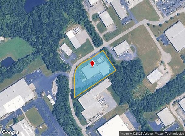
5300 Foundation Blvd, New Albany, IN 47150

NEARBY LISTINGS FOR SALE OR LEASE
Property Detail
5300 Foundation Blvd
22-05-10-600-539.000-008
Grantline Indust Park
Manufacturinglight
PRT. 106 ILL. GNT. 2.417A. TIF AREA 5300 FOUNDATION BLVD MP 05-10-6B0-210.003
X
Floyd
18019C0256E
Indiana
2024
2.42 AC
2024
Outlying Floyd County
071007
Louisville
30,056 SF
Louisville-Jefferson County, KY-IN
DEMOGRAPHICS near 5300 Foundation Blvd
1 Mile
3 Mile
5 Mile
2024 Total Population
3,272
27,176
80,645
2029 Population
3,297
27,803
83,213
Pop Growth 2024-2029
+ 0.76%
+ 2.31%
+ 3.18%
Average Age
42
41
41
2024 Total Households
1,278
10,468
32,689
HH Growth 2024-2029
+ 0.70%
+ 2.27%
+ 3.18%
Median Household Inc
$80,946
$78,614
$61,797
Avg Household Size
2.50
2.50
2.40
2024 Avg HH Vehicles
2.00
2.00
2.00
Median Home Value
$235,994
$232,357
$183,745
Median Year Built
1994
1992
1978
Nearby Places
Map Layers
Map Styles
 Street
 Aerial
- Restaurants
- Banks
- Shops
- Fitness
- Groceries
PUBLIC TRANSPORTATION
AIRPORT
Louisville Muhammad Ali International
DRIVE
WALK
Distance
Louisville Muhammad Ali International
33 min
20.0 mi
Nearby Properties
Address
Land Use
TOTAL SIZE
Lot Size
Zoning
Address
Land Use
TOTAL SIZE
Lot Size
Zoning
27,360 SF
10.17 AC
Address
Land Use
TOTAL SIZE
Lot Size
Zoning
21,540 SF
9.35 AC
Address
Land Use
TOTAL SIZE
Lot Size
Zoning
84,873 SF
15.71 AC
Address
Land Use
TOTAL SIZE
Lot Size
Zoning
11,695 SF
18.33 AC
Address
Land Use
TOTAL SIZE
Lot Size
Zoning
4,512 SF
17.76 AC
Address
Land Use
TOTAL SIZE
Lot Size
Zoning
1.84 AC
Address
Land Use
TOTAL SIZE
Lot Size
Zoning
270,377 SF
17.54 AC
Address
Land Use
TOTAL SIZE
Lot Size
Zoning
204,750 SF
26.96 AC
Address
Land Use
TOTAL SIZE
Lot Size
Zoning
58,884 SF
7.92 AC
Address
Land Use
TOTAL SIZE
Lot Size
Zoning
81,000 SF
44.74 AC
Address
Land Use
TOTAL SIZE
Lot Size
Zoning
2,300 SF
15.14 AC
Address
Land Use
TOTAL SIZE
Lot Size
Zoning
27,039 SF
3.35 AC
Address
Land Use
TOTAL SIZE
Lot Size
Zoning
67,471 SF
7 AC
Address
Land Use
TOTAL SIZE
Lot Size
Zoning
80,812 SF
10.05 AC
Address
Land Use
TOTAL SIZE
Lot Size
Zoning
169 SF
35.25 AC
Address
Land Use
TOTAL SIZE
Lot Size
Zoning
3,760 SF
3.05 AC
Address
Land Use
TOTAL SIZE
Lot Size
Zoning
44,144 SF
6.26 AC
Address
Land Use
TOTAL SIZE
Lot Size
Zoning
17,572 SF
9.25 AC
Address
Land Use
TOTAL SIZE
Lot Size
Zoning
27,132 SF
4.27 AC
Address
Land Use
TOTAL SIZE
Lot Size
Zoning
56,496 SF
7.28 AC
Address
Land Use
TOTAL SIZE
Lot Size
Zoning
31,646 SF
5.63 AC
Address
Land Use
TOTAL SIZE
Lot Size
Zoning
21.12 AC
Address
Land Use
TOTAL SIZE
Lot Size
Zoning
3,360 SF
9.40 AC
Address
Land Use
TOTAL SIZE
Lot Size
Zoning
19,426 SF
3.97 AC
Address
Land Use
TOTAL SIZE
Lot Size
Zoning
13,712 SF
2 AC
Address
Land Use
TOTAL SIZE
Lot Size
Zoning
200,208 SF
10.66 AC
Address
Land Use
TOTAL SIZE
Lot Size
Zoning
101,806 SF
8.60 AC
Address
Land Use
TOTAL SIZE
Lot Size
Zoning
23,508 SF
1.99 AC
Address
Land Use
TOTAL SIZE
Lot Size
Zoning
42,344 SF
6.77 AC
Address
Land Use
TOTAL SIZE
Lot Size
Zoning
23,508 SF
2.05 AC
The World's #1 Commercial Real Estate Marketplace
Connect with us
© 2025 CoStar Group
The information above has been obtained from sources believed reliable. While we do not doubt its accuracy we have not verified it and make no guarantee, warranty or representation about it. It is your responsibility to independently confirm its accuracy and completeness. Any projections, opinions, assumptions, or estimates used are for example only and do not represent the current or future performance of the property. The value of this transaction to you depends on tax and other factors which should be evaluated by your tax, financial, and legal advisors. You and your advisors should conduct a careful, independent investigation of the property to determine to your satisfaction the suitability of the property for your needs.