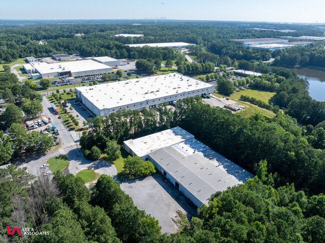
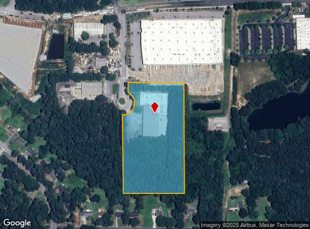
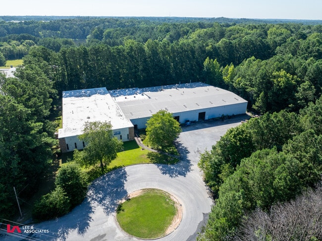
Property Record
400 Port Blvd S, Atlanta, GA 30349
This Property Is For Sale
NEARBY LISTINGS FOR SALE OR LEASE
Property Detail
400 Port Blvd S
09F-2508-0128-006-2
Viking Incorporated
Warehouse
Fulton
X
Georgia
13121C0457F
6.16 AC
2024
Airport/North Clayton
2025
Atlanta
010529
Atlanta-Sandy Springs-Roswell, GA
42,380 SF
DEMOGRAPHICS near 400 Port Blvd S
1 Mile
3 Mile
5 Mile
2024 Total Population
5,345
54,812
148,873
2029 Population
5,571
56,960
153,545
Pop Growth 2024-2029
+ 4.23%
+ 3.92%
+ 3.14%
Average Age
38
36
37
2024 Total Households
1,918
20,724
56,463
HH Growth 2024-2029
+ 4.38%
+ 4.03%
+ 3.13%
Median Household Inc
$59,610
$56,236
$57,971
Avg Household Size
2.70
2.60
2.60
2024 Avg HH Vehicles
2.00
2.00
2.00
Median Home Value
$160,773
$172,879
$196,278
Median Year Built
2003
1989
1993
Nearby Places
- Restaurants
- Banks
- Shops
- Fitness
- Groceries
PUBLIC TRANSPORTATION
AIRPORT
Hartsfield - Jackson Atlanta International
DRIVE
WALK
Distance
Hartsfield - Jackson Atlanta International
17 min
8.6 mi
Freight Ports
Georgia Ports - Savannah
DRIVE
WALK
Distance
Georgia Ports - Savannah
279 min
245.9 mi
Nearby Properties
Address
Land Use
TOTAL SIZE
Lot Size
Zoning
Address
Land Use
TOTAL SIZE
Lot Size
Zoning
929,571 SF
65.66 AC
M1
Address
Land Use
TOTAL SIZE
Lot Size
Zoning
2,329,350 SF
32.55 AC
A
Address
Land Use
TOTAL SIZE
Lot Size
Zoning
11.10 AC
SUBC
Address
Land Use
TOTAL SIZE
Lot Size
Zoning
992,870 SF
59.71 AC
M1
Address
Land Use
TOTAL SIZE
Lot Size
Zoning
1,020,000 SF
59.94 AC
Address
Land Use
TOTAL SIZE
Lot Size
Zoning
1,026,040 SF
72.52 AC
M1
Address
Land Use
TOTAL SIZE
Lot Size
Zoning
948,900 SF
16.24 AC
RM
Address
Land Use
TOTAL SIZE
Lot Size
Zoning
4,381,104 SF
26.70 AC
AG1
Address
Land Use
TOTAL SIZE
Lot Size
Zoning
78.33 AC
Address
Land Use
TOTAL SIZE
Lot Size
Zoning
920,396 SF
62.40 AC
R3
Address
Land Use
TOTAL SIZE
Lot Size
Zoning
997,011 SF
68.07 AC
M1
Address
Land Use
TOTAL SIZE
Lot Size
Zoning
663,520 SF
62.96 AC
C1
Address
Land Use
TOTAL SIZE
Lot Size
Zoning
85,347 SF
49.56 AC
AG1
Address
Land Use
TOTAL SIZE
Lot Size
Zoning
17,174,332 SF
39.44 AC
R3
Address
Land Use
TOTAL SIZE
Lot Size
Zoning
855,399 SF
41.79 AC
C2
Address
Land Use
TOTAL SIZE
Lot Size
Zoning
3,904,656 SF
30.58 AC
RM
Address
Land Use
TOTAL SIZE
Lot Size
Zoning
39.08 AC
SUBC
Address
Land Use
TOTAL SIZE
Lot Size
Zoning
602,694 SF
9.32 AC
C1
Address
Land Use
TOTAL SIZE
Lot Size
Zoning
768,288 SF
40.65 AC
M1
Address
Land Use
TOTAL SIZE
Lot Size
Zoning
619,194 SF
49.22 AC
R3
Address
Land Use
TOTAL SIZE
Lot Size
Zoning
7,229,804 SF
29.30 AC
AC
Address
Land Use
TOTAL SIZE
Lot Size
Zoning
2,563,484 SF
12.54 AC
MF
Address
Land Use
TOTAL SIZE
Lot Size
Zoning
606,450 SF
34.63 AC
M1
Address
Land Use
TOTAL SIZE
Lot Size
Zoning
327,250 SF
23.20 AC
R3
Address
Land Use
TOTAL SIZE
Lot Size
Zoning
358,011 SF
60.44 AC
AG1
Address
Land Use
TOTAL SIZE
Lot Size
Zoning
247,088 SF
20.90 AC
Address
Land Use
TOTAL SIZE
Lot Size
Zoning
773,776 SF
61.42 AC
M1
Address
Land Use
TOTAL SIZE
Lot Size
Zoning
499,800 SF
18.43 AC
AG1
Address
Land Use
TOTAL SIZE
Lot Size
Zoning
669,152 SF
39.13 AC
M1C
Address
Land Use
TOTAL SIZE
Lot Size
Zoning
546,520 SF
31.54 AC
M1C
The World's #1 Commercial Real Estate Marketplace
Connect with us
© 2025 CoStar Group
The information above has been obtained from sources believed reliable. While we do not doubt its accuracy we have not verified it and make no guarantee, warranty or representation about it. It is your responsibility to independently confirm its accuracy and completeness. Any projections, opinions, assumptions, or estimates used are for example only and do not represent the current or future performance of the property. The value of this transaction to you depends on tax and other factors which should be evaluated by your tax, financial, and legal advisors. You and your advisors should conduct a careful, independent investigation of the property to determine to your satisfaction the suitability of the property for your needs.