Property Record
5300 Post Rd, Charlestown, RI 02813
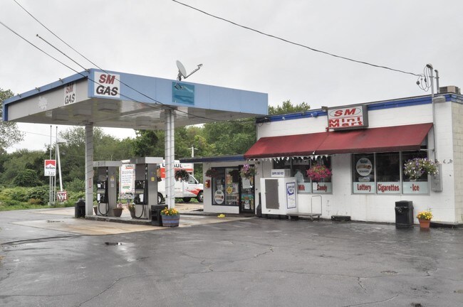

Property Detail
5300 Post Rd
CHAR-000005-000000-000096
Washington
Commercialbuilding
Rhode Island
C3
96
B and X Area of moderate flood hazard, usually the area between the limits of the 100-year and 500-year floods.
0.86 AC
2025
Washington County
2025
Providence
051101
Providence-Warwick, RI-MA
1,120 SF
NEARBY LISTINGS FOR SALE OR LEASE
-
-
View all Charlestown listings for sale on LoopNet.com
DEMOGRAPHICS near 5300 Post Rd
1 mile
3 mile
5 mile
2025 Total Population
550
5,012
14,655
2030 Population
561
5,262
15,085
Pop Growth 2025-2030
+ 2.00%
+ 4.99%
+ 2.93%
Average Age
49
52
49
2025 Total Households
237
2,363
6,531
HH Growth 2025-2030
+ 2.11%
+ 5.33%
+ 3.22%
Median Household Inc
$108,836
$109,020
$110,052
Avg Household Size
2.30
2.10
2.20
2025 Avg HH Vehicles
2.00
2.00
2.00
Median Home Value
$646,789
$722,979
$613,385
Median Year Built
1981
1977
1978
Nearby Places
Map Layers
Map Styles
 Street
 Aerial
Transit
 Traffic
 Biking
Places
Listings with unknown addresses are not visible on the map
- Restaurants
- Banks
- Shops
- Fitness
- Groceries
PUBLIC TRANSPORTATION
AIRPORT
Rhode Island Tf Green International
Drive
Walk
Distance
Rhode Island Tf Green International
54 min
37.5 mi
Freight Ports
Port of Davisville, RI
Drive
Walk
Distance
Port of Davisville, RI
43 min
27.3 mi
SALE & LEASE HISTORY
LISTING DATE
SALE/LEASE

Sep 19, 2017
For Lease
Nov 22, 2016
For Sale
Apr 24, 2019
For Sale
Nearby Properties
Address
Land Use
TOTAL SIZE
Lot Size
Zoning
Address
Land Use
TOTAL SIZE
Lot Size
Zoning
6.54 AC
GI
Address
Land Use
TOTAL SIZE
Lot Size
Zoning
2.78 AC
R2A
Address
Land Use
TOTAL SIZE
Lot Size
Zoning
2.12 AC
R2A
Address
Land Use
TOTAL SIZE
Lot Size
Zoning
643 AC
OSR
Address
Land Use
TOTAL SIZE
Lot Size
Zoning
847 AC
OSR
Address
Land Use
TOTAL SIZE
Lot Size
Zoning
175 AC
M
Address
Land Use
TOTAL SIZE
Lot Size
Zoning
379.71 AC
OSR
Address
Land Use
TOTAL SIZE
Lot Size
Zoning
2,888 SF
4.23 AC
TVD
Address
Land Use
TOTAL SIZE
Lot Size
Zoning
2.31 AC
R2A
Address
Land Use
TOTAL SIZE
Lot Size
Zoning
806 SF
3.49 AC
R2A
Address
Land Use
TOTAL SIZE
Lot Size
Zoning
3.39 AC
RA
Address
Land Use
TOTAL SIZE
Lot Size
Zoning
9,967 SF
9.48 AC
M
Address
Land Use
TOTAL SIZE
Lot Size
Zoning
796 AC
OSR
Address
Land Use
TOTAL SIZE
Lot Size
Zoning
5.14 AC
R3A
Address
Land Use
TOTAL SIZE
Lot Size
Zoning
362.70 AC
NITSL
Address
Land Use
TOTAL SIZE
Lot Size
Zoning
Address
Land Use
TOTAL SIZE
Lot Size
Zoning
2.14 AC
R2A
Address
Land Use
TOTAL SIZE
Lot Size
Zoning
2,711 SF
0.77 AC
R2A
Address
Land Use
TOTAL SIZE
Lot Size
Zoning
3.91 AC
R2A
Address
Land Use
TOTAL SIZE
Lot Size
Zoning
10.02 AC
R3A
Address
Land Use
TOTAL SIZE
Lot Size
Zoning
0.49 AC
R2A
Address
Land Use
TOTAL SIZE
Lot Size
Zoning
2.50 AC
C2
Address
Land Use
TOTAL SIZE
Lot Size
Zoning
1.02 AC
R2A
Address
Land Use
TOTAL SIZE
Lot Size
Zoning
0.68 AC
R2A
Address
Land Use
TOTAL SIZE
Lot Size
Zoning
104.90 AC
R3A
Address
Land Use
TOTAL SIZE
Lot Size
Zoning
77.90 AC
R2A
Address
Land Use
TOTAL SIZE
Lot Size
Zoning
0.41 AC
R2A
Address
Land Use
TOTAL SIZE
Lot Size
Zoning
1,165 SF
3.16 AC
M
Address
Land Use
TOTAL SIZE
Lot Size
Zoning
1.88 AC
R2A
Address
Land Use
TOTAL SIZE
Lot Size
Zoning
225 AC
NITSL
The World's #1 Commercial Real Estate Marketplace
Connect with us
© 2026 CoStar Group
The information above has been obtained from sources believed reliable. While we do not doubt its accuracy we have not verified it and make no guarantee, warranty or representation about it. It is your responsibility to independently confirm its accuracy and completeness. Any projections, opinions, assumptions, or estimates used are for example only and do not represent the current or future performance of the property. The value of this transaction to you depends on tax and other factors which should be evaluated by your tax, financial, and legal advisors. You and your advisors should conduct a careful, independent investigation of the property to determine to your satisfaction the suitability of the property for your needs.