Property Record
5300 Wible Rd, Bakersfield, CA 93313
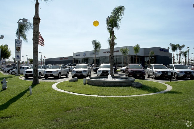


Property Detail
5300 Wible Rd
372-010-39-00-9
PARCEL MAP 7662 , LOT 5
Vehiclerentalsvehiclesales
Kern
M-1
California
B and X Area of moderate flood hazard, usually the area between the limits of the 100-year and 500-year floods.
5
2024
5.10 AC
2025
South Bakersfield
003133
Bakersfield
10,404 SF
Bakersfield-Delano, CA
NEARBY LISTINGS FOR SALE OR LEASE
DEMOGRAPHICS near 5300 Wible Rd
1 mile
3 mile
5 mile
2025 Total Population
15,061
160,958
269,698
2030 Population
15,075
162,465
272,625
Pop Growth 2025-2030
+ 0.09%
+ 0.94%
+ 1.09%
Average Age
35
34
35
2025 Total Households
4,389
46,990
83,236
HH Growth 2025-2030
+ 0.05%
+ 0.87%
+ 1.03%
Median Household Inc
$71,289
$70,176
$70,011
Avg Household Size
3.40
3.30
3.20
2025 Avg HH Vehicles
2.00
2.00
2.00
Median Home Value
$272,603
$323,945
$340,290
Median Year Built
1982
1982
1981
Nearby Places
Map Layers
Map Styles
 Street
 Aerial
Transit
 Traffic
 Biking
Places
Listings with unknown addresses are not visible on the map
- Restaurants
- Banks
- Shops
- Fitness
- Groceries
PUBLIC TRANSPORTATION
COMMUTER RAIL
Bakersfield (San Joaquins - Amtrak)
Drive
Walk
Distance
Bakersfield (San Joaquins - Amtrak)
13 min
7.0 mi
AIRPORT
Meadows Field
Drive
Walk
Distance
Meadows Field
20 min
10.5 mi
Freight Ports
The Port of Hueneme
Drive
Walk
Distance
The Port of Hueneme
148 min
117.6 mi
Nearby Properties
Address
Land Use
TOTAL SIZE
Lot Size
Zoning
Address
Land Use
TOTAL SIZE
Lot Size
Zoning
587,976 SF
40.01 AC
M-2
Address
Land Use
TOTAL SIZE
Lot Size
Zoning
23,615 SF
39.38 AC
C2
Address
Land Use
TOTAL SIZE
Lot Size
Zoning
114,500 SF
12.02 AC
C-2
Address
Land Use
TOTAL SIZE
Lot Size
Zoning
354,000 SF
20 AC
M2
Address
Land Use
TOTAL SIZE
Lot Size
Zoning
185,181 SF
14.67 AC
C2
Address
Land Use
TOTAL SIZE
Lot Size
Zoning
269,429 SF
12.71 AC
R-2
Address
Land Use
TOTAL SIZE
Lot Size
Zoning
17.96 AC
C2
Address
Land Use
TOTAL SIZE
Lot Size
Zoning
218,345 SF
19.54 AC
PCD
Address
Land Use
TOTAL SIZE
Lot Size
Zoning
37,760 SF
12.16 AC
R3
Address
Land Use
TOTAL SIZE
Lot Size
Zoning
62,941 SF
8.79 AC
M-1
Address
Land Use
TOTAL SIZE
Lot Size
Zoning
79,325 SF
7.77 AC
C-2
Address
Land Use
TOTAL SIZE
Lot Size
Zoning
88,988 SF
9.82 AC
C-2
Address
Land Use
TOTAL SIZE
Lot Size
Zoning
11,780 SF
11.25 AC
C1
Address
Land Use
TOTAL SIZE
Lot Size
Zoning
23,600 SF
8.17 AC
C2
Address
Land Use
TOTAL SIZE
Lot Size
Zoning
5,756 SF
9.70 AC
C-2-D
Address
Land Use
TOTAL SIZE
Lot Size
Zoning
147,451 SF
9.55 AC
C2
Address
Land Use
TOTAL SIZE
Lot Size
Zoning
69,414 SF
4.47 AC
M1
Address
Land Use
TOTAL SIZE
Lot Size
Zoning
12,008 SF
7.18 AC
Address
Land Use
TOTAL SIZE
Lot Size
Zoning
123,844 SF
7.49 AC
R-3
Address
Land Use
TOTAL SIZE
Lot Size
Zoning
149,499 SF
13.20 AC
GC
Address
Land Use
TOTAL SIZE
Lot Size
Zoning
30,854 SF
12.17 AC
M1
Address
Land Use
TOTAL SIZE
Lot Size
Zoning
92,469 SF
7.15 AC
R-3
Address
Land Use
TOTAL SIZE
Lot Size
Zoning
41,507 SF
10.37 AC
C2
Address
Land Use
TOTAL SIZE
Lot Size
Zoning
10,073 SF
15.48 AC
PCD
Address
Land Use
TOTAL SIZE
Lot Size
Zoning
161,608 SF
10.70 AC
M2
Address
Land Use
TOTAL SIZE
Lot Size
Zoning
75,800 SF
7.18 AC
C-2
Address
Land Use
TOTAL SIZE
Lot Size
Zoning
1,100 SF
6.28 AC
R-3
Address
Land Use
TOTAL SIZE
Lot Size
Zoning
149,187 SF
7.14 AC
Address
Land Use
TOTAL SIZE
Lot Size
Zoning
154,581 SF
2.11 AC
C-2
Address
Land Use
TOTAL SIZE
Lot Size
Zoning
81,682 SF
12.27 AC
M-2
The World's #1 Commercial Real Estate Marketplace
Connect with us
© 2026 CoStar Group
The information above has been obtained from sources believed reliable. While we do not doubt its accuracy we have not verified it and make no guarantee, warranty or representation about it. It is your responsibility to independently confirm its accuracy and completeness. Any projections, opinions, assumptions, or estimates used are for example only and do not represent the current or future performance of the property. The value of this transaction to you depends on tax and other factors which should be evaluated by your tax, financial, and legal advisors. You and your advisors should conduct a careful, independent investigation of the property to determine to your satisfaction the suitability of the property for your needs.