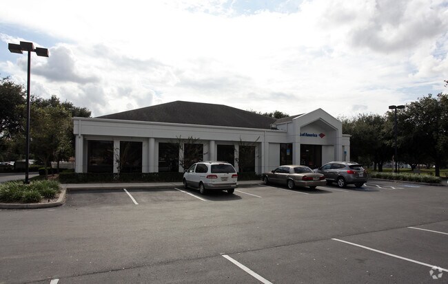
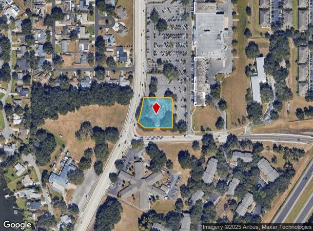
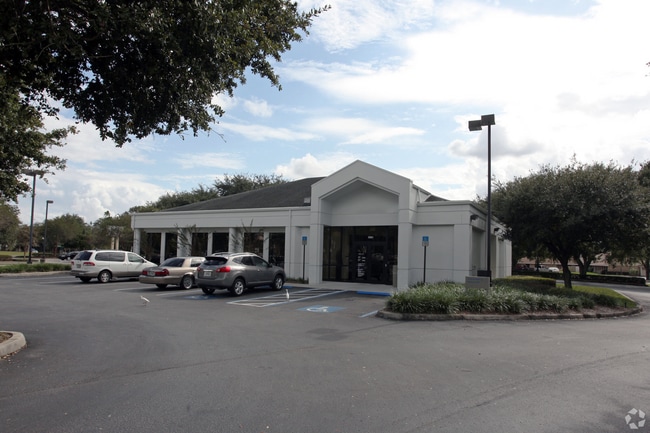
Property Record
5301 N Socrum Loop Rd, Lakeland, FL 33809

NEARBY LISTINGS FOR SALE OR LEASE
Property Detail
5301 N Socrum Loop Rd
24-27-30-000000-013060
Bristows Props
Financialbuilding
BEG NW COR NE1/4 RUN E 50 FT S 851.71 FT TO POINT ON A CURVE SWLY ALONG CURVE 183 FT TO POB CONT SWLY ALONG CURVE 173 FT S 52 DEG 02 MIN 02 SEC E 37.75 FT E 185 FT N 184 FT TO POINT ON CURVE NWLY ALONG CURVE 31.42 FT W 171.98 FT TO POB
X
Polk
12105C0302G
Florida
2024
0.98 AC
2025
Polk County
012207
Tampa/St Petersburg
5,089 SF
Lakeland-Winter Haven, FL
DEMOGRAPHICS near 5301 N Socrum Loop Rd
1 Mile
3 Mile
5 Mile
2024 Total Population
9,261
53,510
110,163
2029 Population
11,044
63,804
131,558
Pop Growth 2024-2029
+ 19.25%
+ 19.24%
+ 19.42%
Average Age
43
42
40
2024 Total Households
4,086
21,420
42,409
HH Growth 2024-2029
+ 19.24%
+ 19.17%
+ 19.38%
Median Household Inc
$54,185
$58,832
$54,162
Avg Household Size
2.20
2.40
2.50
2024 Avg HH Vehicles
2.00
2.00
2.00
Median Home Value
$163,072
$209,558
$204,995
Median Year Built
1991
1991
1989
Nearby Places
Map Layers
Map Styles
 Street
 Aerial
- Restaurants
- Banks
- Shops
- Fitness
- Groceries
PUBLIC TRANSPORTATION
COMMUTER RAIL
DRIVE
WALK
Distance
10 min
5.0 mi
Freight Ports
Port of Tampa Bay
DRIVE
WALK
Distance
Port of Tampa Bay
47 min
36.5 mi
SALE & LEASE HISTORY
LISTING DATE
SALE/LEASE

Jul 28, 2023
For Sale
Nearby Properties
Address
Land Use
TOTAL SIZE
Lot Size
Zoning
Address
Land Use
TOTAL SIZE
Lot Size
Zoning
1,013,375 SF
59.99 AC
Address
Land Use
TOTAL SIZE
Lot Size
Zoning
493,501 SF
39.01 AC
MF12
Address
Land Use
TOTAL SIZE
Lot Size
Zoning
470,032 SF
23.21 AC
Address
Land Use
TOTAL SIZE
Lot Size
Zoning
586,592 SF
30.87 AC
Address
Land Use
TOTAL SIZE
Lot Size
Zoning
1,091,160 SF
133.41 AC
PUD
Address
Land Use
TOTAL SIZE
Lot Size
Zoning
363,693 SF
22.54 AC
R2
Address
Land Use
TOTAL SIZE
Lot Size
Zoning
358,929 SF
65.46 AC
XX
Address
Land Use
TOTAL SIZE
Lot Size
Zoning
361,669 SF
12.73 AC
Address
Land Use
TOTAL SIZE
Lot Size
Zoning
245,853 SF
20.09 AC
Address
Land Use
TOTAL SIZE
Lot Size
Zoning
246,838 SF
24.57 AC
PUD
Address
Land Use
TOTAL SIZE
Lot Size
Zoning
762,259 SF
24.95 AC
PUD
Address
Land Use
TOTAL SIZE
Lot Size
Zoning
400,000 SF
34.91 AC
Address
Land Use
TOTAL SIZE
Lot Size
Zoning
400,000 SF
18.51 AC
Address
Land Use
TOTAL SIZE
Lot Size
Zoning
338,930 SF
24.33 AC
Address
Land Use
TOTAL SIZE
Lot Size
Zoning
208,898 SF
17.62 AC
PUD
Address
Land Use
TOTAL SIZE
Lot Size
Zoning
359,142 SF
22.39 AC
Address
Land Use
TOTAL SIZE
Lot Size
Zoning
301,940 SF
21.85 AC
RE1
Address
Land Use
TOTAL SIZE
Lot Size
Zoning
324,191 SF
23.37 AC
PUD
Address
Land Use
TOTAL SIZE
Lot Size
Zoning
169,546 SF
14.40 AC
PUD
Address
Land Use
TOTAL SIZE
Lot Size
Zoning
226,953 SF
34.42 AC
Address
Land Use
TOTAL SIZE
Lot Size
Zoning
425,986 SF
45.72 AC
C5
Address
Land Use
TOTAL SIZE
Lot Size
Zoning
171,525 SF
40.58 AC
RC
Address
Land Use
TOTAL SIZE
Lot Size
Zoning
115,608 SF
11.44 AC
RC
Address
Land Use
TOTAL SIZE
Lot Size
Zoning
142,936 SF
26.38 AC
Address
Land Use
TOTAL SIZE
Lot Size
Zoning
156,987 SF
51.52 AC
Address
Land Use
TOTAL SIZE
Lot Size
Zoning
101,501 SF
16.54 AC
Address
Land Use
TOTAL SIZE
Lot Size
Zoning
180,802 SF
76.35 AC
Address
Land Use
TOTAL SIZE
Lot Size
Zoning
87,975 SF
5.45 AC
O1
Address
Land Use
TOTAL SIZE
Lot Size
Zoning
226,634 SF
27.21 AC
C3
Address
Land Use
TOTAL SIZE
Lot Size
Zoning
183,800 SF
19.26 AC
The World's #1 Commercial Real Estate Marketplace
Connect with us
© 2026 CoStar Group
The information above has been obtained from sources believed reliable. While we do not doubt its accuracy we have not verified it and make no guarantee, warranty or representation about it. It is your responsibility to independently confirm its accuracy and completeness. Any projections, opinions, assumptions, or estimates used are for example only and do not represent the current or future performance of the property. The value of this transaction to you depends on tax and other factors which should be evaluated by your tax, financial, and legal advisors. You and your advisors should conduct a careful, independent investigation of the property to determine to your satisfaction the suitability of the property for your needs.