Property Record
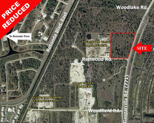
5301 Redwood Rd, Placida, FL 33946

Property Detail
5301 Redwood Rd
412120151003
20-41-21 P-6-1 5.82A M/L BEG AT NE COR LEMON BAY GROVES UNIT 2 TH W285 FT N 660FT FOR POB TH CONT N 710FT E 450FT M/L S 690FT ALG A LINE 150 FT W OF SR771 ROW W 260.75FT M/L TO POB P6-1 81/538 448/894 779/212 2445/1284 2535/1173 2884/2135 3176637
Industrialacreage
CHARLOTTE
II
Florida
AE The base floodplain where base flood elevations are provided. AE Zones are now used on new format FIRMs instead of A1-A30 Zones.
5.41 AC
2024
Charlotte County
2025
Southwest Florida
030504
Punta Gorda, FL
NEARBY LISTINGS FOR SALE OR LEASE
DEMOGRAPHICS near 5301 Redwood Rd
1 mile
3 mile
5 mile
2025 Total Population
1,962
21,936
44,058
2030 Population
2,226
24,573
48,881
Pop Growth 2025-2030
+ 13.46%
+ 12.02%
+ 10.95%
Average Age
57
57
56
2025 Total Households
900
10,157
20,846
HH Growth 2025-2030
+ 13.33%
+ 11.90%
+ 10.85%
Median Household Inc
$106,005
$89,037
$78,096
Avg Household Size
2.20
2.10
2.10
2025 Avg HH Vehicles
2.00
2.00
2.00
Median Home Value
$444,605
$447,581
$403,362
Median Year Built
2007
2004
1998
Nearby Places
Map Layers
Map Styles
 Street
 Aerial
Layers
 Traffic
 Biking
Places
Listings with unknown addresses are not visible on the map
- Restaurants
- Banks
- Shops
- Fitness
- Groceries
PUBLIC TRANSPORTATION
AIRPORT
Punta Gorda
Drive
Walk
Distance
Punta Gorda
40 min
23.3 mi
Freight Ports
Port Manatee
Drive
Walk
Distance
Port Manatee
90 min
65.3 mi
Nearby Properties
Address
Land Use
TOTAL SIZE
Lot Size
Zoning
Address
Land Use
TOTAL SIZE
Lot Size
Zoning
99,840 SF
7.60 AC
IG
Address
Land Use
TOTAL SIZE
Lot Size
Zoning
67,466 SF
16.30 AC
CG
Address
Land Use
TOTAL SIZE
Lot Size
Zoning
27.65 AC
RMF15
Address
Land Use
TOTAL SIZE
Lot Size
Zoning
108,048 SF
14.84 AC
CG
Address
Land Use
TOTAL SIZE
Lot Size
Zoning
42,935 SF
167.66 AC
RE1
Address
Land Use
TOTAL SIZE
Lot Size
Zoning
1,200 SF
29.50 AC
CG
Address
Land Use
TOTAL SIZE
Lot Size
Zoning
2,016 SF
315.56 AC
PD
Address
Land Use
TOTAL SIZE
Lot Size
Zoning
34.11 AC
CG
Address
Land Use
TOTAL SIZE
Lot Size
Zoning
20.12 AC
CG
Address
Land Use
TOTAL SIZE
Lot Size
Zoning
24,708 SF
14.89 AC
CT
Address
Land Use
TOTAL SIZE
Lot Size
Zoning
38.14 AC
IG
Address
Land Use
TOTAL SIZE
Lot Size
Zoning
12,300 SF
5.02 AC
IG
Address
Land Use
TOTAL SIZE
Lot Size
Zoning
0.20 AC
RSF3.5
Address
Land Use
TOTAL SIZE
Lot Size
Zoning
6,476 SF
17.26 AC
II
Address
Land Use
TOTAL SIZE
Lot Size
Zoning
4,776 SF
20 AC
II
Address
Land Use
TOTAL SIZE
Lot Size
Zoning
2,940 SF
332.40 AC
RSF5
Address
Land Use
TOTAL SIZE
Lot Size
Zoning
560 SF
10.23 AC
IG
Address
Land Use
TOTAL SIZE
Lot Size
Zoning
16.53 AC
CG
Address
Land Use
TOTAL SIZE
Lot Size
Zoning
20,650 SF
1.61 AC
CG
Address
Land Use
TOTAL SIZE
Lot Size
Zoning
8,510 SF
2.25 AC
CG
Address
Land Use
TOTAL SIZE
Lot Size
Zoning
5,222 SF
85.60 AC
RMF10
Address
Land Use
TOTAL SIZE
Lot Size
Zoning
1,430 SF
5.98 AC
CG
Address
Land Use
TOTAL SIZE
Lot Size
Zoning
6,852 SF
161.47 AC
RSF5
Address
Land Use
TOTAL SIZE
Lot Size
Zoning
3,864 SF
2 AC
CG
Address
Land Use
TOTAL SIZE
Lot Size
Zoning
12,907 SF
165.69 AC
RSF5
Address
Land Use
TOTAL SIZE
Lot Size
Zoning
18,599 SF
1.96 AC
IG
Address
Land Use
TOTAL SIZE
Lot Size
Zoning
576 SF
5 AC
II
Address
Land Use
TOTAL SIZE
Lot Size
Zoning
11,550 SF
1.18 AC
CG
Address
Land Use
TOTAL SIZE
Lot Size
Zoning
10.88 AC
CG
The World's #1 Commercial Real Estate Marketplace
Connect with us
© 2026 CoStar Group
The information above has been obtained from sources believed reliable. While we do not doubt its accuracy we have not verified it and make no guarantee, warranty or representation about it. It is your responsibility to independently confirm its accuracy and completeness. Any projections, opinions, assumptions, or estimates used are for example only and do not represent the current or future performance of the property. The value of this transaction to you depends on tax and other factors which should be evaluated by your tax, financial, and legal advisors. You and your advisors should conduct a careful, independent investigation of the property to determine to your satisfaction the suitability of the property for your needs.