Property Record
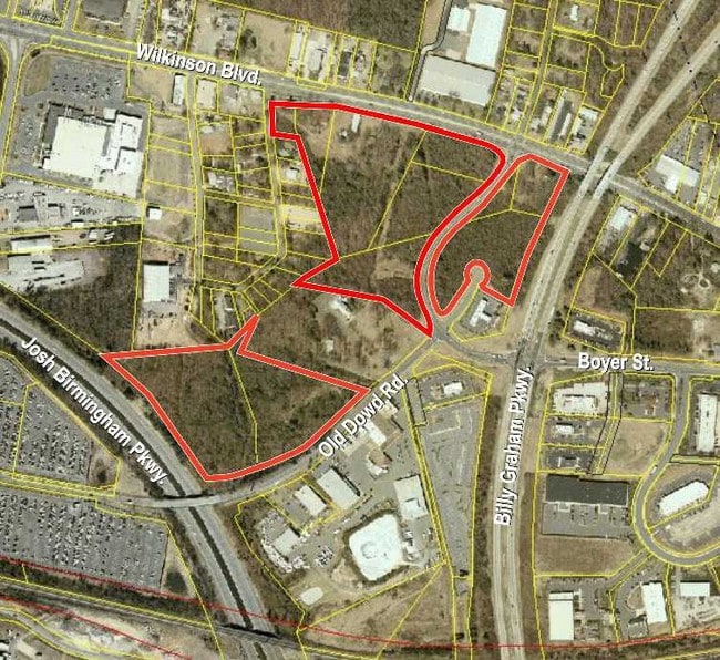
5301 Wilkinson Blvd, Charlotte, NC 28208
NEARBY LISTINGS FOR SALE OR LEASE
Property Detail
5301 Wilkinson Blvd
115-133-18
Mccoy Properties Inc
Industrialgeneral
Mecklenburg
X
North Carolina
3710452400K
16
2024
18.52 AC
2025
Airport
004000
Charlotte
170,968 SF
Charlotte-Concord-Gastonia, NC-SC
DEMOGRAPHICS near 5301 Wilkinson Blvd
1 Mile
3 Mile
5 Mile
2024 Total Population
2,127
44,631
150,163
2029 Population
2,274
47,654
160,833
Pop Growth 2024-2029
+ 6.91%
+ 6.77%
+ 7.11%
Average Age
36
37
36
2024 Total Households
798
16,834
66,161
HH Growth 2024-2029
+ 6.77%
+ 6.95%
+ 7.34%
Median Household Inc
$58,067
$46,355
$65,520
Avg Household Size
2.60
2.50
2.20
2024 Avg HH Vehicles
2.00
2.00
2.00
Median Home Value
$153,793
$153,939
$255,022
Median Year Built
1976
1977
1998
Nearby Places
Map Layers
Map Styles
 Street
 Aerial
- Restaurants
- Banks
- Shops
- Fitness
- Groceries
PUBLIC TRANSPORTATION
COMMUTER RAIL
Charlotte Amtrak Station (Carolinian - Amtrak, Crescent - Amtrak, Piedmont - Amtrak)
DRIVE
WALK
Distance
Charlotte Amtrak Station (Carolinian - Amtrak, Crescent - Amtrak, Piedmont - Amtrak)
12 min
6.8 mi
AIRPORT
Charlotte/Douglas International
DRIVE
WALK
Distance
Charlotte/Douglas International
10 min
4.4 mi
Concord-Padgett Regional
DRIVE
WALK
Distance
Concord-Padgett Regional
28 min
19.3 mi
Freight Ports
North Charleston Terminal
DRIVE
WALK
Distance
North Charleston Terminal
227 min
199.7 mi
Nearby Properties
Address
Land Use
TOTAL SIZE
Lot Size
Zoning
Address
Land Use
TOTAL SIZE
Lot Size
Zoning
5,290,257 SF
502.52 AC
I2
Address
Land Use
TOTAL SIZE
Lot Size
Zoning
309.30 AC
I-2
Address
Land Use
TOTAL SIZE
Lot Size
Zoning
1,519,630 SF
235.59 AC
I2
Address
Land Use
TOTAL SIZE
Lot Size
Zoning
399,398 SF
35.02 AC
Address
Land Use
TOTAL SIZE
Lot Size
Zoning
621,107 SF
250.06 AC
I2
Address
Land Use
TOTAL SIZE
Lot Size
Zoning
100.51 AC
I-2
Address
Land Use
TOTAL SIZE
Lot Size
Zoning
863,490 SF
93.41 AC
Address
Land Use
TOTAL SIZE
Lot Size
Zoning
24.40 AC
UR-2(CD)
Address
Land Use
TOTAL SIZE
Lot Size
Zoning
473,430 SF
3.35 AC
I1
Address
Land Use
TOTAL SIZE
Lot Size
Zoning
416,720 SF
81 AC
I2
Address
Land Use
TOTAL SIZE
Lot Size
Zoning
661,612 SF
32.38 AC
I1CD
Address
Land Use
TOTAL SIZE
Lot Size
Zoning
375,318 SF
37.31 AC
B2
Address
Land Use
TOTAL SIZE
Lot Size
Zoning
311,541 SF
40.41 AC
INST
Address
Land Use
TOTAL SIZE
Lot Size
Zoning
70.83 AC
I-2
Address
Land Use
TOTAL SIZE
Lot Size
Zoning
162,354 SF
6.97 AC
I-2
Address
Land Use
TOTAL SIZE
Lot Size
Zoning
625,790 SF
89.50 AC
I-2(CD)
Address
Land Use
TOTAL SIZE
Lot Size
Zoning
242,699 SF
20.50 AC
R17MF
Address
Land Use
TOTAL SIZE
Lot Size
Zoning
892,468 SF
14.48 AC
I2
Address
Land Use
TOTAL SIZE
Lot Size
Zoning
394,084 SF
29.35 AC
Address
Land Use
TOTAL SIZE
Lot Size
Zoning
238,075 SF
9.52 AC
Address
Land Use
TOTAL SIZE
Lot Size
Zoning
250,079 SF
52.97 AC
R3
Address
Land Use
TOTAL SIZE
Lot Size
Zoning
536,042 SF
37.24 AC
R-22MF
Address
Land Use
TOTAL SIZE
Lot Size
Zoning
182,124 SF
8.25 AC
I-1(CD)
Address
Land Use
TOTAL SIZE
Lot Size
Zoning
227 AC
I-2
Address
Land Use
TOTAL SIZE
Lot Size
Zoning
351,278 SF
28.88 AC
Address
Land Use
TOTAL SIZE
Lot Size
Zoning
154,799 SF
6.09 AC
R12MF
Address
Land Use
TOTAL SIZE
Lot Size
Zoning
152,800 SF
7.25 AC
I-1(CD)
Address
Land Use
TOTAL SIZE
Lot Size
Zoning
330,680 SF
25.87 AC
I2CD
Address
Land Use
TOTAL SIZE
Lot Size
Zoning
351,253 SF
27.85 AC
I-1(CD)
Address
Land Use
TOTAL SIZE
Lot Size
Zoning
315,480 SF
24.38 AC
R22MF
The World's #1 Commercial Real Estate Marketplace
Connect with us
© 2025 CoStar Group
The information above has been obtained from sources believed reliable. While we do not doubt its accuracy we have not verified it and make no guarantee, warranty or representation about it. It is your responsibility to independently confirm its accuracy and completeness. Any projections, opinions, assumptions, or estimates used are for example only and do not represent the current or future performance of the property. The value of this transaction to you depends on tax and other factors which should be evaluated by your tax, financial, and legal advisors. You and your advisors should conduct a careful, independent investigation of the property to determine to your satisfaction the suitability of the property for your needs.