Property Record
5302 E Fowler Ave, Temple Terrace, FL 33617


Property Detail
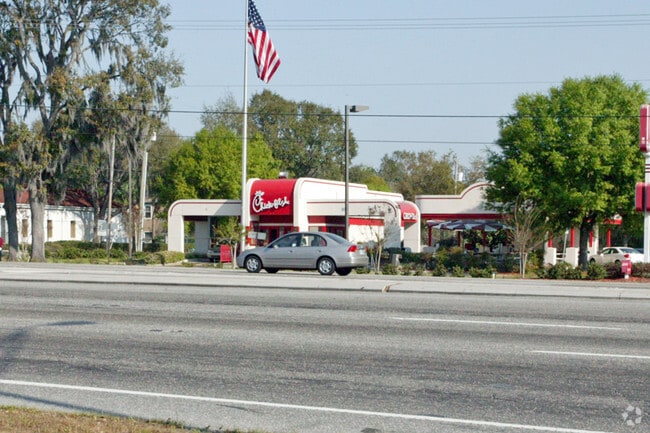
5302 E Fowler Ave
T-10-28-19-1HK-000000-0055A.0
TEMPLE TERRACES W 198 FT OF S 238 FT OF LOT 55A LESS R/W
Restaurantdrivein
Hillsborough
CG
Florida
B and X Area of moderate flood hazard, usually the area between the limits of the 100-year and 500-year floods.
55a
2024
0.87 AC
2025
Northeast Tampa
010809
Tampa/St Petersburg
4,170 SF
Tampa-St. Petersburg-Clearwater, FL
NEARBY LISTINGS FOR SALE OR LEASE
DEMOGRAPHICS near 5302 E Fowler Ave
1 mile
3 mile
5 mile
2025 Total Population
23,755
127,902
250,184
2030 Population
25,004
136,544
268,344
Pop Growth 2025-2030
+ 5.26%
+ 6.76%
+ 7.26%
Average Age
32
35
36
2025 Total Households
6,688
49,708
95,812
HH Growth 2025-2030
+ 6.94%
+ 7.05%
+ 7.47%
Median Household Inc
$54,581
$48,609
$51,730
Avg Household Size
2.40
2.30
2.40
2025 Avg HH Vehicles
2.00
1.00
1.00
Median Home Value
$405,130
$319,585
$324,855
Median Year Built
1983
1984
1983
Nearby Places
Map Layers
Map Styles
 Street
 Aerial
Layers
 Traffic
 Biking
Places
Listings with unknown addresses are not visible on the map
- Restaurants
- Banks
- Shops
- Fitness
- Groceries
PUBLIC TRANSPORTATION
AIRPORT
Tampa International
Drive
Walk
Distance
Tampa International
29 min
18.5 mi
St Pete-Clearwater International
Drive
Walk
Distance
St Pete-Clearwater International
46 min
27.7 mi
Freight Ports
Port of Tampa Bay
Drive
Walk
Distance
Port of Tampa Bay
23 min
11.8 mi
Nearby Properties
Address
Land Use
TOTAL SIZE
Lot Size
Zoning
Address
Land Use
TOTAL SIZE
Lot Size
Zoning
4,011,409 SF
1,558.97 AC
UC
Address
Land Use
TOTAL SIZE
Lot Size
Zoning
1,181,974 SF
23.01 AC
SPI-UC-2
Address
Land Use
TOTAL SIZE
Lot Size
Zoning
780,872 SF
290.33 AC
PD
Address
Land Use
TOTAL SIZE
Lot Size
Zoning
606,020 SF
28.56 AC
PD
Address
Land Use
TOTAL SIZE
Lot Size
Zoning
727,236 SF
61.10 AC
CU
Address
Land Use
TOTAL SIZE
Lot Size
Zoning
514,860 SF
47.74 AC
SPI-UC-2
Address
Land Use
TOTAL SIZE
Lot Size
Zoning
671,677 SF
72.27 AC
RMFA
Address
Land Use
TOTAL SIZE
Lot Size
Zoning
702,607 SF
63.42 AC
PROF
Address
Land Use
TOTAL SIZE
Lot Size
Zoning
598,043 SF
47.58 AC
PD
Address
Land Use
TOTAL SIZE
Lot Size
Zoning
348,850 SF
4.45 AC
PD
Address
Land Use
TOTAL SIZE
Lot Size
Zoning
405,529 SF
26.81 AC
SPI-UC-1
Address
Land Use
TOTAL SIZE
Lot Size
Zoning
594,270 SF
23.02 AC
PD
Address
Land Use
TOTAL SIZE
Lot Size
Zoning
322,637 SF
18.12 AC
PD
Address
Land Use
TOTAL SIZE
Lot Size
Zoning
302,910 SF
29.81 AC
PD
Address
Land Use
TOTAL SIZE
Lot Size
Zoning
355,261 SF
22 AC
CU
Address
Land Use
TOTAL SIZE
Lot Size
Zoning
290,322 SF
12.51 AC
SPI-UC-1
Address
Land Use
TOTAL SIZE
Lot Size
Zoning
344,877 SF
47.21 AC
PD
Address
Land Use
TOTAL SIZE
Lot Size
Zoning
282,000 SF
6.53 AC
PD
Address
Land Use
TOTAL SIZE
Lot Size
Zoning
475,272 SF
19.44 AC
PD
Address
Land Use
TOTAL SIZE
Lot Size
Zoning
306,031 SF
16.15 AC
PD-A
Address
Land Use
TOTAL SIZE
Lot Size
Zoning
351,811 SF
70.56 AC
CU
Address
Land Use
TOTAL SIZE
Lot Size
Zoning
287,530 SF
9.09 AC
PD
Address
Land Use
TOTAL SIZE
Lot Size
Zoning
241,449 SF
9.99 AC
PD
Address
Land Use
TOTAL SIZE
Lot Size
Zoning
154,301 SF
19.82 AC
PD
Address
Land Use
TOTAL SIZE
Lot Size
Zoning
345,992 SF
20.90 AC
SPI-UC-1
Address
Land Use
TOTAL SIZE
Lot Size
Zoning
381,714 SF
4.66 AC
PD
Address
Land Use
TOTAL SIZE
Lot Size
Zoning
264,202 SF
12.86 AC
PD
Address
Land Use
TOTAL SIZE
Lot Size
Zoning
342,686 SF
4.30 AC
PD
Address
Land Use
TOTAL SIZE
Lot Size
Zoning
374,282 SF
13.50 AC
PD
Address
Land Use
TOTAL SIZE
Lot Size
Zoning
706,512 SF
76.54 AC
PD
The World's #1 Commercial Real Estate Marketplace
Connect with us
© 2026 CoStar Group
The information above has been obtained from sources believed reliable. While we do not doubt its accuracy we have not verified it and make no guarantee, warranty or representation about it. It is your responsibility to independently confirm its accuracy and completeness. Any projections, opinions, assumptions, or estimates used are for example only and do not represent the current or future performance of the property. The value of this transaction to you depends on tax and other factors which should be evaluated by your tax, financial, and legal advisors. You and your advisors should conduct a careful, independent investigation of the property to determine to your satisfaction the suitability of the property for your needs.